Good evening, everyone. Warmer winds continue to blow across the state as we get set for rounds of storms to rumble through over the next few days. These may wind up causing some issues for parts of the state.
A Flood Watch is currently out for northern and northeastern Kentucky…

That could easily be pushed a few counties to the south, especially considering the recent farther south trend for these waves of showers and storms.
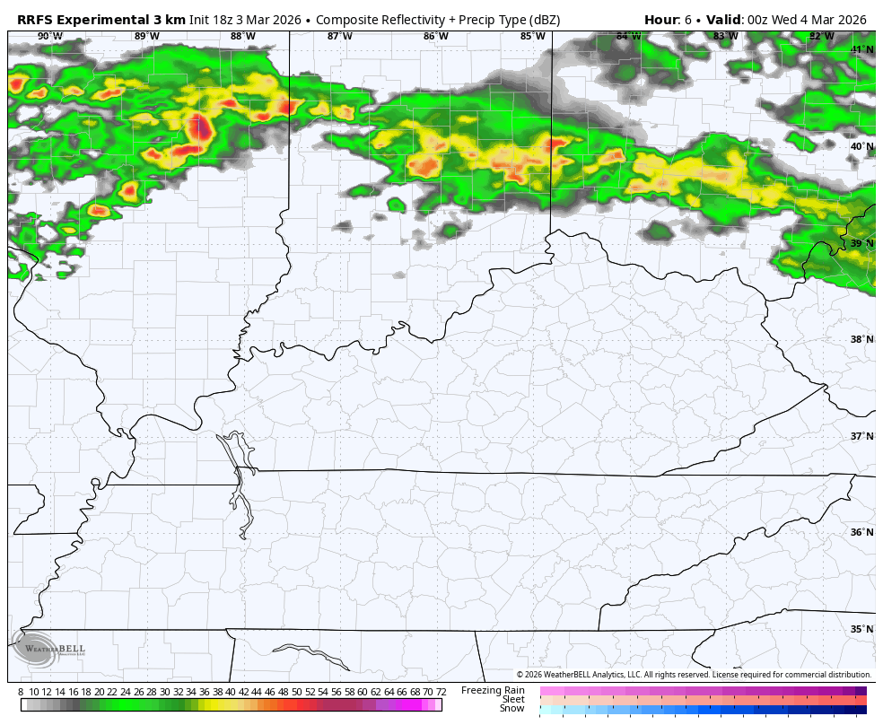
The future radar from the HRRR goes through Friday and shows how these storms do focus much farther south into Kentucky…
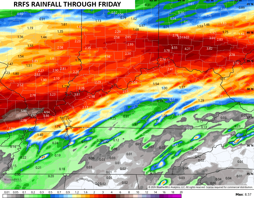
Here’s the rainfall forecast for that time period from the same model…
The threat for a few severe storms is with us as the Storm Prediction Center has a Marginal Risk to Slight Risk out…

Here’s a look at the individual threats from the SPC…


The full update comes your way later tonight. I’ll also have updates on my Meteorologist Chris Bailey Facebook Page
Until then, here are your tracking tools for the day…


Make it a terrific Tuesday and take care.
