Good evening, everyone. Rounds of showers and storms targeted many areas of Kentucky today and we have more to go through tonight and Thursday. This is part of a very active setup with some big temp swings lurking over the next few weeks.
Scattered showers and storms continue to be more prominent across western and northern Kentucky. That’s the area picking up on the best threat for strong and severe storms and the chance for too much rain.
Here’s a look at the current watches…

Any warnings will show up here…

Scattered showers and storms linger into Thursday with a similar setup to today. Highs are in the 60s and 70s.
Friday is the day when everyone has a chance to flirt with 80 and record highs. Some isolated storms are a good bet still.
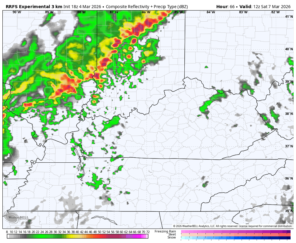
A cold front moves in late Saturday with an increase in showers and storms and some of these may be strong or severe. Here’s the future radar from the RRFS for Saturday…
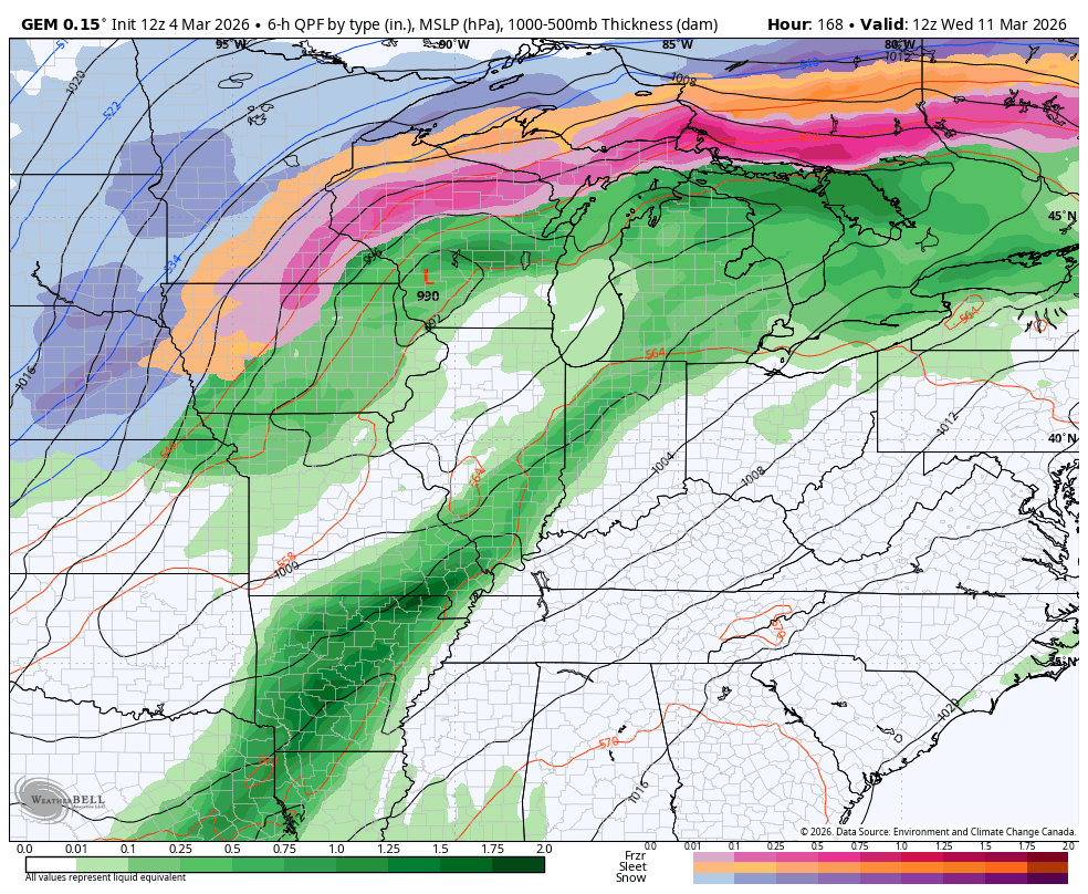
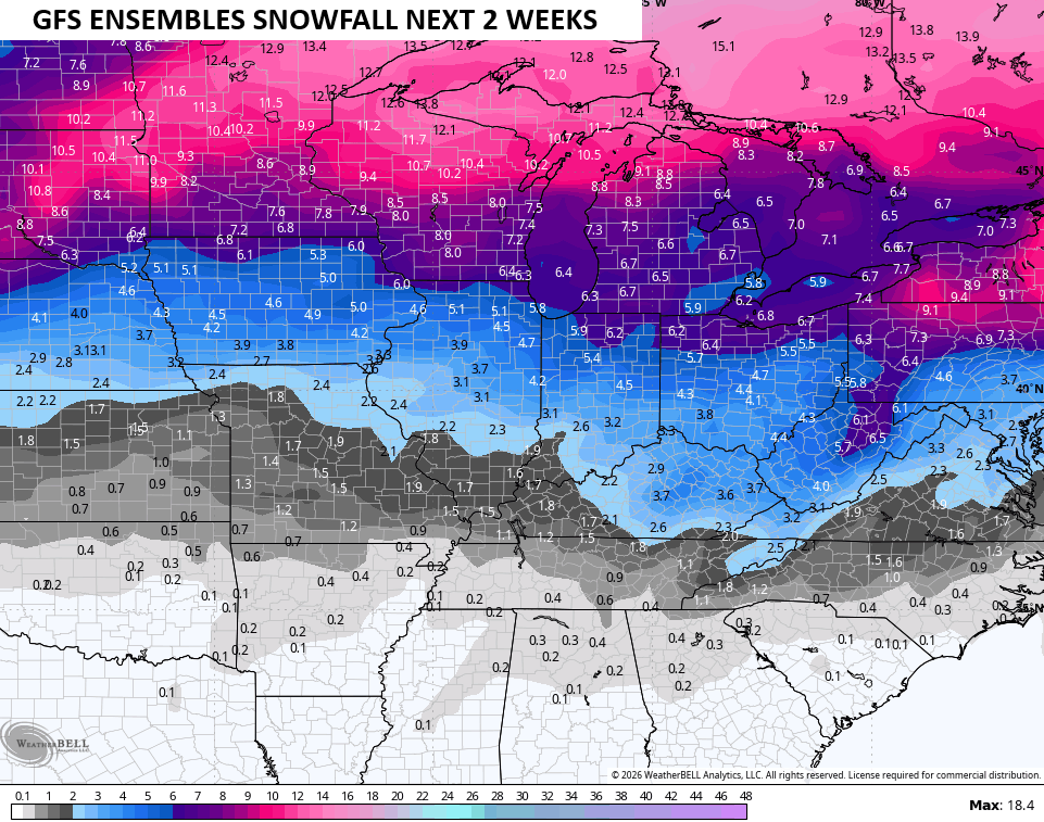
Sunday looks cooler and fairly calm before temps jump right back up early next week. This is ahead of a pattern change late next week into the weekend with the potential for some winter weather showing up…
I don’t think we are done with light accumulations and the GFS Ensembles agree…
Ugh!
The main update comes your way later tonight. Until then, here are all the storm tracking tools you need to start the week…


Current watches

Possible Watch Areas

Make it a great day and take care.
