Good evening, everyone. Record highs and possible severe storms are with us over the next few days as our pattern is more typical of May than March. This setup has more back and forth to it once we get into next week.
With a boundary slowly lifting to the north this evening, some of the storms may be strong or severe, but this looks pretty isolated. The Storm Prediction Center has a Marginal Risk out for much of the state…

As that boundary lifts northward, a warm southerly wind flow brings upper 70s and low 80s in here for Friday…
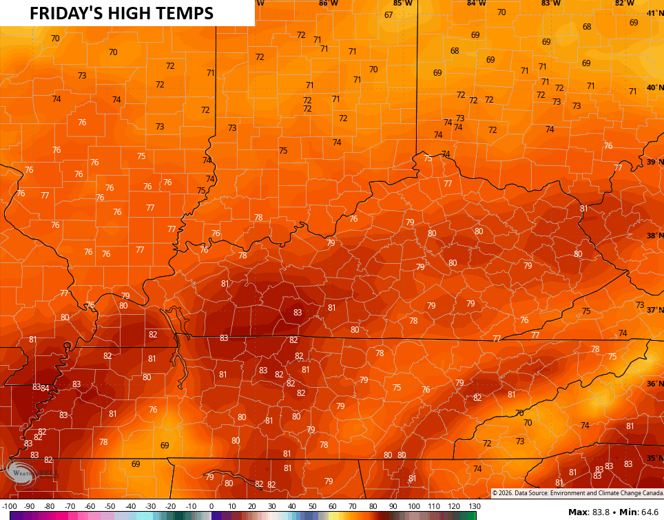
Records are likely to fall.
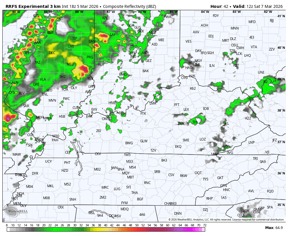
A cold front then moves in on Saturday, bringing showers and thunderstorms through here. The future radar from the RRFS from Saturday morning into Saturday night looks like this…
The Storm Prediction Center is blanketing the entire region with a Marginal Risk and Slight Risk for severe storms…

Leftover showers will be with us Sunday morning with drying and cooler winds for Sunday. Beyond that, temps jump back up with another active setup next week. These showers and storms will be noted from time to time with the chance for more severe weather by the middle of the week as colder air crashes in…

The full update comes your way later tonight. Until then, here are all the storm tracking tools you need to start the week…


Current watches

Possible Watch Areas

Make it a great Thursday and take care.
