Good Friday to one and all. We are likely to break all kinds of record highs out there today as a surge of May air takes hold. This is ahead of a stormy setup for Saturday as the potential for severe weather blows across the Commonwealth.
Let’s start with today’s record temps. Highs generally hit the upper 70s and low 80s for the entire state with the chance for a location or two in the west and south to push 85 degrees. This incredible surge of late spring air will be accompanied by the chance for an isolated shower or storm.
Southwest winds will be gusting through the day as a cold front rolls toward the region from the west. This arrives late Saturday with showers and storms along and ahead of it. This future radar from the RRFS shows this action…
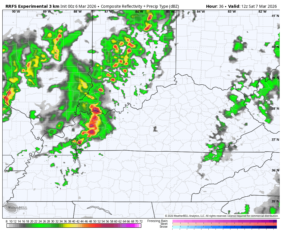
The chance is there for some of these storms to go severe and the Storm Prediction Center continues to blanket the entire region with the Marginal Risk to Slight Risk…

Here’s a look at the individual severe weather threats from the Storm Prediction Center…


Temps Saturday can reach 80 again in the east with falling temps behind the front blowing in early Sunday. Some leftover showers look to impact areas of southern and eastern Kentucky early on with improving skies throughout the day from west to east.
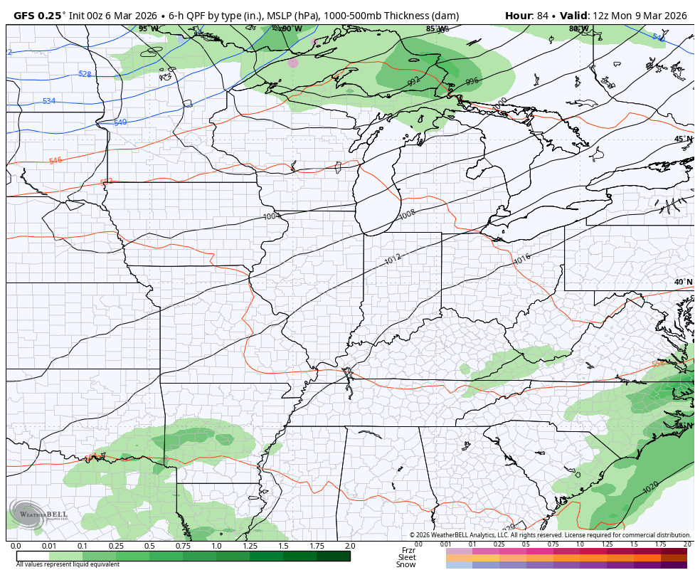
The setup after this features the 70s surging back in early next week as rounds of showers and storms roll back in. This is ahead of a potent storm system bringing a front in here later Wednesday or Thursday with the potential for severe weather before temps drop in a big way…
Another update comes your way later today. Until then, here are all the storm tracking tools you need to start the week…


Current watches

Possible Watch Areas

Make it a great Friday and take care.

This late in the season, any snow or cold is typically short-lived and pretty weak. I’m not concerned at all.