Good Saturday, everyone. A potent cold front is sweeping across the state today, bringing the potential for strong to severe storms. This is the first of two big systems over the next week, with the second one having the chance to produce a little winter behind it.
Let’s start with today’s system and roll forward.
A line of storms develops early today across western Kentucky and rolls east from there. This line increases the farther east it gets before exiting the east early this evening. This future radar from the HRRR shows the line from 7am this morning through the wee hours of Sunday morning…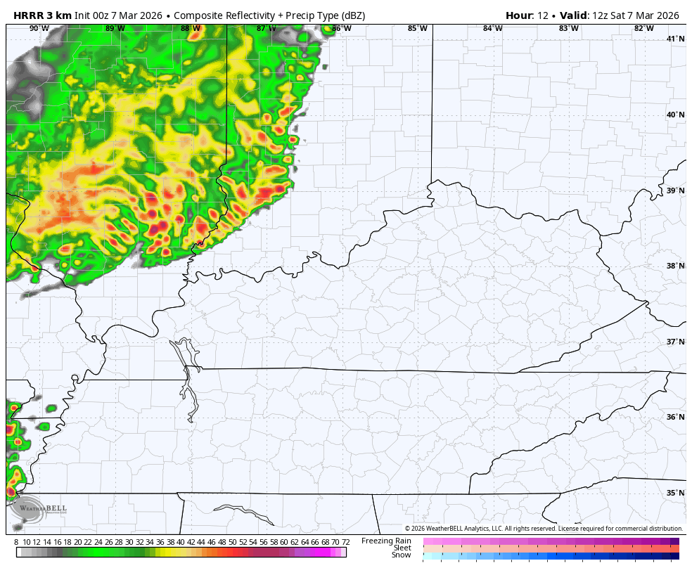
The Storm Prediction Center continues to blanket the entire state in a Marginal Risk to a Slight Risk for severe storms today…

The individual severe weather threats from the SPC look like this…


Morning showers linger into Sunday, especially in the east and southeast. Clearing takes place from west to east through the day as thermometers come way down with highs generally from 60-65, which is still very nice.
Temps jump back up for Monday and Tuesday with scattered showers and storms returning.
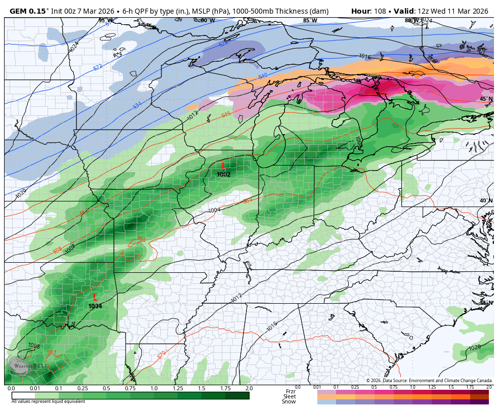
The signal for the chance of severe weather to snowflakes continues to show up Wednesday into Thursday as a healthy storm system races through the Ohio Valley. Here’s the GFS…
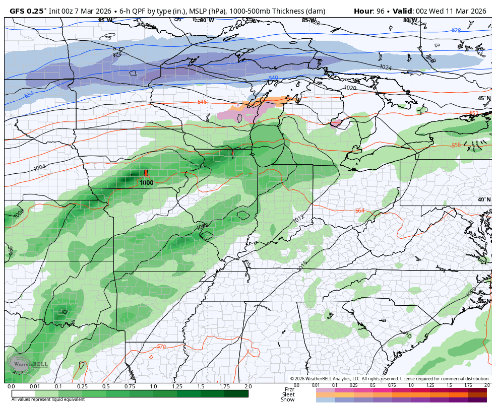
The Canadian is similar…
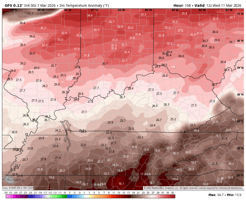
Wednesday could be a pretty active weather day in this area as we transition from May weather to February weather in just a few hours. Watch how the temps go from way above normal Wednesday to way below normal Thursday…
Another update comes your way later today. Until then, here are all the storm tracking tools you need to start the week…


Current watches

Possible Watch Areas

Make it a great Saturday and take care.
