Good evening, everyone. Rounds of showers and thunderstorms continue to push out of the state as cooler winds blow in for Sunday. Behind this comes a super active setup that features a fight between spring and winter.
Showers will linger tonight into Sunday morning in the east with clearing skies coming in from west to east. Highs are in the 60s.
Temps surge back into the 70s Monday and Tuesday with some scattered showers and storms firing back up. This is ahead of a potent storm system rolling in here on Wednesday, bringing a severe weather threat that may be followed up by some flakes on Thursday.
The Storm Prediction Center already has our region in the Wednesday Severe Weather Outlook…

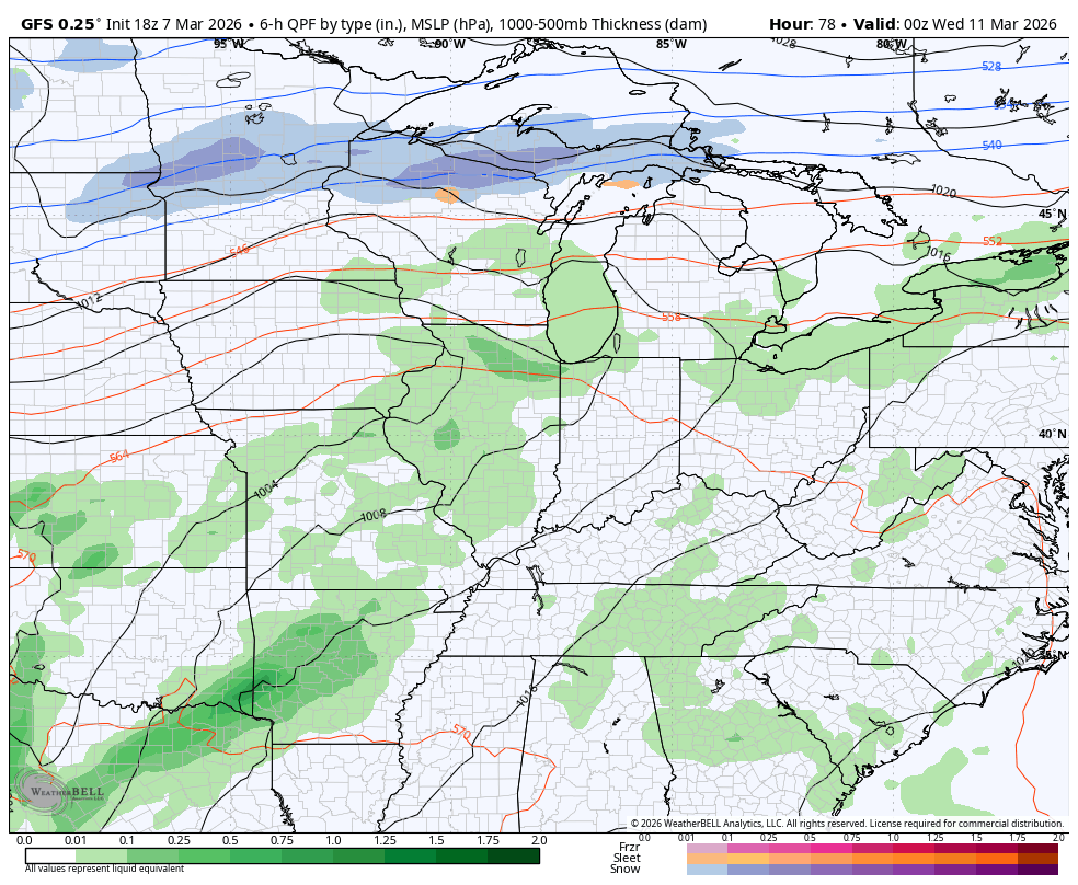
The GFS shows this rapid transition from storms to snowflakes Wednesday into Thursday…
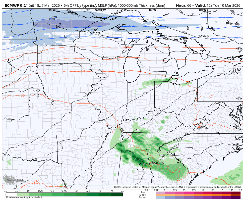
The EURO has a similar look…
I’ll go more in depth on this with the full update later tonight. Until then, here are all the storm tracking tools you need to start the week…


Current watches

Possible Watch Areas

Make it a great Saturday and take care.
