Good evening, everyone. It’s full steam ahead toward a major change on the way and it gets started with severe weather by Wednesday. After that comes a big temp swing that brings Old Man Winter back into town.
The threat for severe weather is greatest to our west and northwest on Tuesday, but the Storm Prediction Center continues to bring the Marginal Risk into parts of Kentucky…

Our greatest threat for severe weather comes in on Wednesday with the Storm Prediction Center showing a Slight Risk for severe storms across the entire state…

I imagine part of that gets upgraded to an Enhanced Risk at some point. Damaging winds, large hail and a few tornadoes will be possible. Hit and run high water issues may also show up.
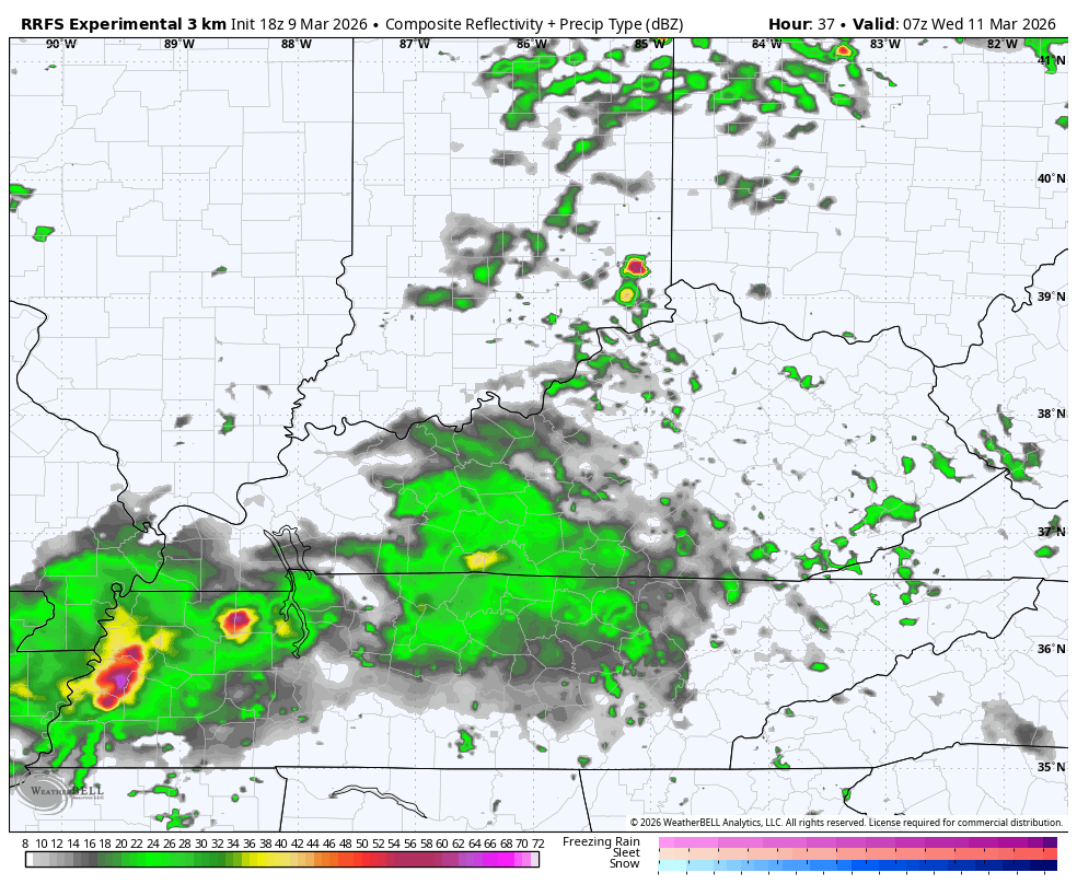
The future radar from the RRFS shows a few big boomers starting Wednesday before the afternoon stuff arrives. That will be followed by a few flurries in the east early Thursday…
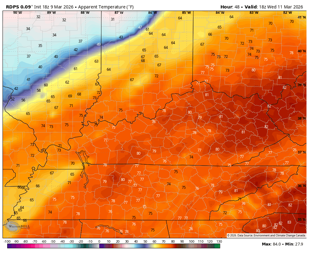
Temps Wednesday may hit 80 in central and eastern Kentucky before crashing from the northwest late Wednesday and early Thursday. It will feel like the 20s by Thursday morning.
This feels like forecast is ugly…
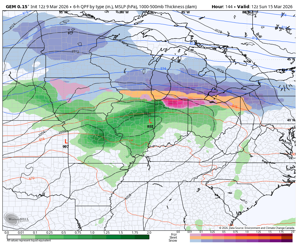
Temps rebound on 40mph winds gusting for Friday into Saturday. That’s ahead of another potent storm system bringing a massive blast of cold air coming in early next week. Rain and thunderstorms will be with us ahead of it with winter surging in behind it Sunday night and Monday. Light snow and snow showers will be possible…
The Barney colors show up behind this Monday and Tuesday…
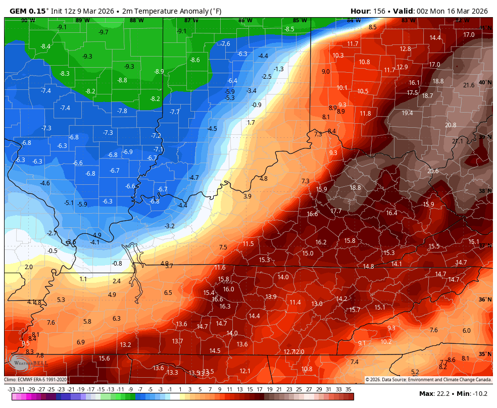
Lows in the teens early next week with a wind chill in the singles? Ouch.
Another update comes your way later today. Until then, here are all the storm tracking tools you need to start the week…


Current watches

Possible Watch Areas

Make it a magnificent Monday and take care.
