Good Thursday to one and all. It’s a much colder day out there with a touch of winter briefly settling into parts of Kentucky. This big swing will be dwarfed by the next change from Sunday into Monday as winter punches back.
Let us, as usual, begin with today.
Some light snows and flurries are possible early today in the east and southeast. Wind chills are in the low and mid 20s this morning in areas that hit the upper 70s to mid 80s just hours before. Incredible.
Highs this afternoon range from the upper 40s to middle 50s with a mix of sun and clouds.
A gusty wind cranks again on Friday with gusts topping 40mph. This is ahead of a system passing by to our north as temps reach the 60-65 degree range to start the weekend. It’s a weekend that’s decent until things wrap up on Sunday.
This is when a powerhouse of a storm system develops and rolls from the Midwest to the Ohio Valley Sunday into Monday. This spikes our temps into the 70s on a strong southwest wind on Sunday. Rain and strong storms race through here with a MAJOR temp drop Sunday night and early Monday. Some snow showers and flurries will also be likely.
Take a look at the whole process that may keep some flakes flying into early St. Patrick’s Day…
The Barney colors are getting brighter and that’s not a good thing. This temp departure animation starts Sunday evening and goes through Wednesday morning…
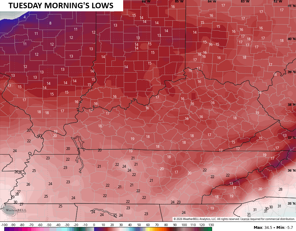
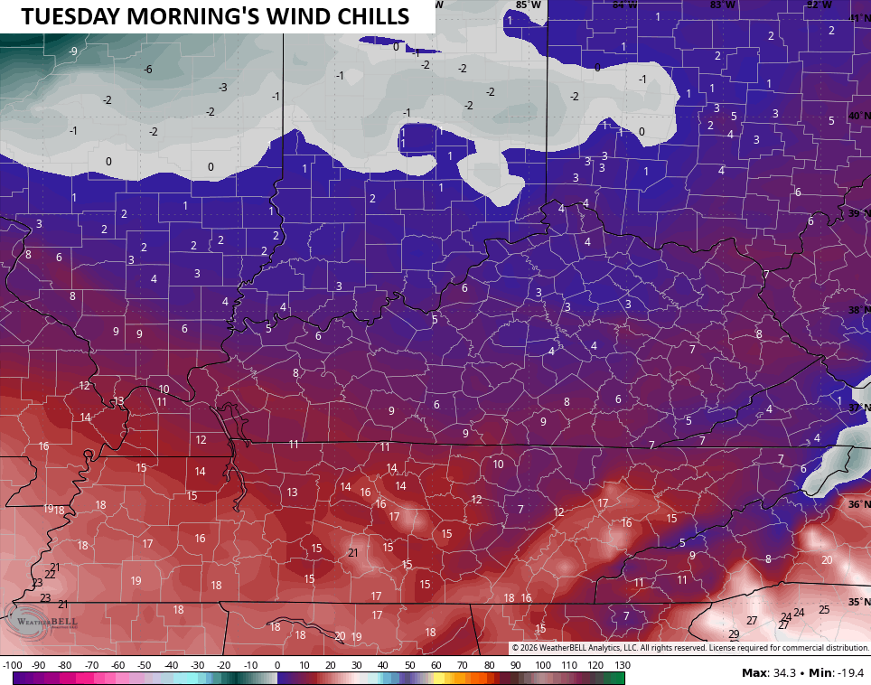
Actual temps behind this are brutal. Temps drop into the upper 20s and low 30s and hold there on Monday with gusty winds making it feel like the teens. Monday night into Tuesday morning is nasty for the middle of March. Lows reach the teens with wind chills dropping into the single digits…
There’s an outside chance for a rain or snow showers on the leading edge of much warmer air fighting in on Wednesday. Highs by the end of the week should be back into the 70s, but I don’t think we’re done with the back and forth part of this setup.
Another update comes your way later today. Until then, here are the tracking tools to keep you company…


Have a terrific Thursday and take care.

Thanks Chris. Our Precipitation Total For Maple Was 0.00 Since 12:00 AM. No Strong, Damaging Straight Line Winds, That Were In The Forecast Yesterday. Hope This Pattern Continues Except For The Low Rainfall. The Sad Part Is, That The Growing Season Has Begun Much Too Early. The Frigid Temperatures Returning Will Only ” Cut Down ” On Horticultural Enjoyment This Spring.
A Recap Of The Winter ( DJ F ) 2025 – 26 From The Climate Impact Company 🙂
Kentucky Was Near Normal On Temperature, And Much Below Normal On Precipitation.
https://climateimpactcompany.com/daily-feature-winter-2025-26-state-temperature-precipitation-rankings-record-warm-west-south-scarry-dry-mid-south-u-s-2/
Snowing In Jenkins And Pine Mountain, Where Spring Doesn’t Come So Early. Better Climate For Horticultural Enjoyment.
Here is the link for the summary of the strong tornadoes and giant hail that occurred over NE IL and NW IN on Tuesday.
https://weather.gov/lot/2026_03_10_Severe_Weather
There’s a couple of really scary photos that were taken of the tornadoes on the ground near Aroma Park IL, and also of the giant hail that was 4 inches in diameter that fell in Kankakee. There was even a report of an incredible 6-inch hailstone from Kankakee which, if verified, would be an IL record for the largest hailstone. The Western Suburbs of Chicago received hail as large as between 4 and 5 inches. Here in the SW Suburbs where I am, we received pea-sized hail.
WOW ! Mike, Glad You Didn’t Received That Extra Large Hail. That Size Is Practically Unheard Of. Like A Soft Ball Made Of Ice. The Larges Hail I’ve Ever Experienced Was Golf Ball Size, Way Back In April, 1960. I Heard There May Be A Blizzard Just To Your North In The Coming Days.
https://climateimpactcompany.com/u-s-early-notes-high-impact-weather-high-wind-events-through-early-next-week-2/