Good Tuesday, everyone. Much milder winds are surging into Kentucky today with even warmer air set to follow for the weekend. As a matter of fact, temps will likely flirt with record highs by Sunday. That’s ahead of a front that knocks the numbers back down early next week.
There’s a slight chance for a shower or storm going up today, but most stay dry. Highs reach the 60s for most of the state with 70 in the west.
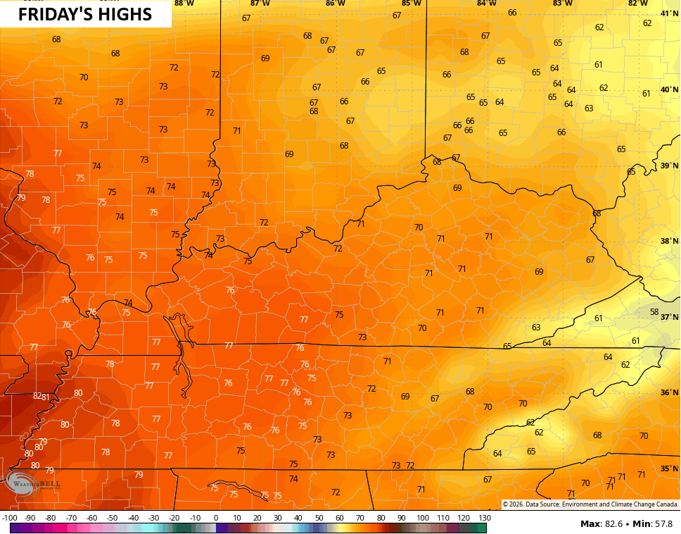
Those 70s engulf the entire state on Friday…
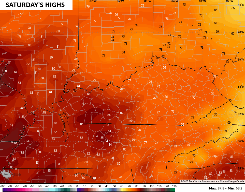
Those head deeper into the 70s for Saturday with an 80 in the west…
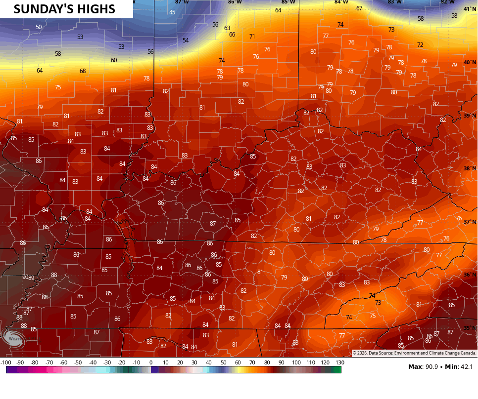
Record highs may show up in the west Saturday and across the entire state Sunday. That’s when temps jump deep into the 80s…
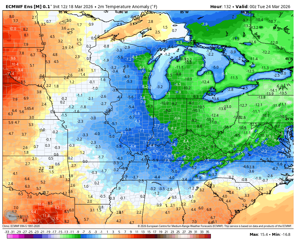
A cold front brings some showers and storms in her Sunday nigt and Monday as temps come way down. We go back to below normal for a few days as we continue with a back and forth temperature setup through the rest of the month into the start of April…
I leave you with your isolated shower and thunderstorm trackers for the day…

Make it a terrific Tuesday and take care.

These back and forth swings are directly related to the influence of a leftover core of colder than normal air over Canada, which is a remnant of the most recent Polar Vortex incursion. While these swings continue, the shift from weak La Nina conditions to a strong El Nino continues to accelerate, and I suspect that the period under ENSO-Neutral conditions will be significantly less than originally forecasted. In particular, we are likely to see a heat-dome establish itself over the western states. The following link goes into this transition in more detail:
https://www.severe-weather.eu/long-range-2/spring-2026-forecast-update-polar-vortex-core-el-nino-rising-united-states-canada-europe-fa/
Very Interesting Joe. Thanks For The Link. Great And Informative Articles. The Only El Nino, That Truly Affected Our Atmosphere, That I Can Remember Was In 1969 – 70. The Last El Nino 2015 – 16 Also Impacted Our Weather Patterns, But Not As Much As The El Nino Event 1969 – 70. We Shall See How This Coming Super ( Never Heard This Term Describing ENSO Events ) El Nino Event Plays With Our Atmosphere Next Fall And Winter ? Here In Maple, We Received A Total Snowfall Here In Maple Of Only 3 inches, But It Was A Colder, Drier Fall And Winter 2025 – 26. Now We Shall See How Our Spring And Summer Turns Out. Wet Or Dry, Or Just Plain Hot And Humid, Like It Does Almost Every Year.