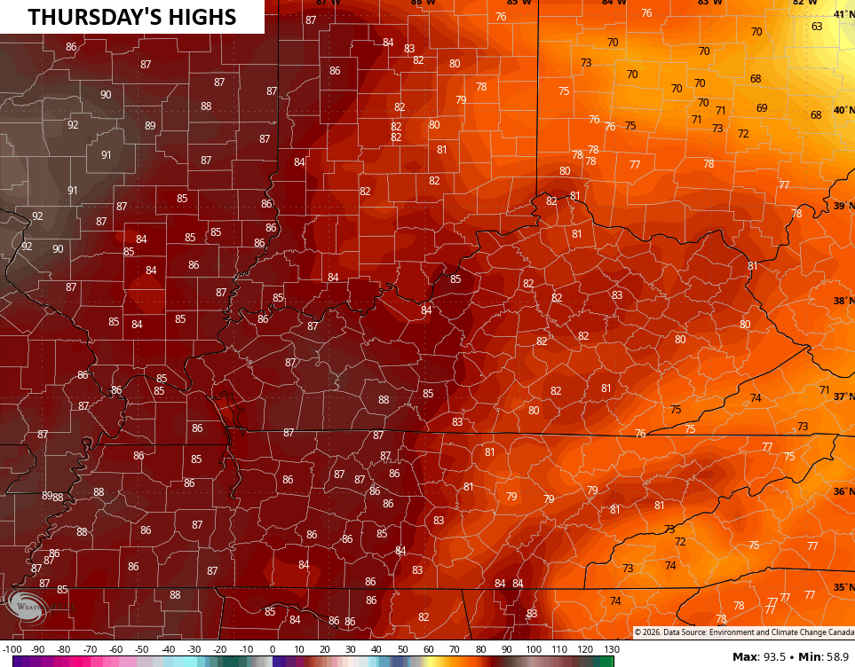
Good Sunday, everyone. Today is a day for record books as record highs will likely fall in what could be one of the hottest March days on record for our region. A cold front dropping in from the north will put an end to the heat as booming thunderstorms sweep through.
Let’s begin with the heat…
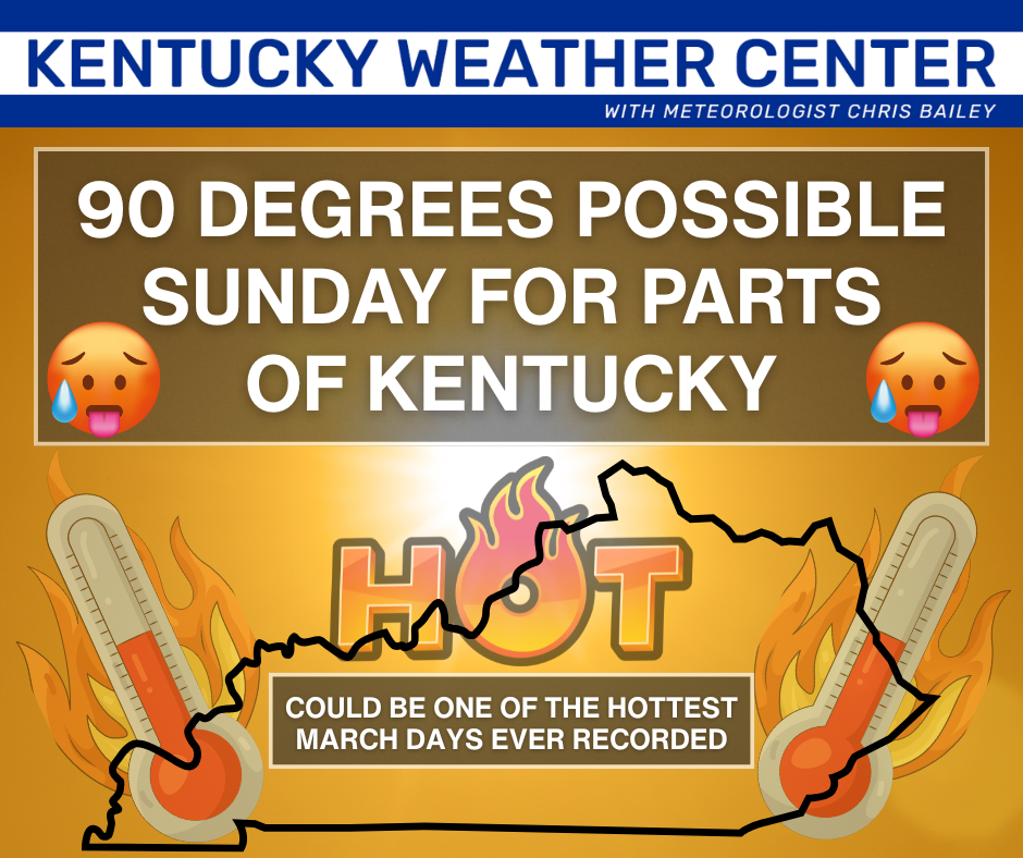
Yes, that’s right, 90 degree temps may show up for parts of Kentucky with the west having the best chance at seeing those kinds of numbers. We have only had a handful of days in history with 90 degree temps showing up anywhere in Kentucky, so this is rather extreme.
Record daily highs will fall in many locations with the potential for all-time monthly record highs for March possible.
This is part of one of the most extreme heat waves on record to hit the United States, but this is our only day of dealing with it.
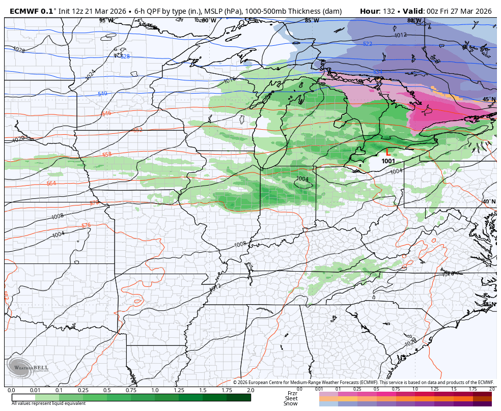
Winds are cranking on this strong southwest flow ahead of a potent cold front dropping in here from the northwest. This brings a line of thunderstorms in here late this evening into the wee hours of Monday. This line will be weakening from north to south…
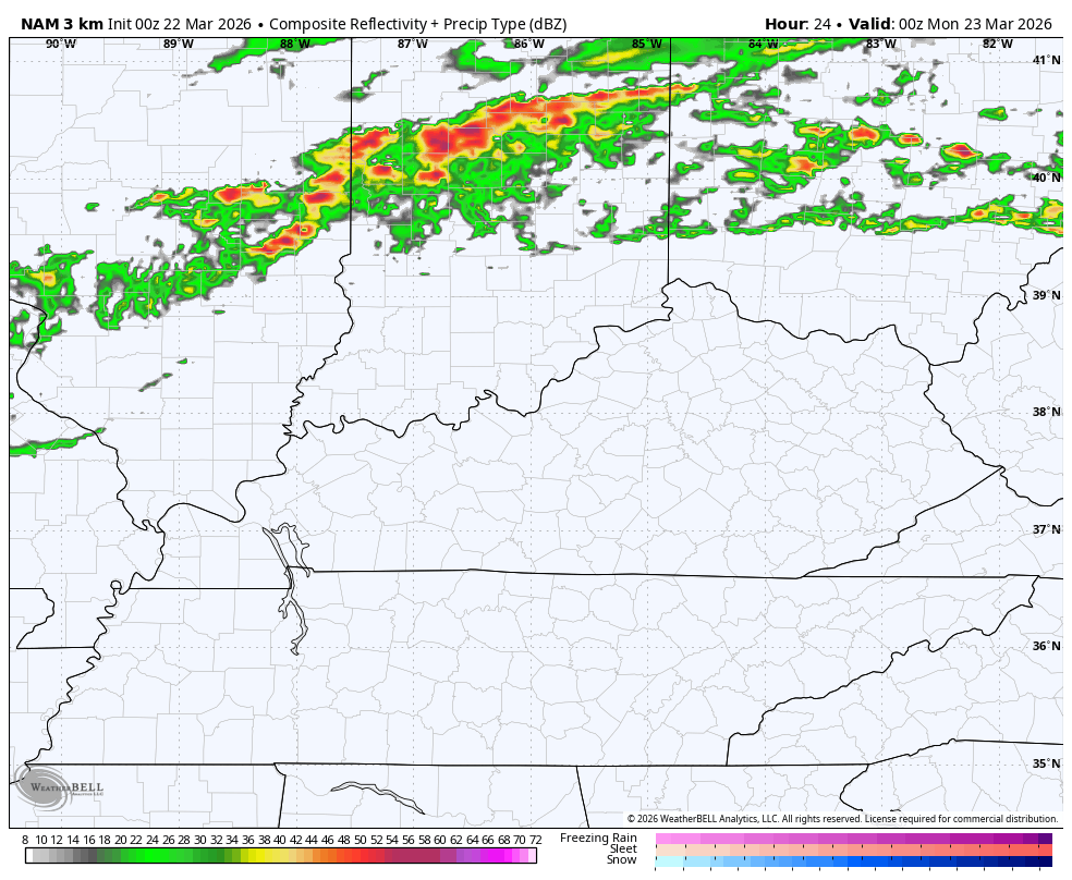
Severe storms are a good bet with this line with the greatest possibility across northern Kentucky. Here’s today’s Severe Weather Outlook from the Storm Prediction Center…

While there is a low-end tornado risk in the north…

The greatest risk is from damaging winds and large hail…


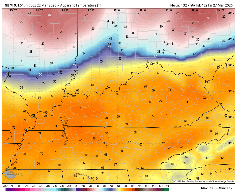
Much cooler temps then drop in here behind this on Monday as highs are back into the 50s. The 60s shoot back in here for Tuesday and Wednesday with another crack at the 80s possible on a strong southwest wind on Thursday.
That’s ahead of what may be another strong to severe storm maker rolling in along a Thursday night/Friday cold front. This may bring another dramatic drop in temps and what it feels like. This animation starts at 8am Friday and ends at 8am Saturday…
Temps behind that should shoot right back up, leading to a rather robust signal for strong/severe storms to end March and begin April…
Another update comes your way later today. Until then, here are all the storm tracking tools you need to start the week…


Current watches

Possible Watch Areas

Make it a sensational Sunday and take care.

Happy Spring! 🙂
Thanks Chris. Hoping We Receive Some ” Spring Showers ” And Not The Large Hail And Strong Wind Gust That Are Forecast For My Area Sometime Tonight. Early Summer Like Weather Almost Always Happens With Every Spring. A Lot Of Agreement On How Our Summer Will Unfold With Temperature And Precipitation. Many Expect A Very Prolong Period Of Heat, With Maybe Average Precipitation. I Always Like It Hot On The Fourth Of July, Then I’m Ready For Autumn Like Weather.
The most recent sea surface temperature anomaly chart shows warmer than normal ocean temps getting established along the eastern shore of the Pacific. This plus trade winds intensity and direction indicates that ENSO-Neutral is currently in play and I continue to believe that we could phase into an El Nino as early as mid July to early August. Also, some very warm water is beginning to show up in the Gulf of Mexico, which will provide fuel for tropical storms this summer.
https://www.ospo.noaa.gov/data/cb/ssta/ssta.daily.current.png
That Would Be An Indication Of A Positive PDO, Which Is Not Going To Happen.
At 10:00am CDT the temperature at my PWS near Bowling Green is 75°F, which is 9° warmer than yesterday at this time. Yesterday’s high was 84° F, so we have a realistic chance of hitting 90°F today, however, there is little chance of breaking BG’s all-time record high for this day of 99°F. We continue to be dryer than normal, having picked up just over 6 inches of rain since January 1st.
Very Dry Here, Due To Those Dry Southwest Winds, That Seem To Dominate In La Nina Years.
Enough of the cold shots!
Now It Doesn’t Look like A Very Wet Spring : )
https://climateimpactcompany.com/ag-market-global-weather-climate-sunday-report-u-s-ag-belt-is-less-wet-warmer-eastern-europe-black-sea-region-shift-wetter-2/