Good Monday to one and all. We’re coming off an historic weekend with record setting high temps, but Mother Nature is smacking us back into reality today with cooler temps. This up and down temperature pattern is settling in for a while, but I suspect more ups than downs.
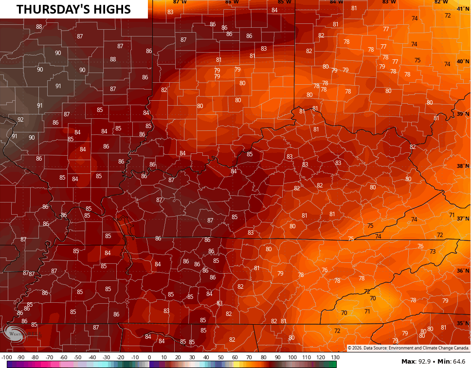
As expected, Sunday turned into one of the hottest March days ever recorded for the state of Kentucky. Record highs fell in many cities with the first 90 degree temps of the year coming MUCH earlier than normal.
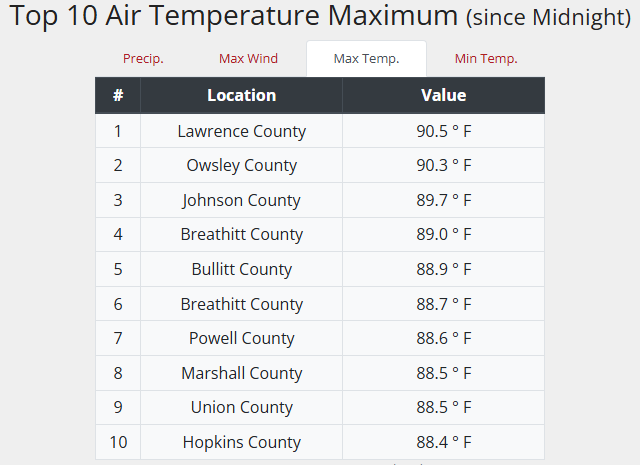
Even the Kentucky Mesonet sites hit 90…
Temps today are in the 50s to near 60 in the west and southwest. The numbers will jump back into the 60s for Tuesday then upper 60s and low 70s for Wednesday.
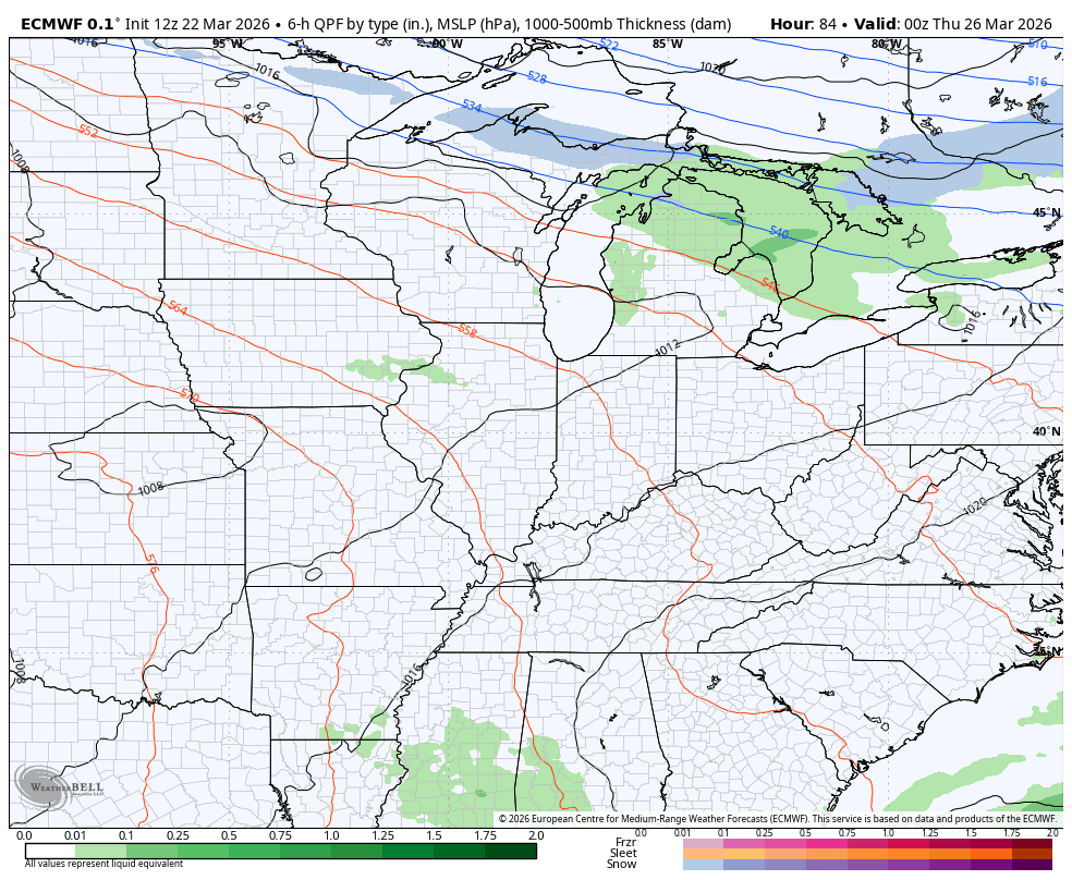
Say hello to another round of record or near record highs for Thursday…
This comes along with a few storms that may fire up at some point on Thursday then a better chance for showers and storms on Friday as a cold front sweeps through…
Well above normal temps go back to normal or below right behind the boundary into the start of the weekend…
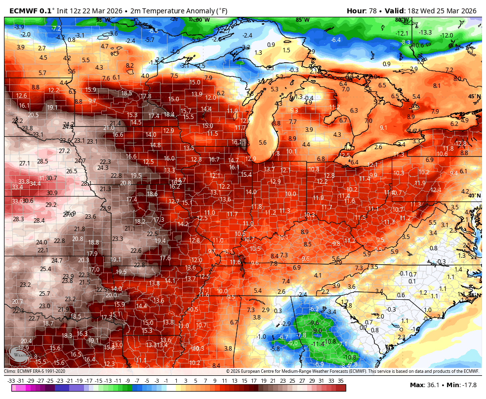
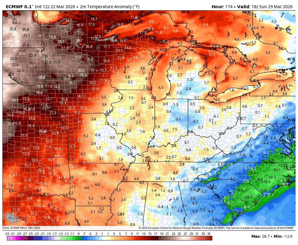
This pattern then goes back warm with back and forth shots leading to rounds of storms zipping through into early April…
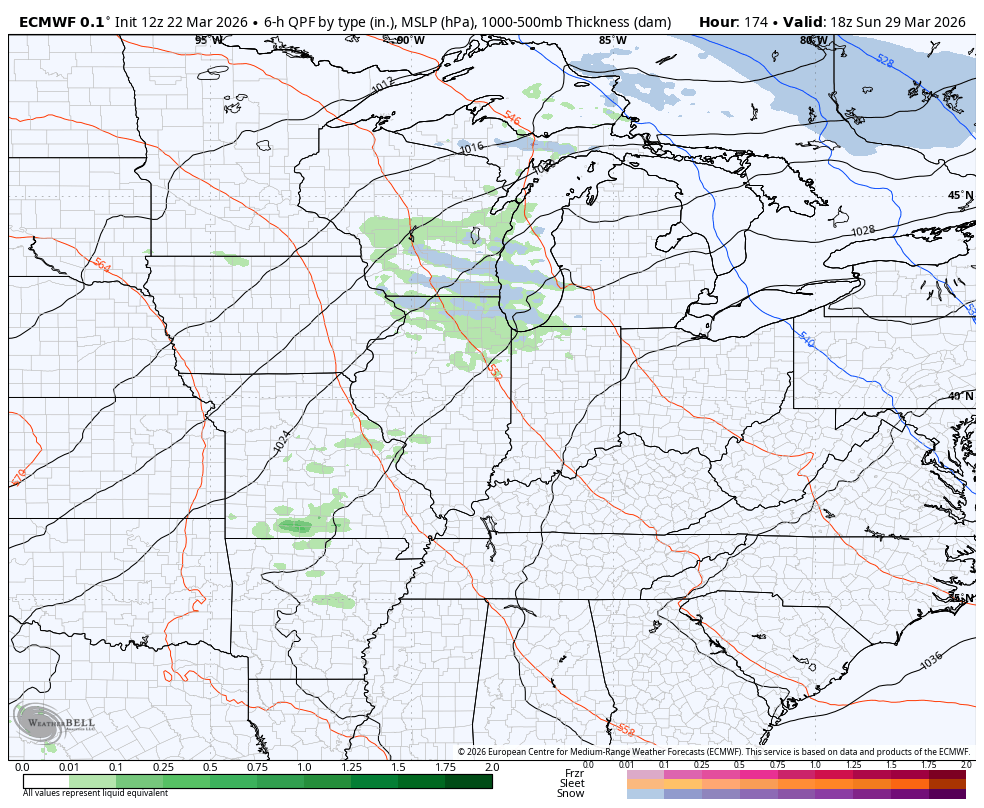
I suspect the EURO is too cold in early April…
Here are your tracking tools to get you through this Monday…


Make it a magnificent Monday and take care.

Spring is in full effect and winter can’t handle the truth.
Maybe not as warm it was yesterday, but its typical having yo yo temps this time of year. Usually don’t Seattle until May or June.