Good Tuesday, everyone. Better winds are kicking in across Kentucky today, leading to temps on the upswing. This is ahead of a MUCH bigger surge that may take us back into record territory before a cold front smacks it back down.
A kiss of frost is possible out there this morning before temps jump back toward the upper 50s to middle 60s with a mix of sun and clouds. Wednesday’s temps jump even more with upper 60s to middle 70s.
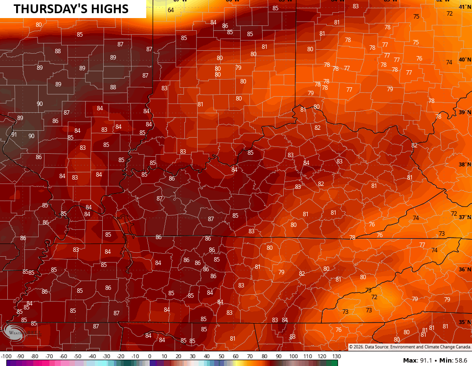
This is ahead of a really warm day that can break a few more records on Thursday. Highs look to jump into the 80-85 degree range for many…
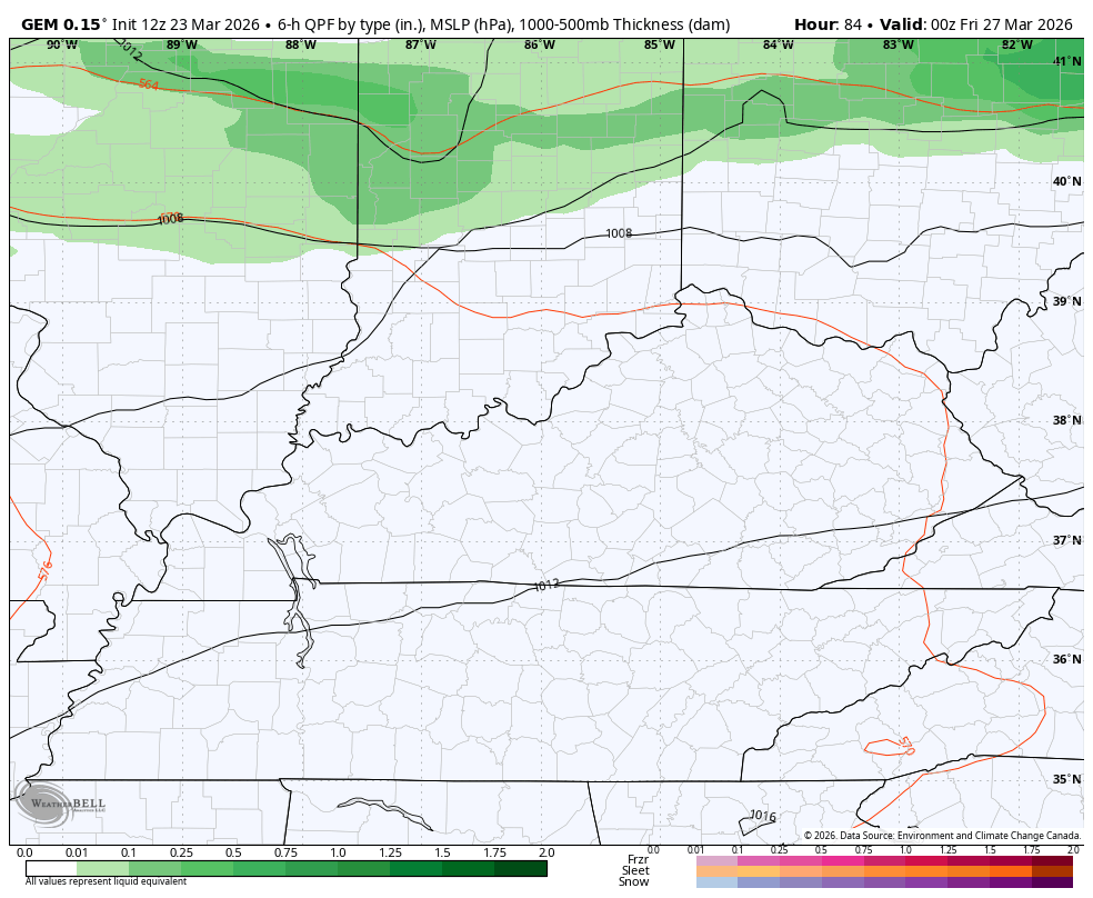
The potential for a few storms will be noted ahead of all that with a much better shot of rain and storms arriving from north to south Thursday night and Friday. This is ahead and along of a cold front dropping in…
Temps tank behind that with Friday temps ranging from the 70s in the south to a wind chill in the 30s north… At the same time. The chilly winds win the battle into Saturday as highs come way down into the 50s.
Temps surge again Sunday and Monday as we get ready to end March and begin April. The pattern looks fairly active into the first week of April with a few big thunderstorm threats…
I said yesterday that the EURO looked too chilly for early April and now it’s looking milder…
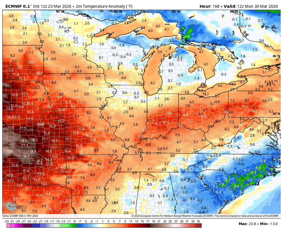
It looks like a rather warm start to the month of April and I’m here for it. Of course, with spring severe weather season kicking in, things can also take a turn in a hurry.
Make it a terrific Tuesday and take care.

Let’s do this!