Good Thursday, everyone. A few storms are ushering in record highs for much of Kentucky out there today… Again. This will be followed by a strong cold front with a dramatic drop in temperatures into the start of the weekend.
High temps out there today generally range from 80-85 degrees on a strong southwest wind. This would be enough to set record highs for the date across most cities in the state. All of this is ushered in by a couple of storms rumbling through central and eastern Kentucky early today.
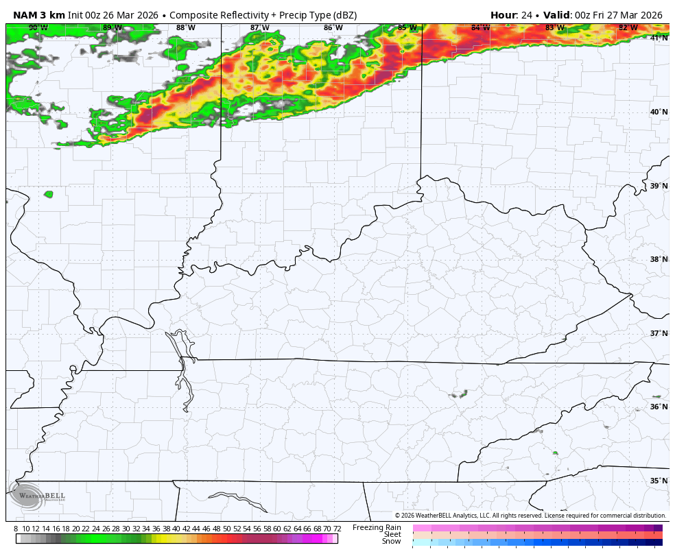
While we are basking in summertime warmth, severe storms are rumbling to our north. The Storm Prediction Center keeps the severe threat to our north…

All of the threats with the evening and overnight action stays north of the state…


That line of storms runs out of steam as it moves in here overnight into Friday. Here’s the future radar from the Hi Res NAM from 8pm today through 8pm Friday…
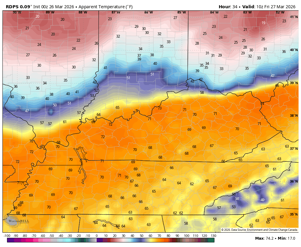
Temps absolutely tank behind this. Areas ahead of the front on Friday reach the 70s before dropping into the 40s from north to south as the front passes. Gusty winds will make it feel like the 30s by later in the afternoon and early evening.
This “feels like” animation shows the drop from Friday morning through Friday evening…
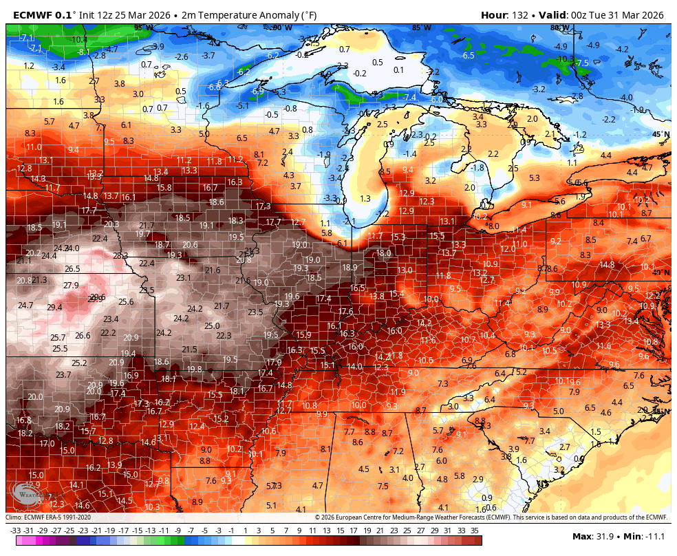
Saturday starts in the frosty upper 20s and ends with highs of only 50-55. The numbers quickly rebound into the 60s by Sunday with the 70s waiting on us by Monday. Those should last through the rest of the month and into the first week of April before a few cold fronts try to work through the region.
The EURO shows this well on the temperature anomalies through April 8th…
Watch for the threat for some big boomers to show up as we get into early April…
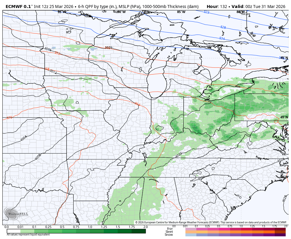
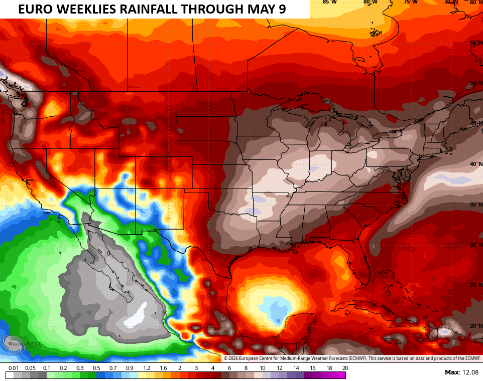
The EURO Weeklies have been overplaying the amount of rain in our region of late, but they suggest a healthy severe storms season through early May. This runs from the Ohio Valley into the eastern part of the southern Plains…
Another update may come your way later today. Until then, here are all the storm tracking tools you need to start the week…


Current watches

Possible Watch Areas

Make it a terrific Thursday and take care.

It’s opening day today in MLB, and it’s going to be a chilly one for the Cubs at Wrigley Field this afternoon, with temps falling throughout the game to the low 40s. A strong NE wind off Lake Michigan will add to the chill.
Right now in the SW Suburbs, it’s in the low 70s, but temps will fall quickly when the cold front goes through in a few hours and the winds shift to the NE.
Good luck to the Cubbies.
The EURO weeklies have overplayed everything.
Happy opening day! Go Dodgers!