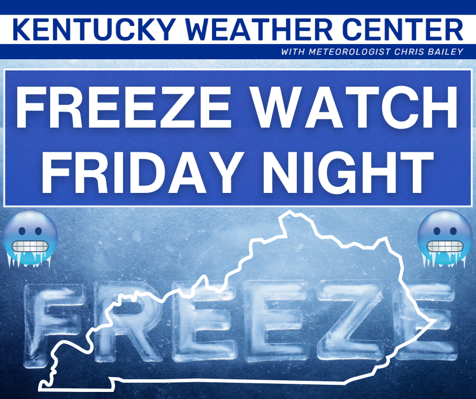
Good Friday to one and all. Today is a day of big changes as a stout cold front drops in from the north. This brings gusty showers and crashing temperatures along for the ride, setting the state for a freeze tonight and early Saturday.
The freeze is the big story as our Freeze Watch will get upgraded to a warning…
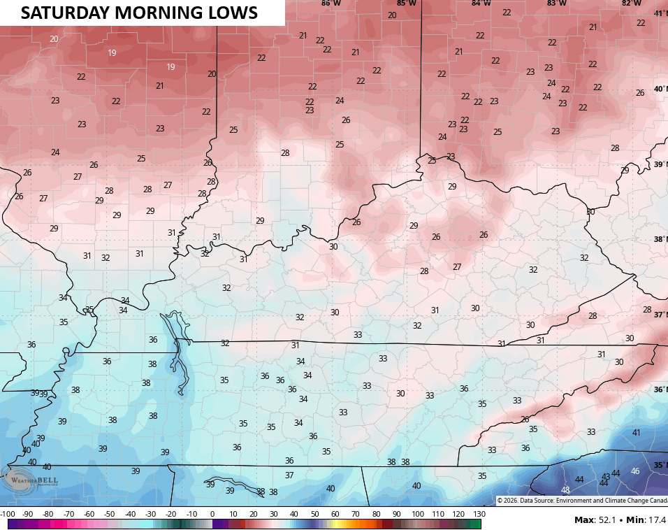
Temps tonight bottom out in the mid and upper 20s for most of the state…
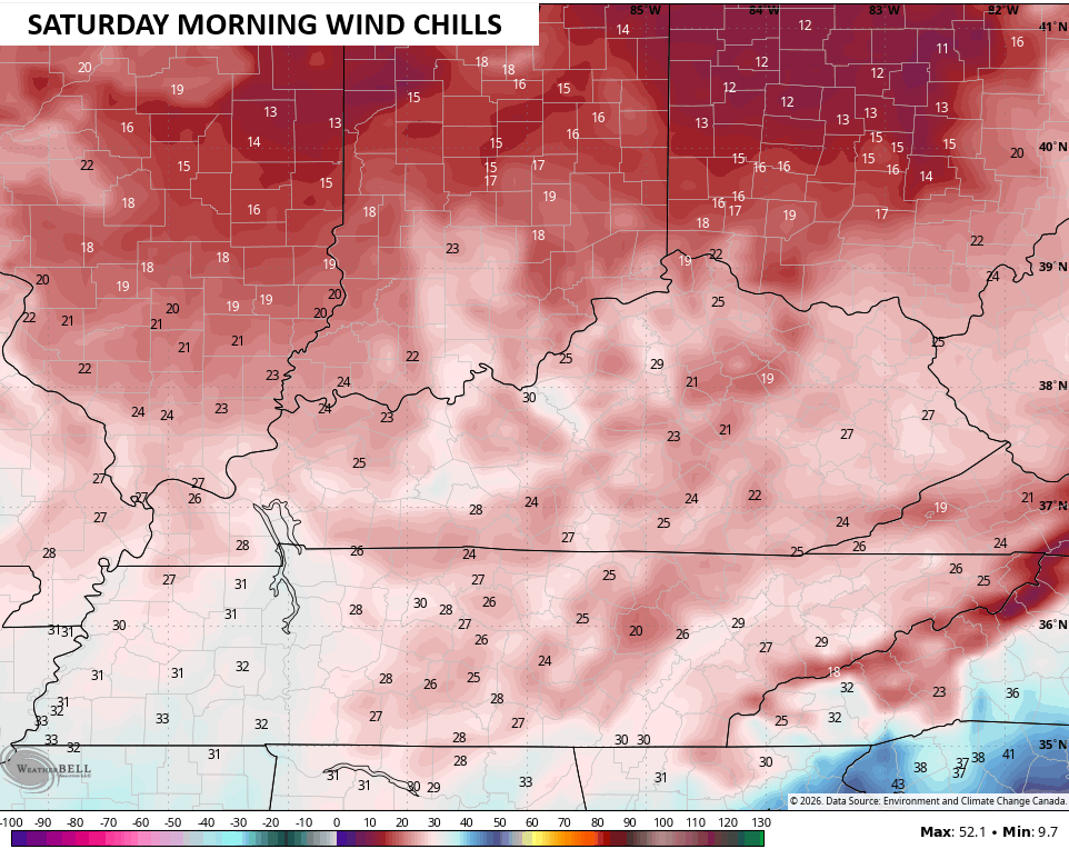
Winds will make it feel quite a bit colder with wind chills nearing 20 in some spots…
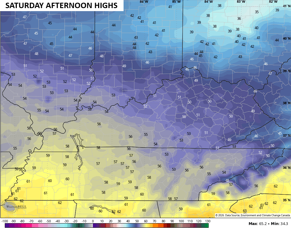
Highs on Saturday are below normal with areas of central and eastern Kentucky barely cracking 50…
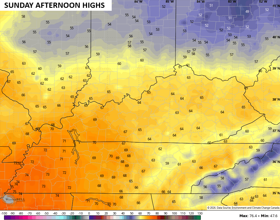
Temps jump back into the 60s for Sunday, which looks really nice…
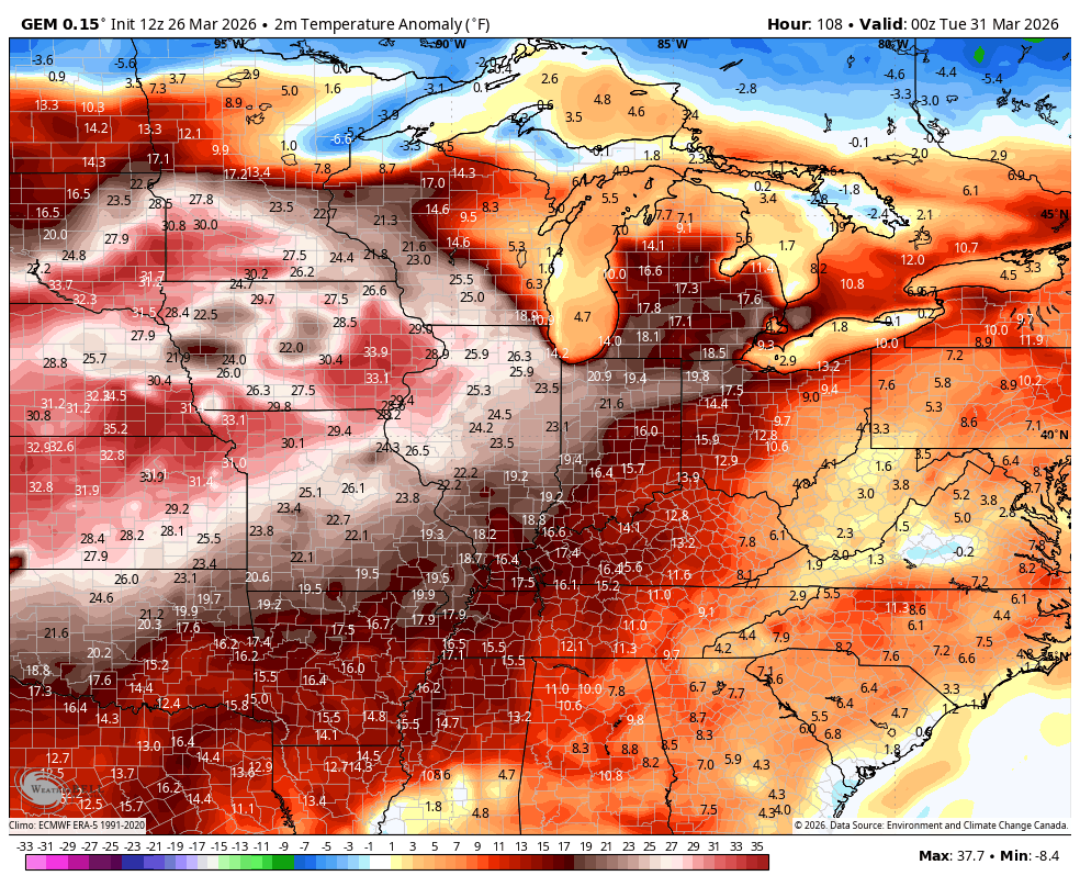
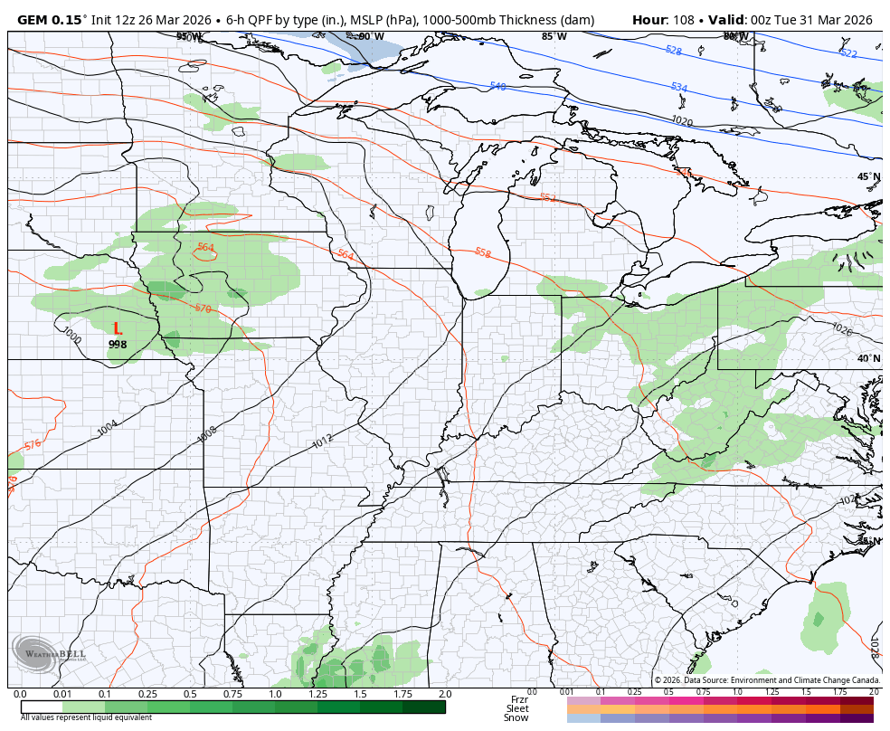
Temps jump into the 70s and 80s next week as we flip back to much above normal to end March and begin April. This warmer setup does have a few cold air intrusions trying to push in…
That kind of setup can produce some hefty rounds of thunderstorms in our part of the world…
I leave you with all the tracking tools you need to end the week…


Current watches

Possible Watch Areas

Make it a fantastic Friday and take care.

https://forecast.weather.gov/showsigwx.php?warnzone=KYZ063&warncounty=KYC099&firewxzone=KYZ063&local_place1=2%20Miles%20NNE%20Canmer%20KY&product1=Freeze+Warning&lat=37.3147&lon=-85.7669