Good Saturday, everyone. Our day is starting with a hard freeze for much of Kentucky as the weekend starts cold. Things get much better by Sunday as our overall pattern looks rather wet and stormy as we head into the month of April.
Temps today are in the 20s to start with upper 40s to upper 50s for afternoon highs. Those numbers jump into the 60s for Sunday then the 70s by Monday. This surge of warm air is ahead of what may be an active storm system arriving for Tuesday and Wednesday. This looks to be the first of two shots at strong storms with the next one arriving a few days later.
This animation from the EURO shows both systems…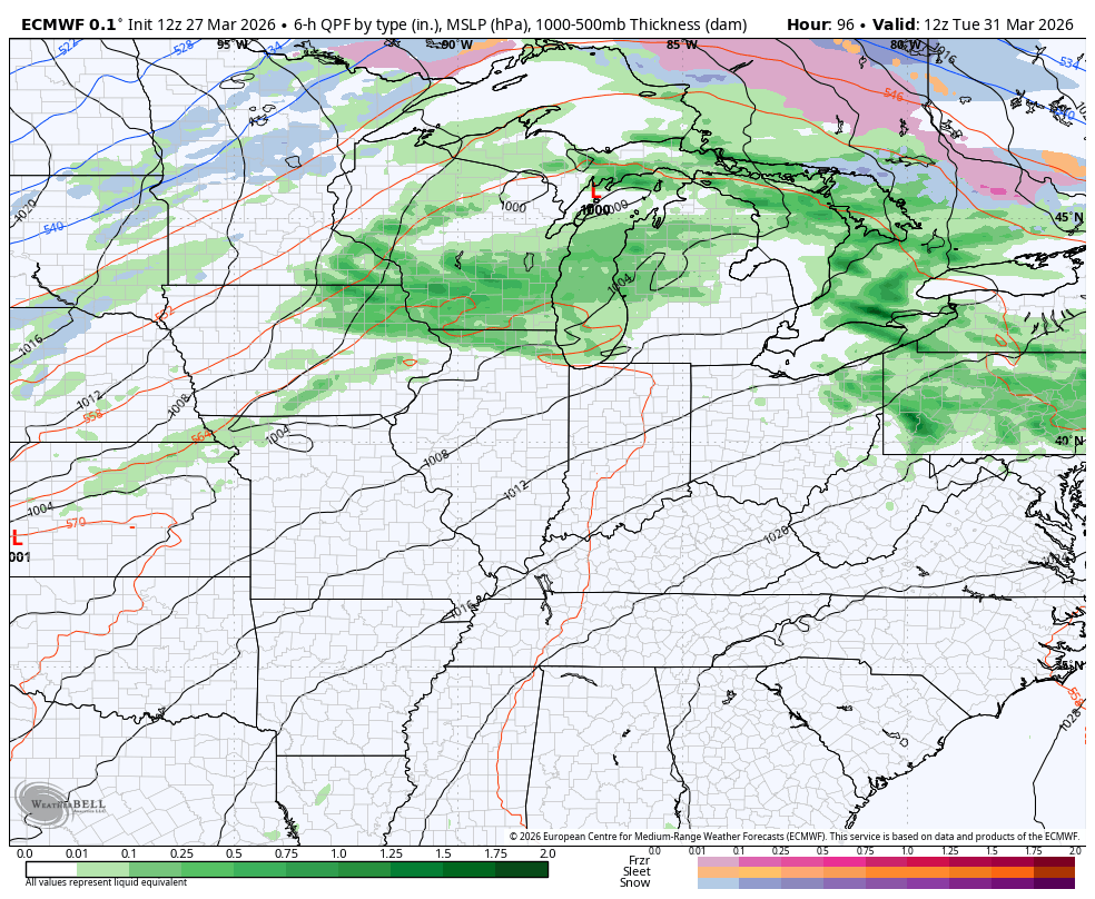
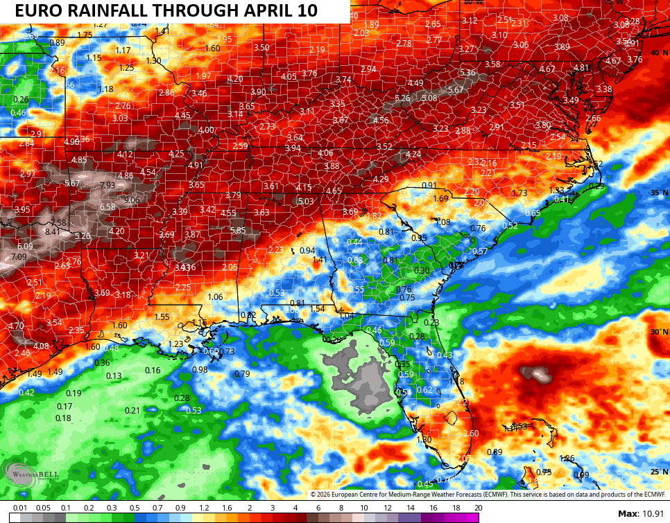
These two systems have the potential to bring quite a bit of rain into the region and we are beginning to see the forecast models all giving us a clear signal. Look at the heavy rain swath from Texas into our region from that run of the EURO…
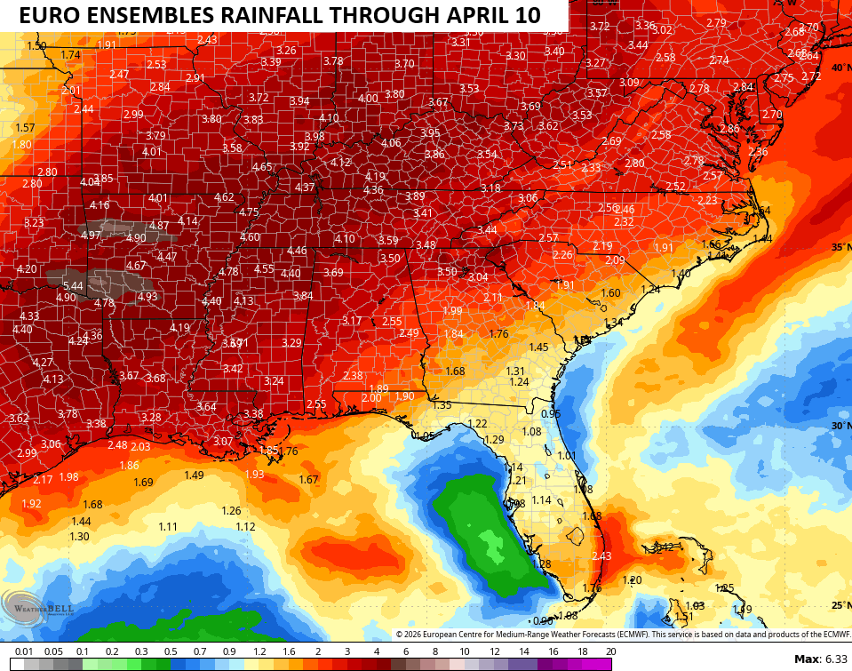
The EURO Ensembles agree…
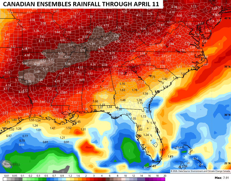
The Canadian Ensembles are even wetter…
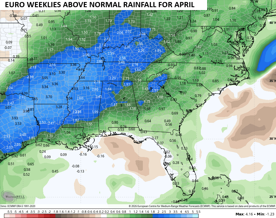
The EURO Weeklies are seeing that as a trend for April with Kentucky averaging 1″-3″ above normal on rainfall for the month…
Have a sensational Saturday and take care.
