Good Monday to one and all. The final few days of March are upon us with April staring us straight in the face. As we close out the month and roll into the new one, temps continue to look very warm with rounds of storms set to join in on the fun.
Speaking of storms, there’s the chance for a shower or storm out there today across central and eastern Kentucky, but the odds are low. Temps are in the 70s.
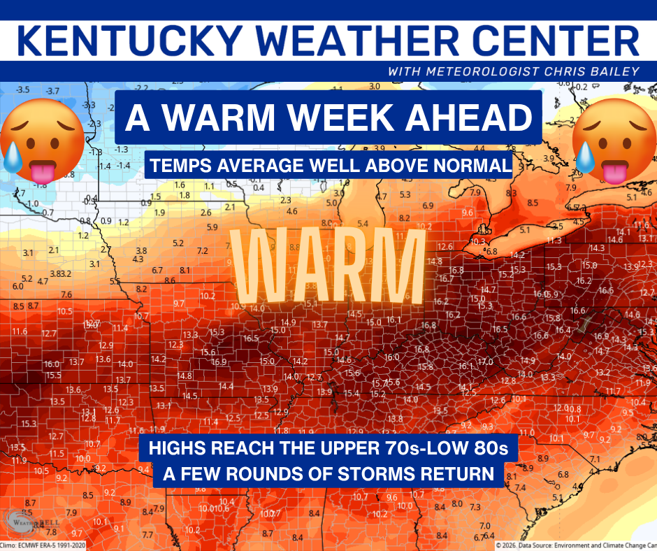
Highs reach the upper 70s to low 80s from Tuesday through much of the rest of the week. The overall numbers from today through the weekend are WELL ABOVE normal…
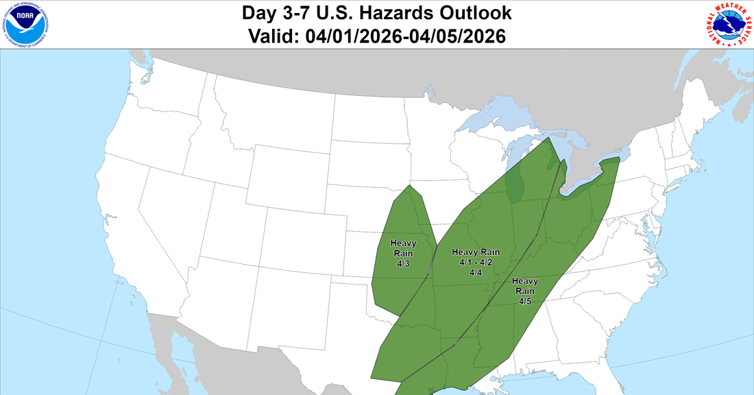
The warmer flex means only some scattered storms over the next few days with the best chance being pushed into the upcoming weekend. You can see this on the Hazards Outlook from The Weather Prediction Center…
You can see all this playing out on the EURO from Thursday through Sunday…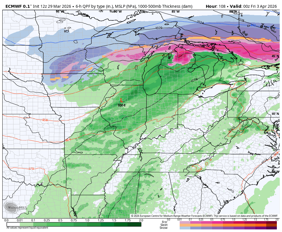
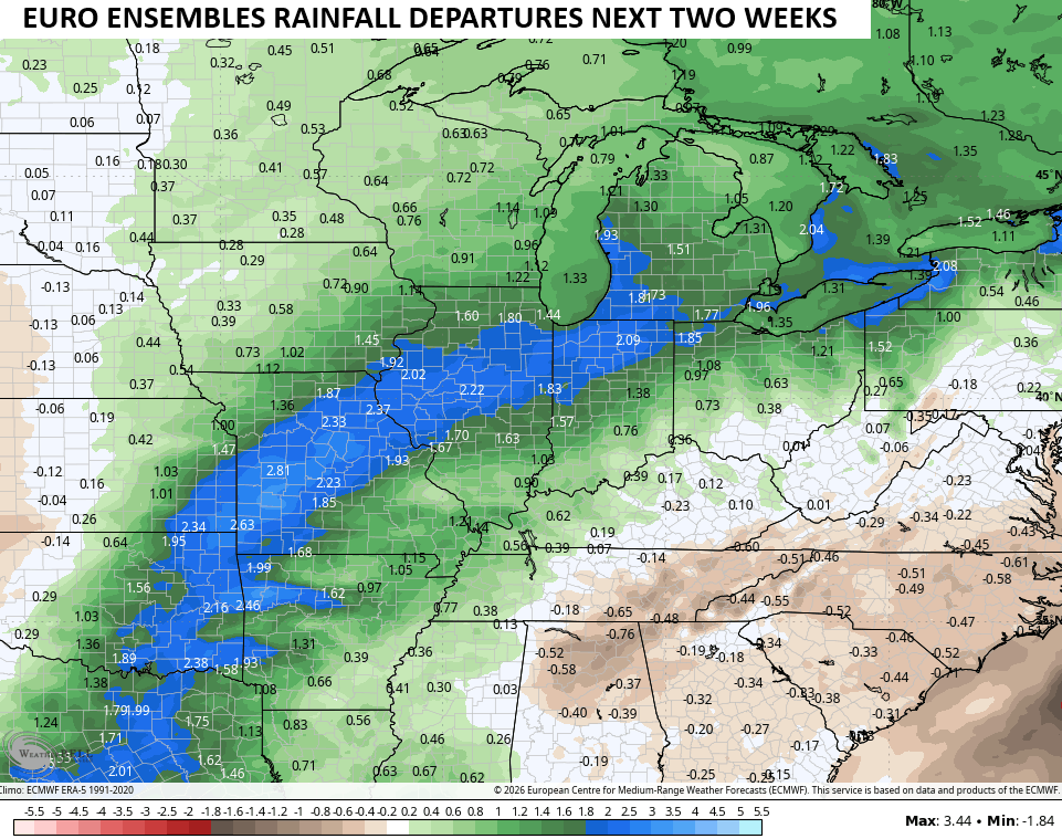
With the models going warmer, the two week rainfall trend is lower as the bulk of the heaviest rains staying just to our west. The EURO Ensembles are showing the much above normal rains staying just west and northwest of us…
I leave you with your Kentucky Weather Radars to follow along with any shower or storm going up today…

Have a magnificent Monday and take care.
