Good Wednesday, everyone. April is off and running on a very warm note with a few thunderstorms jumping into the mix. A few of these storms may be strong or locally severe ahead of a bigger change coming over Easter Weekend.
Let’s kick things off with what’s happening out there today.
A few showers or storms may show up early today with the bulk of the action going up later this afternoon and evening. That’s when clusters of storms ramp up with the greatest concentration across the northern half of the state.
The HRRR Future Radar shows this well…
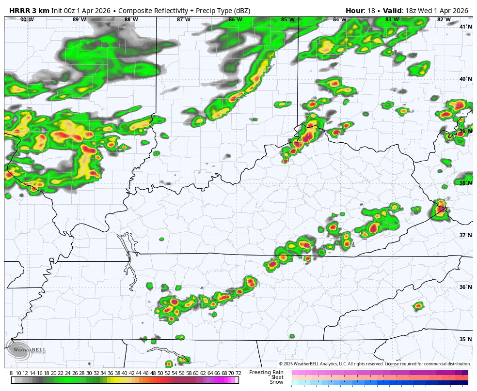
The Storm Prediction Center has a low-end risk for a few severe storms today…

Here’s a look at the individual threats from the SPC…


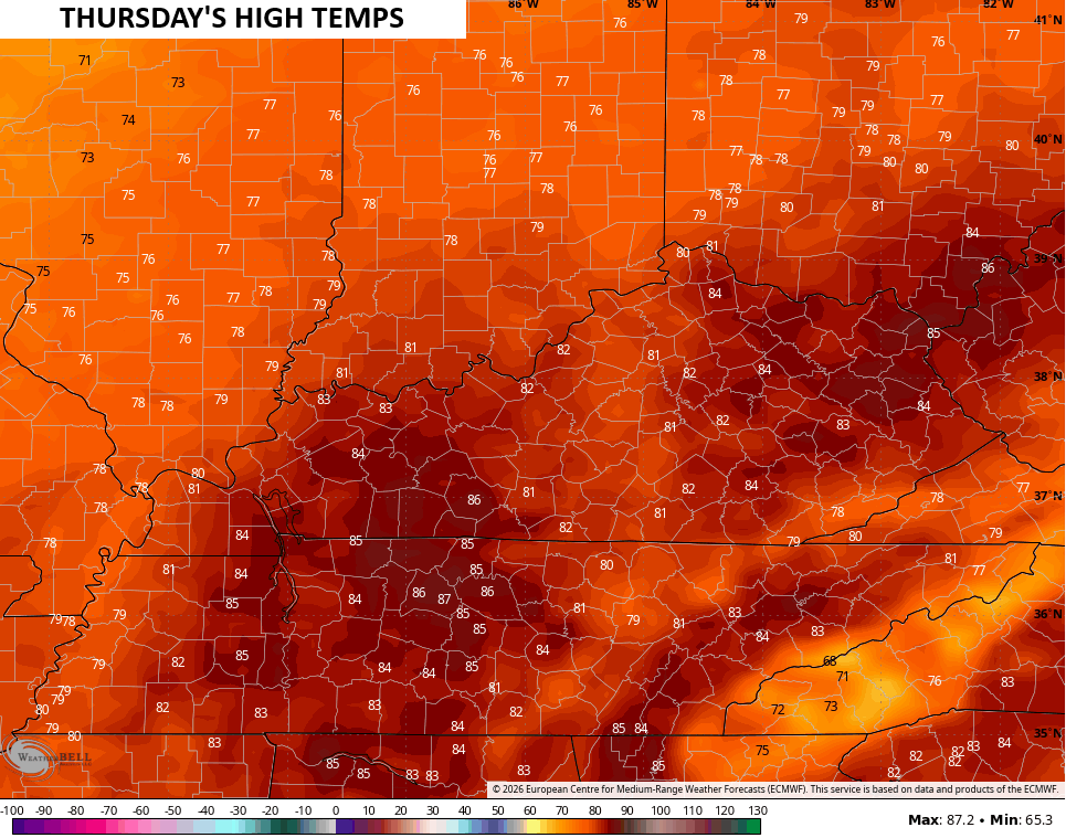
Temps for Thursday surge deep into the 80s, likely breaking records for much of Kentucky…
Isolated storms will be possible with a slightly better shot on Friday with temps back into the upper 70s and low 80s.
Easter Weekend starts windy and very warm on Saturday with highs deep into the 80s. This is ahead of a potent cold front sweeping across the state Saturday night with a healthy line of showers and storms along it. This action looks to spread fairly quickly across the state and should be out of eastern Kentucky by Easter Sunday afternoon…
Temps drop into the 50s for highs Easter Sunday as a chilly wind settles in. Highs are generally in the 50s during the first few days of next week with overnight temps dropping into the upper 20s and low 30s. Warmer temps will then sweep in later in the week.
The pattern for the first three months of the year has been pretty darn dry across Kentucky, in stark contrast of last year at this same time.
Look at the rainfall deficits we are facing on the year…
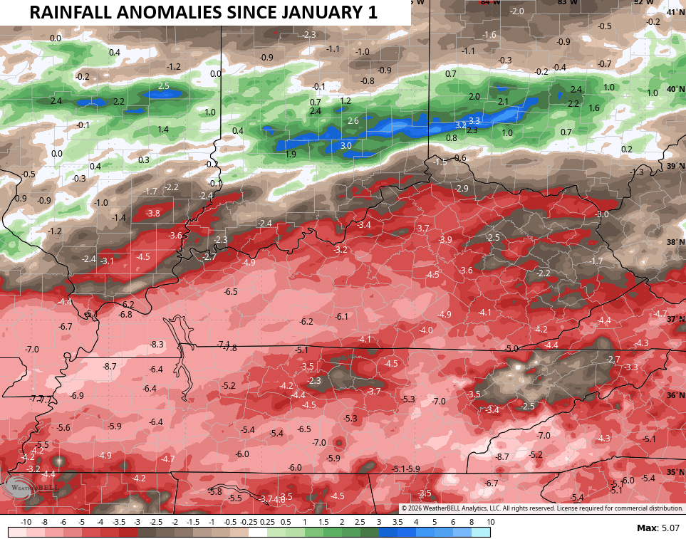
This is concerning as we head into the spring and summer growing season and you guys know me, I’m not one of those weather folks that throw the word “drought” around every time we go two days without rain. If I talk about it, then you know it’s a real concern.
That’s especially true if the EURO Weeklies verify for the next 6 weeks…
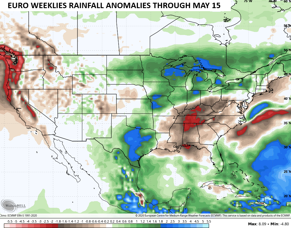
The bullseye of below normal rainfall is right on top of us. Here’s hoping that doesn’t happen. Can’t we ever just have some normal weather around here? Grrr.
Another update comes your way later today. Until then, here are all the storm tracking tools for the day…


Current watches

Possible Watch Areas

Make it a sensational Sunday and take care.

“…normal weather around here!” is a contradiction in terms! I’ve only recorded 3.24 inches of rain since Jan. 1st, and with El Nino ready to flex its wings as early as the end of June, the outlook for Summer precipitation in South Central Kentucky is looking quite bleak.
So those EURO weeklies were lying, just as I thought. Hopefully things turn around. Nobody wants a 2012 repeat, even if we are due.