Good Thursday to one and all. Warm and windy weather continues to rule the weather roost across Kentucky as we make another run at record highs. Big changes are coming for Easter Weekend as a strong cold front crashes through the region.
Temps out there today reach the low and middle 80s for many with a few upper 80s potentially showing up. Records are in jeopardy once again. For Lexington, we tied a record high on Wednesday, giving us 6 record highs in a 27 day span. Pretty wild, huh?
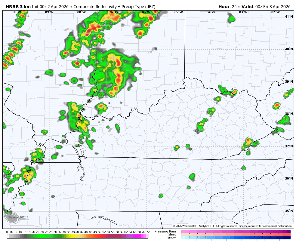
Isolated storms are showing up across parts of the state with a better shot of storms to our north and northwest. A couple of those sneak back in here tonight and Friday. This HRRR future radar starts at 8pm this evening and rolls through 8pm Friday…
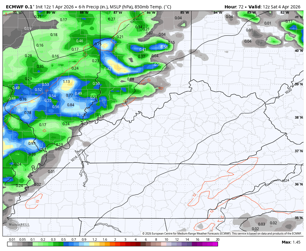
Temps on Saturday surge back into the 80s on a strong southwest wind ahead of our powerhouse of a cold front. That sweeps eastward across the state Saturday night, bringing a band of showers and some thunder along for the ride.
This action looks to move through fairly quickly, leaving us with increasing amounts of sun for Easter. Here’s the EURO showing it all…
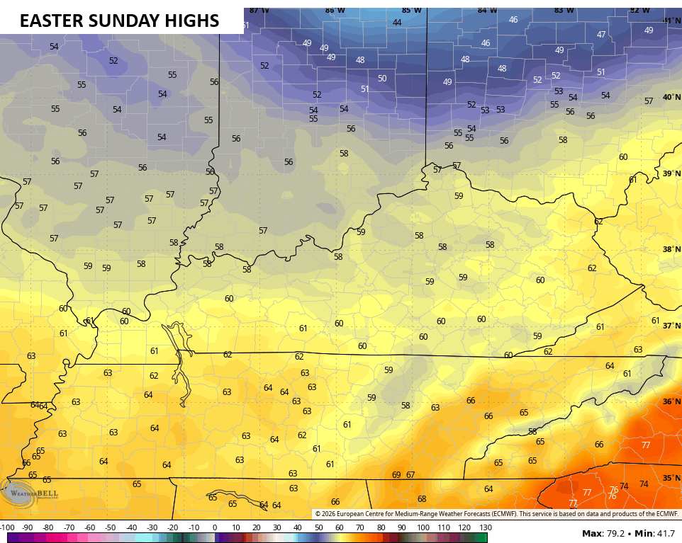
Easter Sunday looks much better with sunshine taking control with much cooler temps. Highs range from 55-60 for many…
Temps remain below normal into the first half of next week before the pattern turns milder with more action taking shape. Here’s the European from late next week into the middle of the following week…
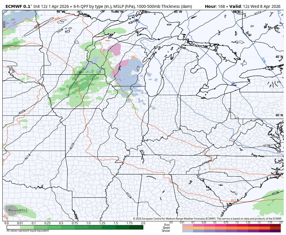
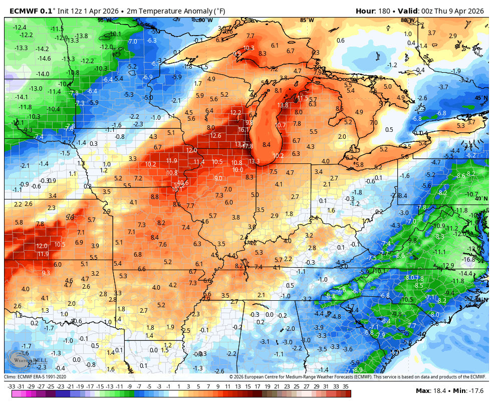
After a dip, the EURO brings above normal numbers back in during much of that time…
Until then, here are all the storm tracking tools for the day…


Current watches

Possible Watch Areas

Make it a terrific Thursday and take care.

Lack of rainfall in South Central Kentucky is getting serious. Soil moisture levels are averaging 26%, and are lower in areas with good drainage. Barren River Lake is currently more than 13.5 ft below full pool; last year at this time it was 1.5 feet above full pool. If we don’t get
…a decent rainfall over the next week or so, a burn ban will be likely.
Joe, I Don’t Ever Remember It Being So Dry In The Spring. Yesterday Evening, We Had A 30 Second Shower. ” Three Drops On A Brick Bat. ” A Strong Upper Level High Pressure To Our South Is The Reason. Rains To Our North, around the Northern Edge Of The High Just Keep ” Fizzling Out ” As They Approach The Rising Air South Of The Ohio River. I’m Sure This Weather Pattern Has Happened Before. In The Western Part Of The CONUS There Is A Serious Water Shortage.
On Another Topic, Not Weather Related : I Have Been Told By My Doctor That I Have Cancer. I Been Busy Going Back And Forth For Treatments At The Hospital. I Start Chemo Therapy And Radiation On Monday. I Have A Serious Battle To Fight.
Stay strong, Schroeder, you’re in our prayers!
Thanks Joe.
You’re in my prayers Schroeder.
Thanks Dottie.
Prayers, Schroeder! We will miss seeing your input around here, but you will be back before you know!
Here’s More On The Water Shortage In The Western States : )
https://climateimpactcompany.com/u-s-sunday-report-the-largest-u-s-climate-problem-as-the-warm-season-approaches-the-western-u-s-drought-and-likely-expansion-2-2/