Good Friday, everyone. It’s another windy and warm day as we get set to kick off our Easter Weekend. A weekend that features a strong cold front dropping into the region Saturday night, bringing cooler but drier air for Easter Sunday.
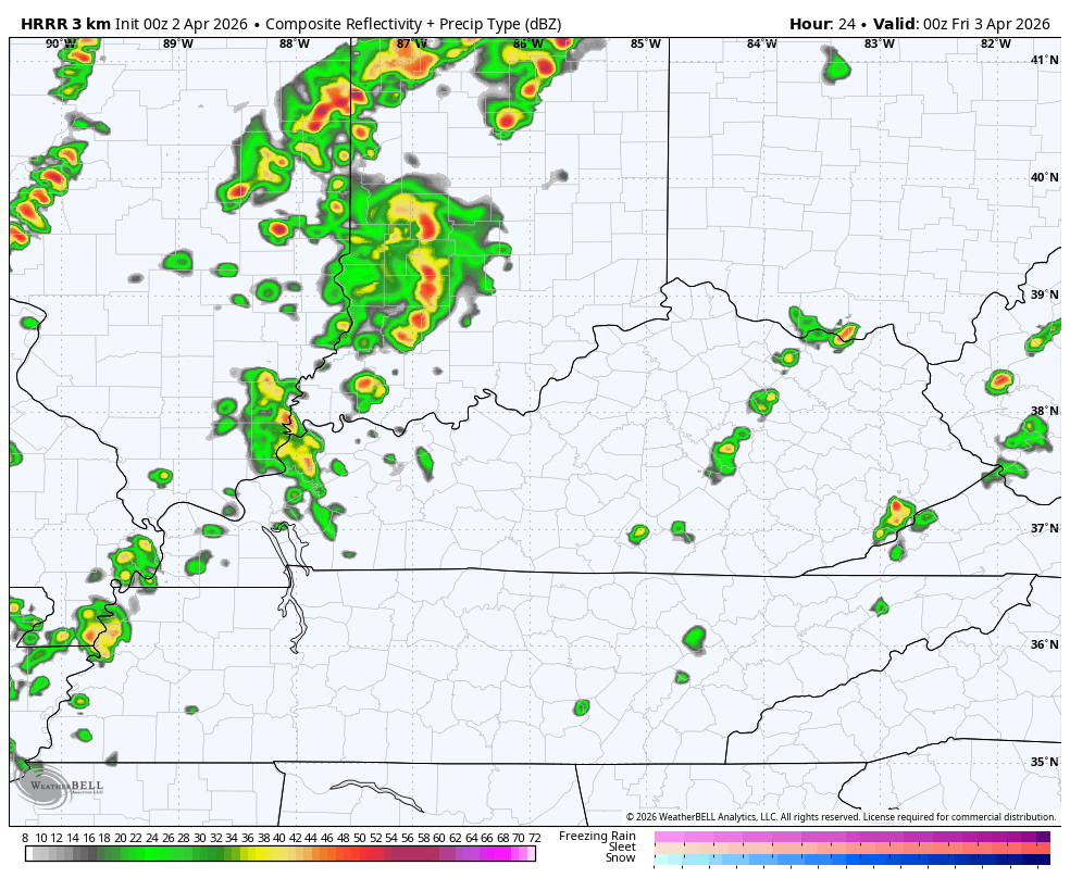
A couple of showers and storms go up out there today with highs ranging from the upper 70s to mid 80s, depending on where you are. The showers and storms are rather scattered compared to what’s happening to our northwest.
That’s where today’s threat for severe storms is located…

The threat on Saturday doesn’t look as great in our region, but there is a low-end risk for parts of the Ohio Valley…

Saturday is a very windy and warm day with highs in the 80s on a strong southwest flow ahead of our cold front. That front has a line of showers and storms along and ahead of it as it crosses the state later Saturday into Saturday night.
This future radar shows the rain exiting eastern Kentucky by 8am Sunday…
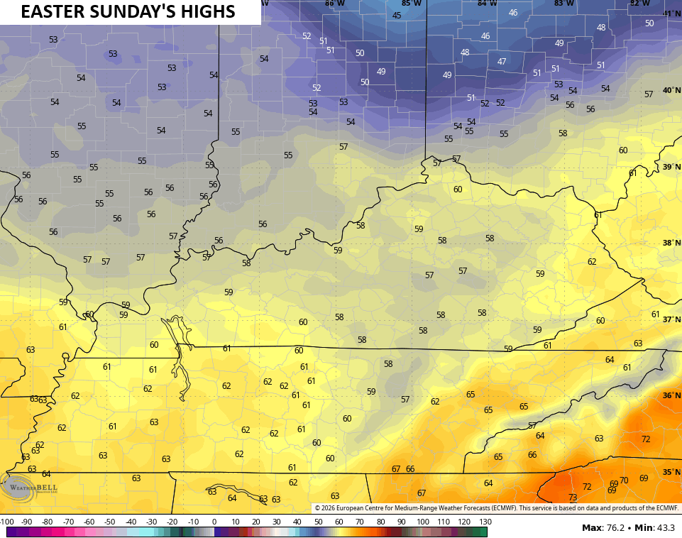
This leaves us with clearing skies for Easter Sunday with much cooler winds blowing. Highs range from the upper 50s to low 60s…
Frost and a light freeze will be possible early next week before temps surge back toward the 60s and 70s by Wednesday. That kicks off a pattern that does try to turn more active…
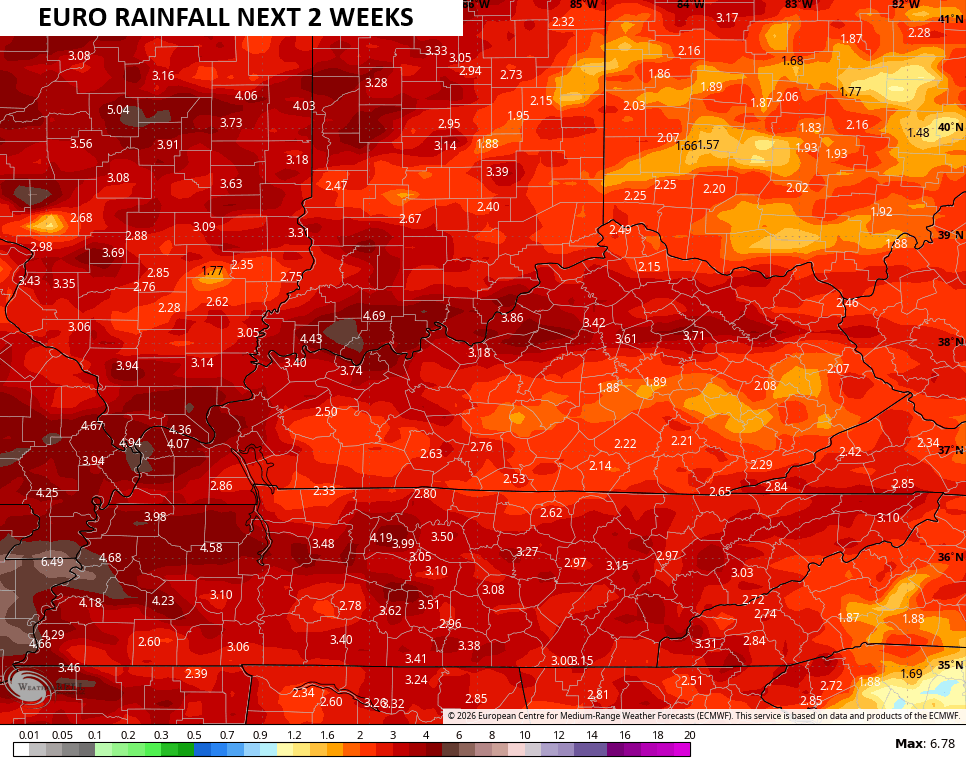
The EURO continues to be the lone model in depicting beneficial rains over the next few weeks…
That’s all I have for you crazy kids, I leave you with all the storm tracking tools you need for the day…


Current watches

Possible Watch Areas

Make it a fantastic Friday and take care.

Thanks Chris. I Hope To Be Back Posting In About Six Weeks Everyone.
We’ll miss you and look forward to when you get back Schroder. Good luck and many prayers to you.
We’ll keep a seat warm for you, brother
Hopefully your treatments and therapies go well. All the best to you!
Schroder my thoughts and prayers to you. Get well soon you’ve got this. Hate that C word.