Good Saturday, everyone. It’s the last day of this amazing stretch of 80 degree temperature days across Kentucky as a big cold front sweeps through. This brings a few strong storms with cooler winds settling in for Easter Sunday.
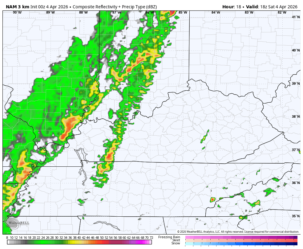
Showers and storms rumble across western Kentucky through the early afternoon before pushing into central and eastern Kentucky during the late afternoon and evening. This line decreases in intensity as it pushes east and should end across the east by Sunday morning. Here’s the Hi Res NAM future radar…
The threat for severe storms is greatest to our north and northeast, but the Storm Prediction Center is highlighting the low-end risk here across parts of Kentucky…

Here’s a look at the individual severe weather threats from the SPC…


Highs ahead of today’s storms hit the low and middle 80s with a huge drop off behind the front. Highs on Easter Sunday range from the mid 50s to low 60s…
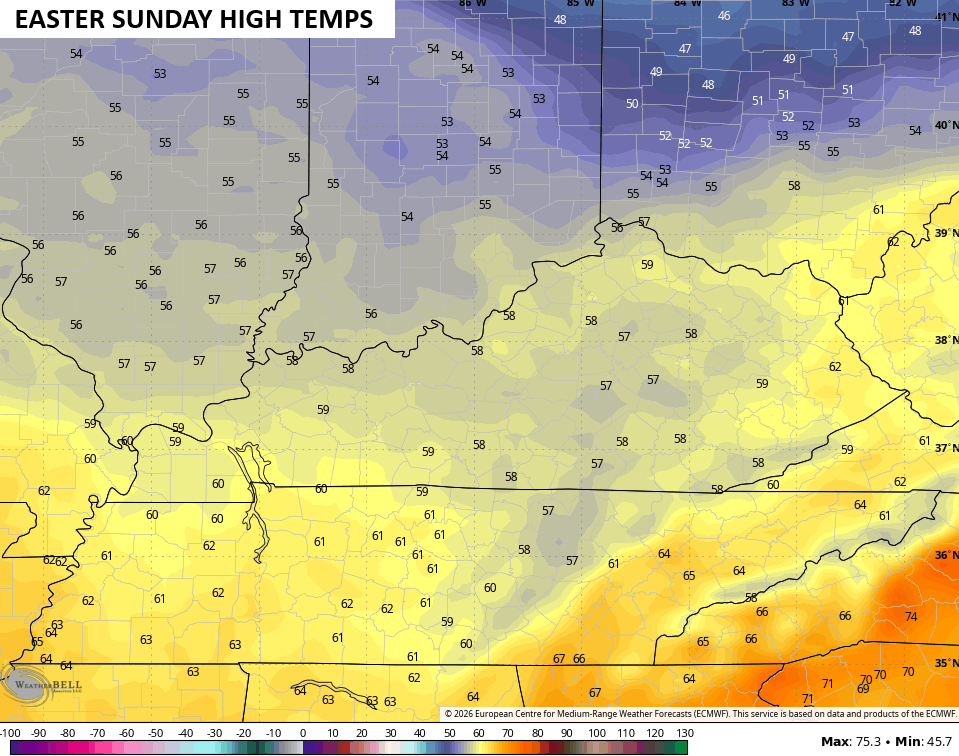
Skies will be partly sunny with winds adding to the chill.
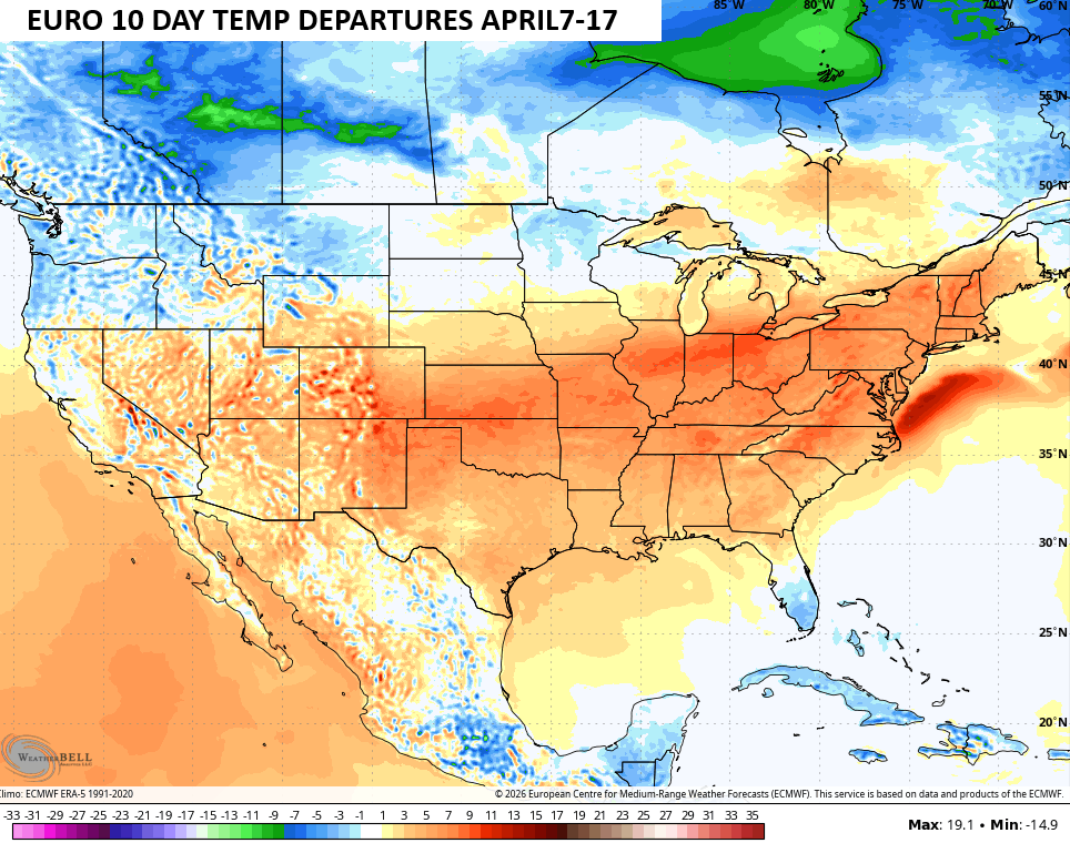
Temps stay below normal Monday through early Wednesday of next week with the chance for some frost and a light freeze.
Thermometers rebound later in the week toward the 70s, likely kicking off another run of above normal temps. The EURO shows above normal temps from April 7-17…
Hhere are all the storm tracking tools you need to start the weekend…


Current watches

Possible Watch Areas

Make it a sensational Saturday and take care.

Let’s hope for a decent soaker, but no flooding.