Good Monday, everyone. Our week is off and running on a frosty cold note, but this turns around in a hurry later in the week. As a matter of fact, temps by the weekend and into next week may very well surge back to record high territory.
Some areas of frost are out there this morning and will be with us again Tuesday and Wednesday mornings. A light freeze may even join in on the fun. Highs today hit the low 60s before coming back down into the 50s for Tuesday.
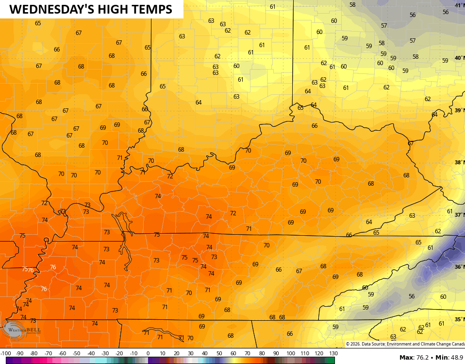
The numbers really jump on Wednesday afternoon with most of the state surging toward 70…
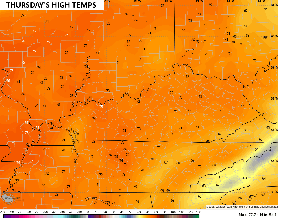
Thursday’s numbers jump deep into the 70s…
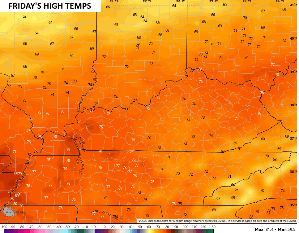
Friday jumps even more with 75-80 for most areas…
There is a front that can approach the region late this week with a shower or storm, but the warm air is set to overwhelm the pattern again. Look at the above normal temps from this Sunday through the following Saturday…
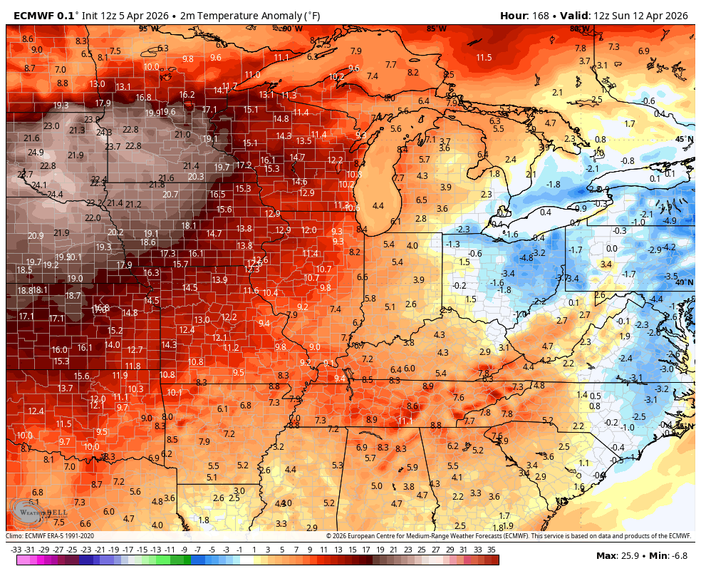
Temps by late this weekend surge into the 80s…
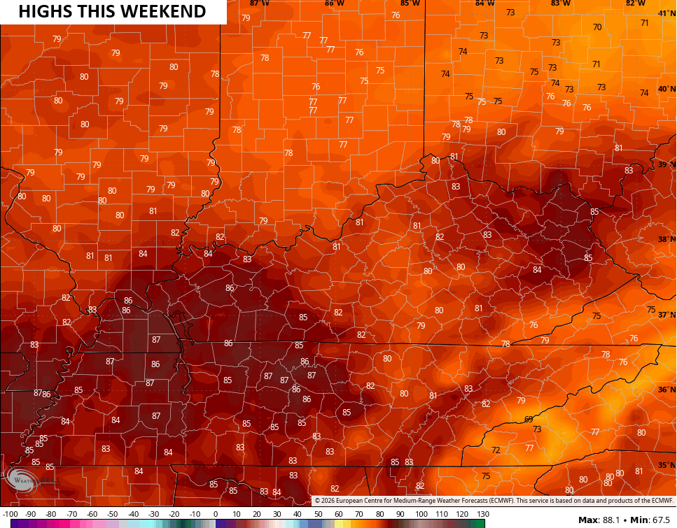
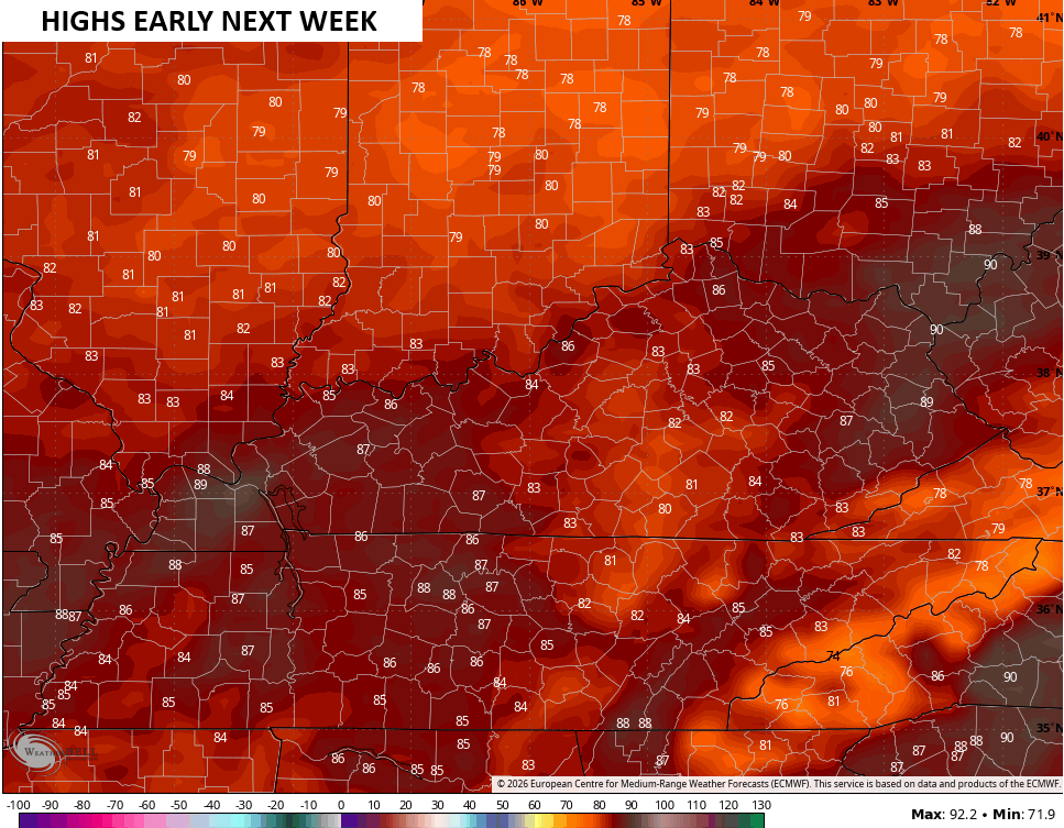
Those numbers would be close to record highs with the numbers following that likely to set some records early next week…
Rain and storm chances during this time are rather limited and this just adds to my drought concern for the spring and, potentially, summer.
We haven’t had a TRUE drought in a long time, so we are overdue.
Have a magnificent Monday and take care.
