Good Wednesday to one and all. It’s a much milder pattern taking shape across the region and this will grow very warm in the coming days. This warm pattern may also finally bring some much-needed rains into the region via some thunderstorms.
Temps this morning are in the upper 20s and low 30s for central and eastern Kentucky in the coldest morning of the week. Oddly enough, it’s the only morning without Frost Advisories or a Freeze Warning into central Kentucky.
Temps this afternoon surge into the upper 60s to low 70s for the entire region. Thursday finds the low and mid 70s for everyone with 75-80 for Friday.
Southwest winds kick in during this time with a weak boundary sliding in here early Saturday. This touches off some scattered showers and storms…
That boundary goes right back to the north by Saturday night with highs in the 80s shooting in here for Sunday. That’s when a few record highs may be noted.
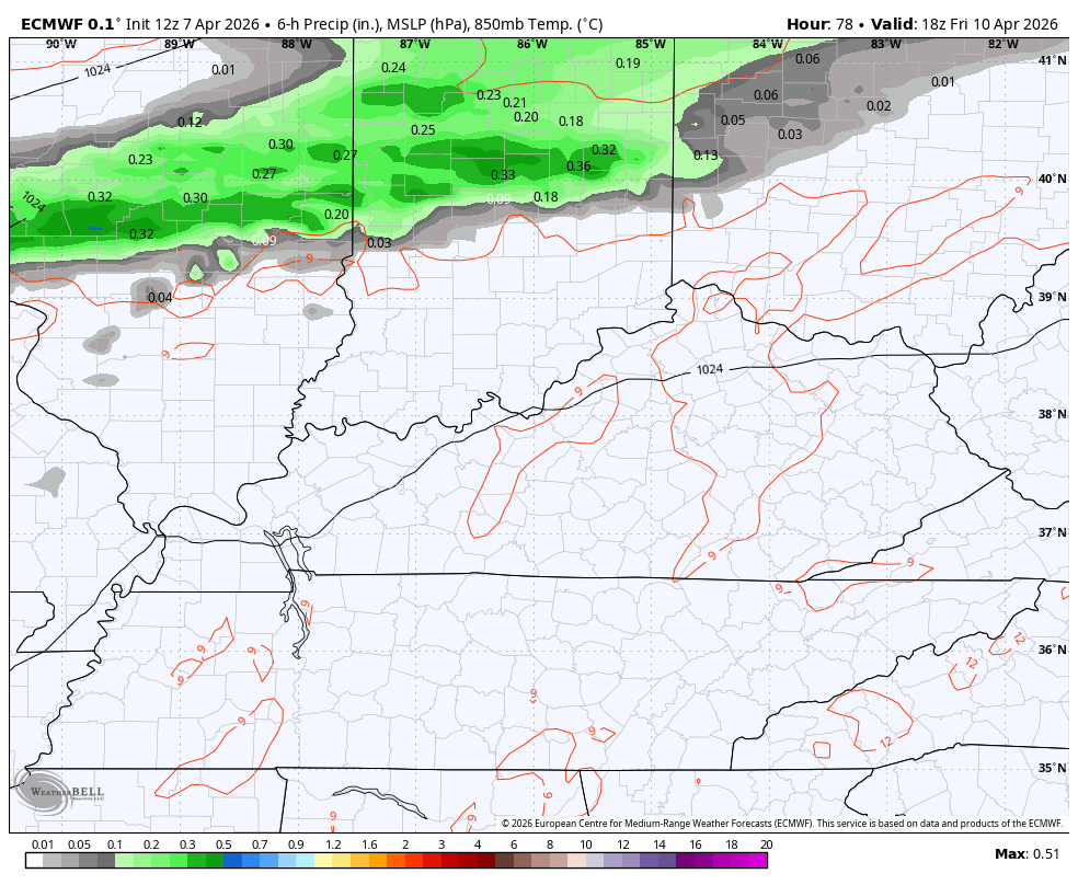
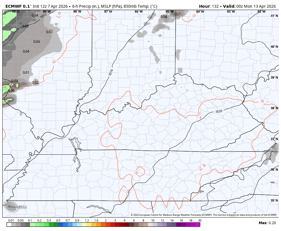
The warm weather continues into next week with the models now indicating a better chance for some thunderstorms sweeping through here. Here’s the EURO next week into next weekend…
The GFS has a better shot of some storms rumbling through here…

That could crank out some strong and severe storms.
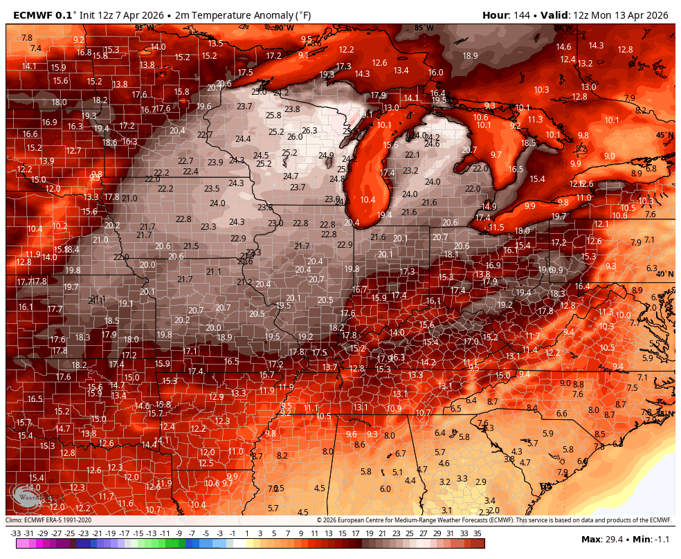
Temps are likely to stay above normal with just a dip or two showing up. Here are the EURO temp anomalies
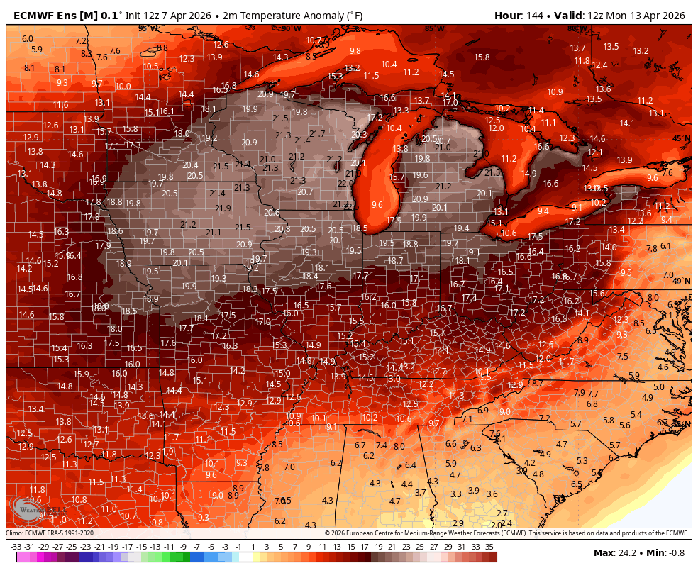
The EURO Ensembles agree with what the operational Euro is cooking up for temps…
Have a wonderful Wednesday and take care.
