Good Thursday, everyone. Today is just about a perfect spring day in Kentucky with lots of sunshine, mild temps and just overall awesomeness. This awesome pattern hangs tough for a while as temps surge toward record high territory once again.
After a few days of colder than normal numbers, the temps have jumped right back up into the mid and upper 70s for many today. Skies look sunny and perfect.
75-80 will show up on Friday with a southwest wind kicking in a little more ahead of a weak boundary dropping in here Friday night and Sunday. This brings a scattered shower or storm along for the ride…
Don’t expect much from that, but it may knock the temps down a degree or two.
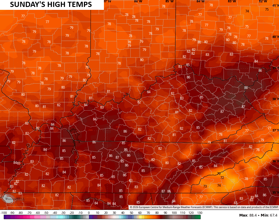
That boundary goes right back to the north as VERY warm air surges in for Sunday. Near record highs in the mid 80s will be possible for many with the chance for a few upper 80s…
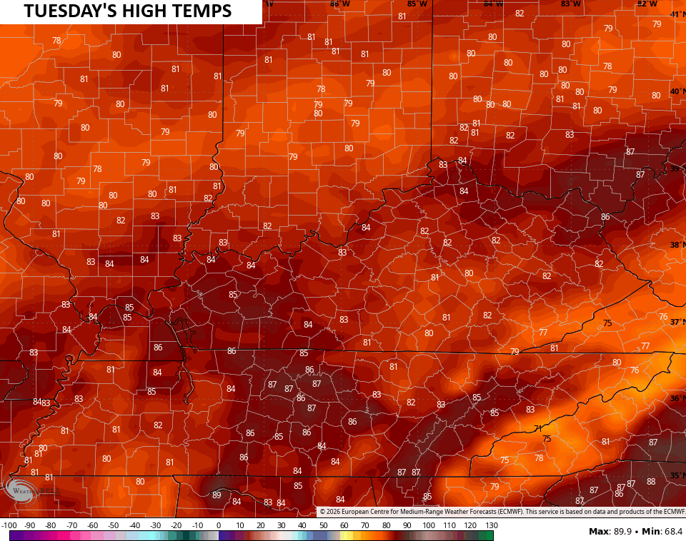
Temps early next week can surge into similar levels on any day that has more dry than any scattered storm action…
The chance for those scattered storms is there on and off next week…
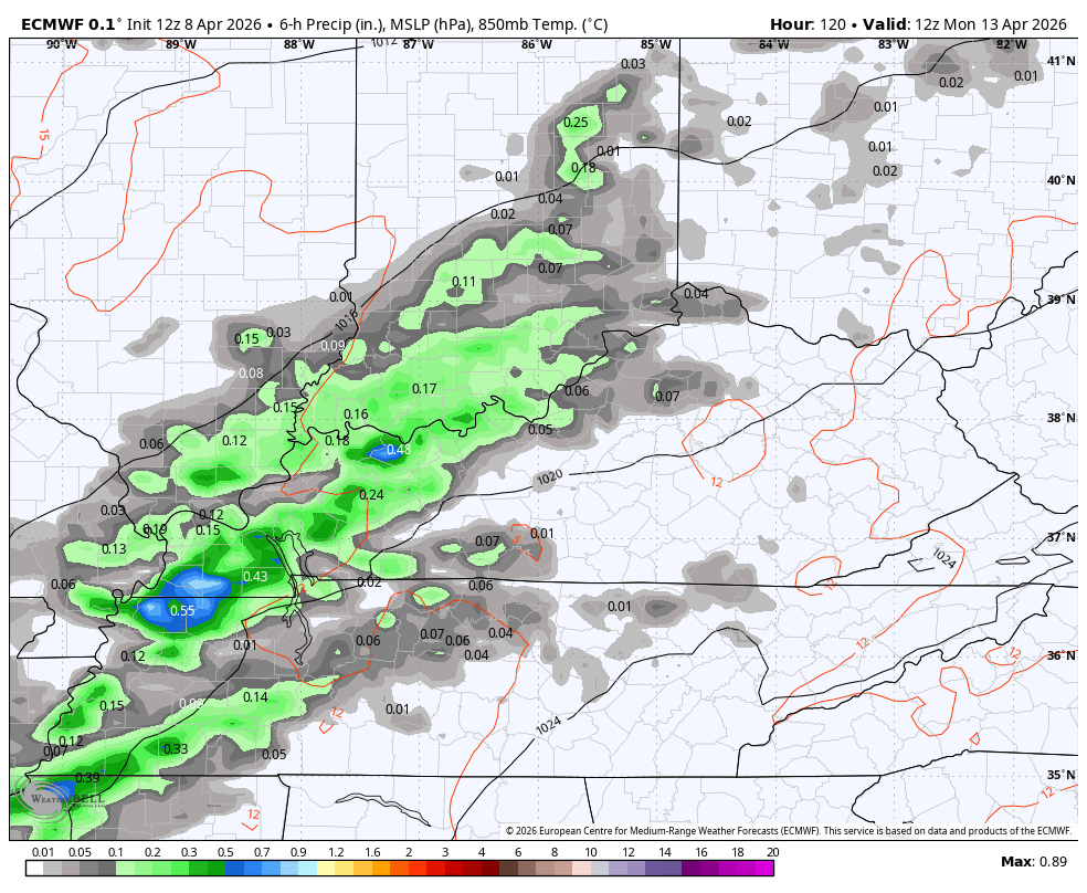
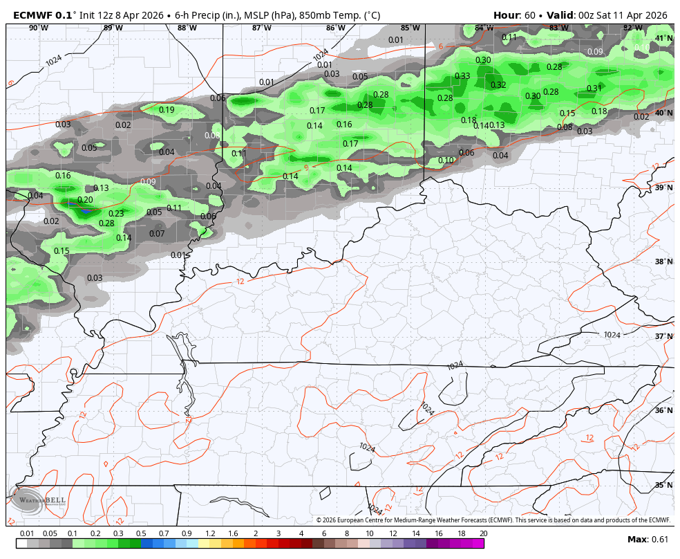
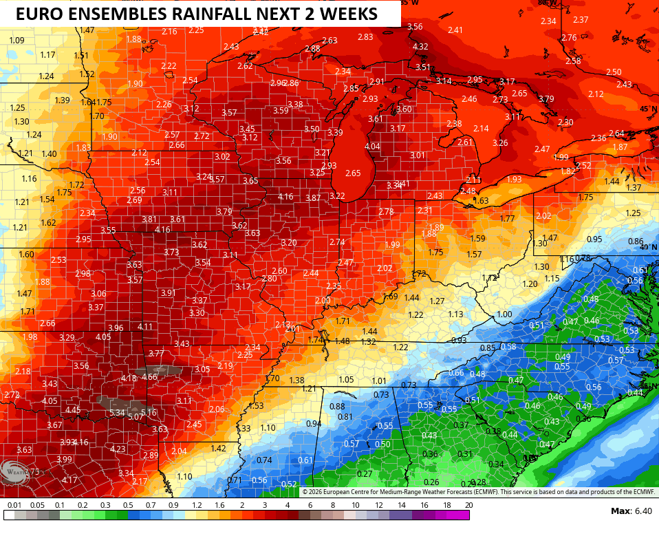
We will take whatever we can get from any of those showers and storms, but the EURO Ensembles continue to focus the best rain and storm chances to our west and northwest over the next few weeks…
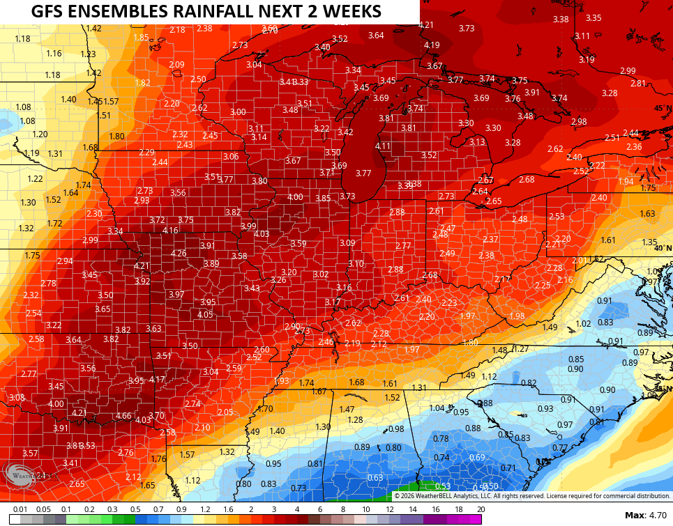
The GFS Ensembles are a little more enthusiastic about the rain chances…
Make it a great Thursday and take care.
