Good Sunday to one and all. It’s a full-blown summertime look and feel out there today and we have more of that on the way for the week ahead. There’s also the chance for a few showers and storms to get into the mix.
Temps today reach the 80s for the entire state with the chance for a few upper 80s. We will flirt with or, perhaps, break a few record highs on the day.
Here’s a temperature map to follow along with…

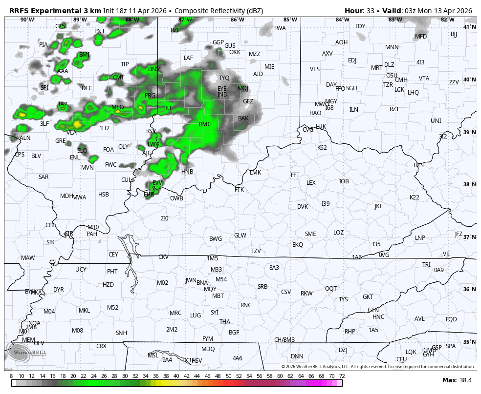
The chance for some scattered showers and storms will move in late tonight into Monday, but this isn’t very widespread at all. This future radar runs from 11 this evening and goes through 8pm Monday…
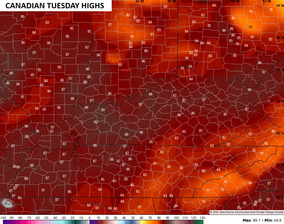
With the chance for some scattered storms, temps come down a bit for Monday but shoot right back up by Tuesday and Wednesday. Temps jump back into the 80s with the Canadian suggesting we flirt with 90…
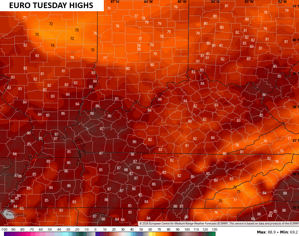
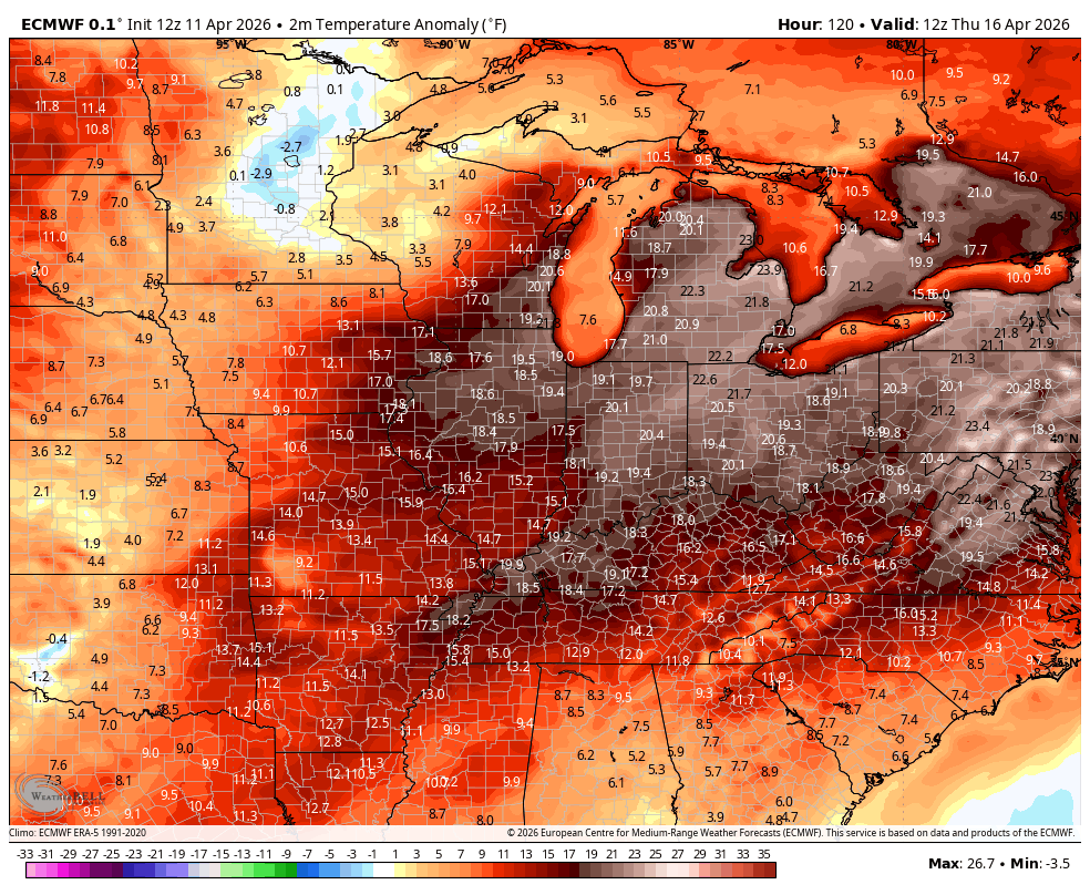
The EURO is just a few degrees cooler, but still very toasty…
The real toast may come on Wednesday with many areas likely topping out 85-90 degrees. That’s something the Canadian and Euro both agree on…
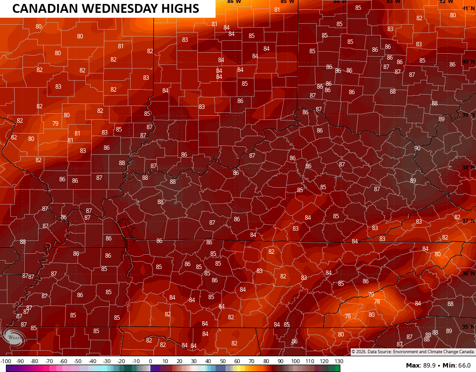
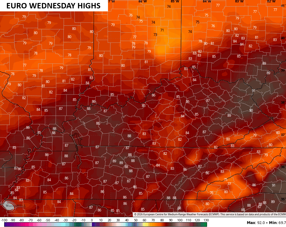
Record highs are a good bet on both days with the potential for some of the earliest 90 degree high temps we’ve ever had in some cities.
Warm temps continue into Thursday with the chance for a few scattered showers and storms moving in. A more important round of showers and storms may move in ahead of a potent cold front next weekend.
The EURO shows all this well…
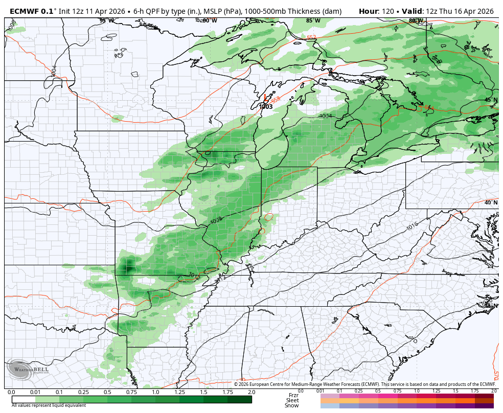
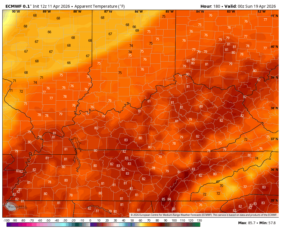
Another surge of near record highs will be possible ahead of the front Friday and Saturday before temps tank behind the boundary. Watch the summer air get wiped out…
The “feels like” numbers have the big drop covered very well…
Have a great Sunday and take care.

It won’t be a lasting nor serious cooldown.
A special weather statement has been issued for Elevated Fire Weather Conditions across all of Kentucky. Humidity levels are expected to drop as low as 25% today, combined with winds gusting to 20-25 mph. There’s a lot of dry fuel lying around, which means that the risk for wildfires is high. Any fires that do start will be difficult to control, so it’s important to report fires in wooded areas to local authorities.
I believe that the long term trend in our region will be for warmer than normal temps and below normal rainfall, so it’s likely that we’ll be seeing a lot more of these types of statements as we get into summer.
Unfortunately I’m afraid you’re right Joe. I sure would like to see some rain soon.