Good Tuesday, everybody. Here’s hoping this post finds each of you out here living your best life. In terms of the weather, we are all living our best lives with a summertime setup that keeps rolling. Near record highs will be noted for a few more before a major change blows in this weekend.
Temps today reach the 80s with a mix of sun and clouds and a gusty southwest wind. That may blow up a shower or thunderstorm, but this looks pretty isolated.
Wednesday is the day when high temps shoot into the 85-90 degree range for many…
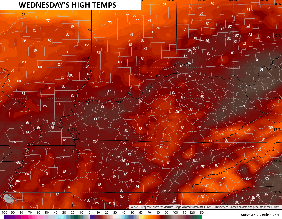
Record highs may fall once again into many cities.
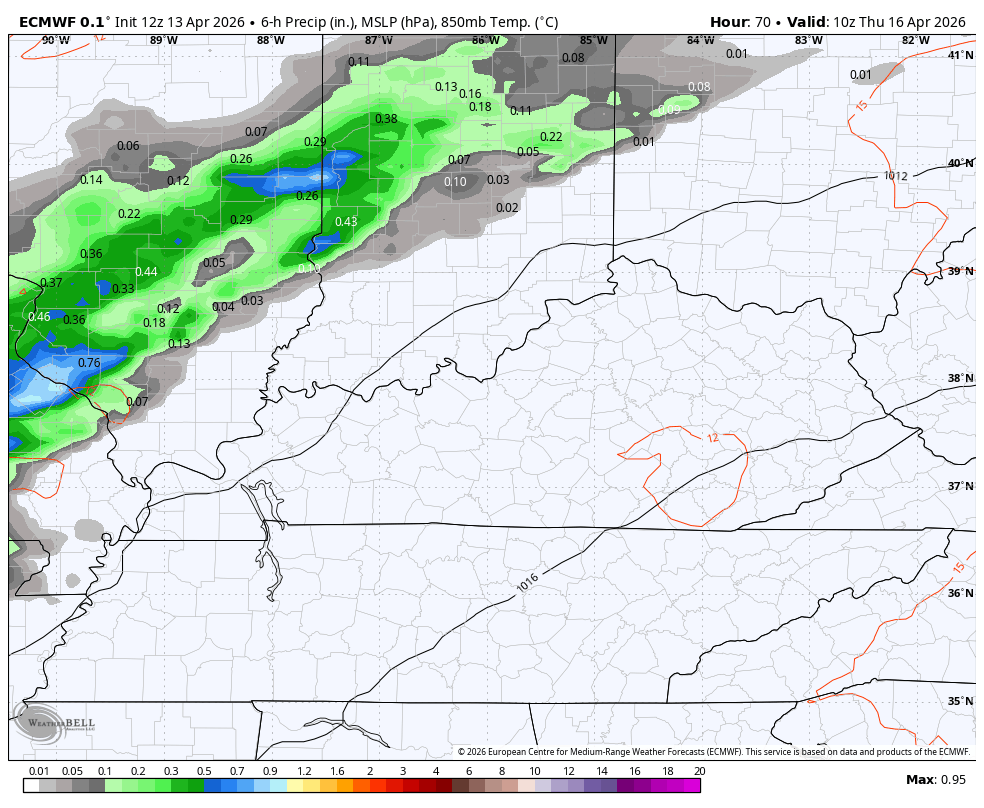
A few showers and storms then develop and move across the state Thursday into Thursday night, bringing some much-needed rains…
Temps are held down into the upper 70s and low 80s for many on Thursday before jumping back into the 80s on Friday. A leftover shower may be noted early Friday with clearing skies throughout the day.
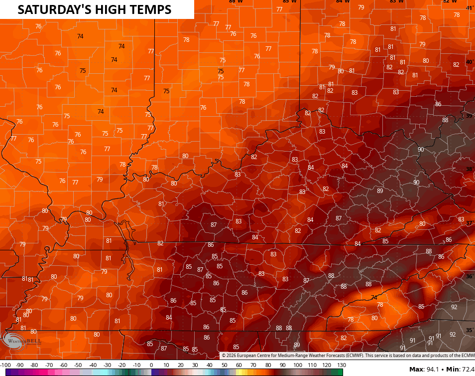
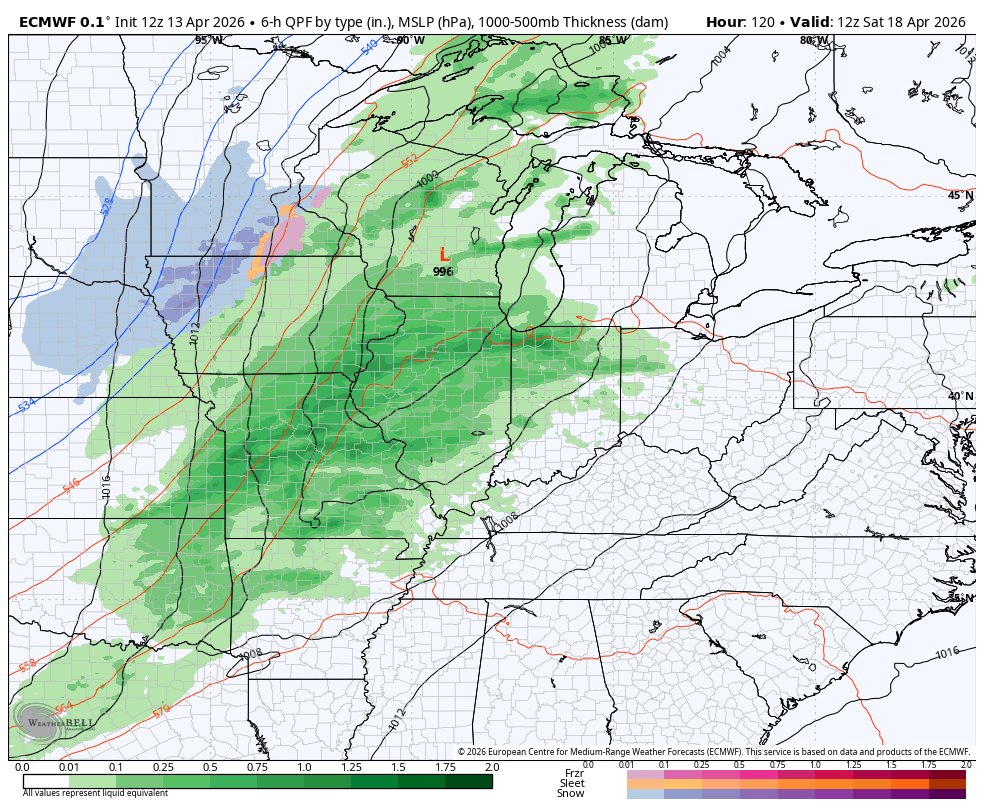
Highs for Saturday then surge into the 80s again ahead of a potent cold front moving in from the west…
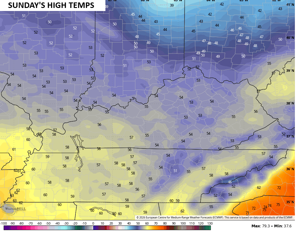
Much colder winds blow behind this front with Sunday’s highs likely staying in the 50s for most of the region…
A band of showers and storms will be along and ahead of this gusty front as it powers through the region. This animation goes from Saturday morning through Sunday morning…
Sunday night lows reach the low 30s for many areas with the chance for frost and a light freeze for some…

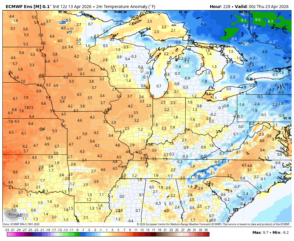
Temps should rebound quickly later next week but odds favor another below normal blast into the final week of April. You can see this showing up on the EURO Ensembles…


Make it a terrific Tuesday and take care.

A burn ban is in effect for much of south central Kentucky, as the area has received a fraction over 2 inches of rain since the beginning of March. I’m not very optimistic about our chances of receiving meaningful rain over the next 4 to 6 weeks. Not good.
I predict upper 70s on Derby Day.