Good Wednesday to one and all. It’s one of the warmest April days on record across Kentucky and surrounding states as record highs likely fall. This summer pattern continues through the start of the weekend with a totally different ending in store.
Temps today are generally 85-90 across most of the state on a strong southwest wind flow. This flow will in on a strong southwest wind of 30mph or a little higher.
Thursday’s temps come down a bit because of some scattered showers and thunderstorms. The future radar from the Hi Res NAM looks like this…
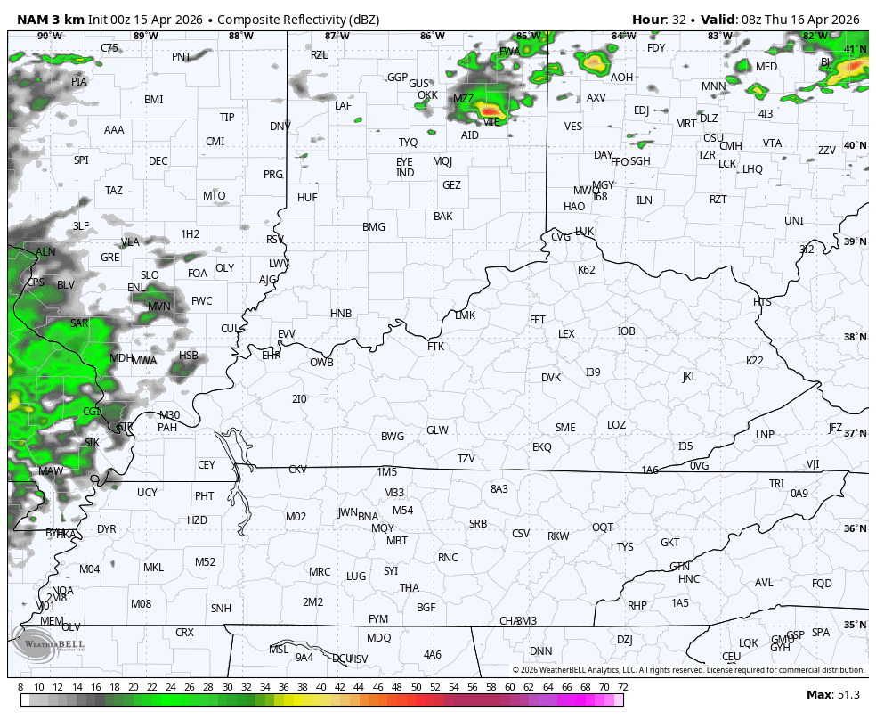
The Storm Prediction Center has a low-end severe risk for parts of the state…

Pockets of damaging wind and large hail are the primary threats.
Warm and windy weather will be with us for Friday with highs back in the 80s.
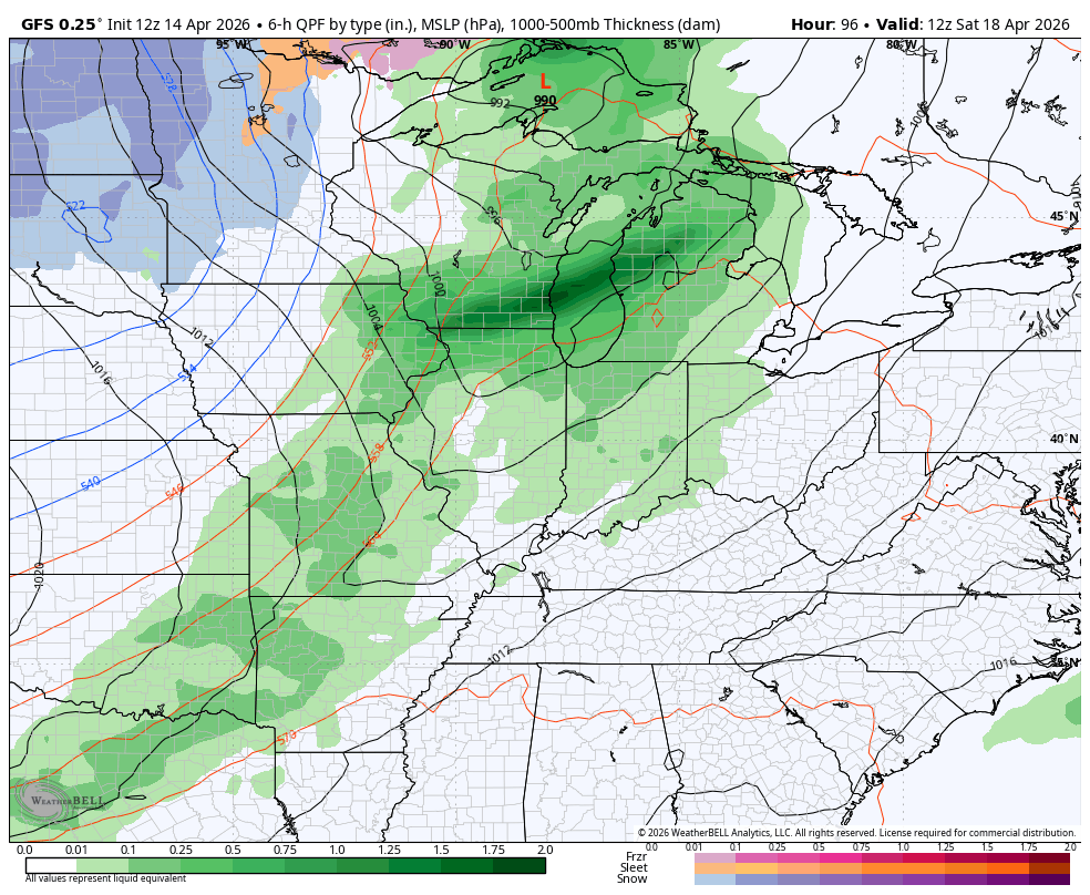
A potent cold front sweeps in here late Saturday with a line of showers and thunderstorms…
Much colder winds blow behind this as our temps go from well above normal to well below normal…
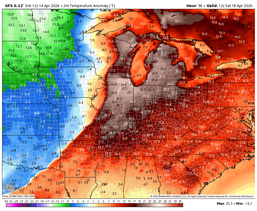
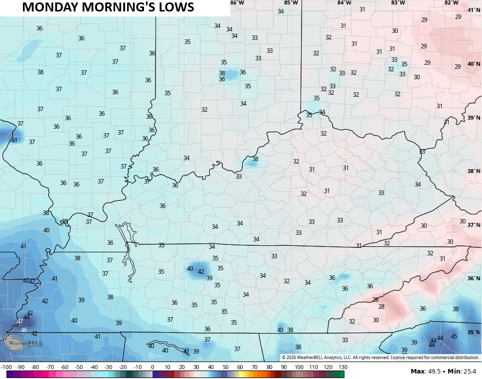
Highs on Sunday likely stay in the 50s with a frost and light freeze possible Sunday night and Monday morning…
Temps should rebound pretty quickly with the 70s showing back up by Tuesday and stay there through the rest of the week.
I’m eyeing the potential for a big upper level low that may get caught under ridging that’s heading up into Canada. We saw this pattern a lot last year and into the winter and it may show up again for the close of April into the start of May…
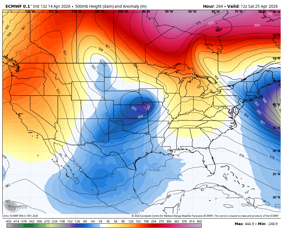
Cooler air and the chance for wet weather would show up with that kind of pattern. I’m fine with the wet because we need it.


Make it a wonderful Wednesday and take care.

Just when I thought we .may go from winter to summer Chris says otherwise. But we badly need rain that’s for sure.
I’m not convinced it happens.
I don’t see that big trough happening.
Last night’s severe storms that went through the Chicago area brought a daily record 2.43 inches of rain at O’Hare Airport. The NWS office in the SW Suburbs only picked up .28 inches, as the heaviest storms stayed to the north. There were several tornadoes that hit Southern WI.
O’Hare Airport has now received 4.75 inches of rain this month, which is only half-over. The entire Chicago Metro area is under a Flood Watch through Thursday, as more strong storms with heavy rain are expected to develop and move through later on today.
The last three days have seen unseasonably warm temps, with highs in the upper 70s to low 80s.
85 at my house on Corbin, absolutely miserable for the early April
There is some hope of a pattern change next week. Looks promising. We need it
80s in April feels great to me.
I think there’s a better than even chance that the trough will make an appearance towards the end of April into early May, but instead of bringing a cold shot, I see it possibly setting up as a conduit for moisture from the Gulf of Mexico. Hopefully it will help put a dent in the growing drought conditions in Southern Kentucky, and not wishful thinking.