Good Friday and Happy Kentucky Oaks Day. Our Derby Weekend is off and running on a very chilly note with temps coming in well below normal. I expect this trend to continue for much of the month as rainfall likely goes toward average or above average.
Our Oaks Day has a fast-moving thin line of showers dropping in from the northwest. More areas stay dry than actually see any drops with the temps being the bigger story. Highs today reach the upper 50s to low 60s for many.
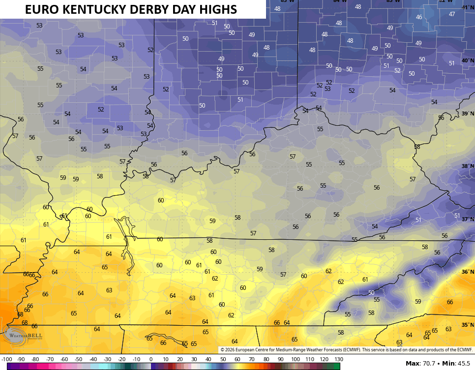
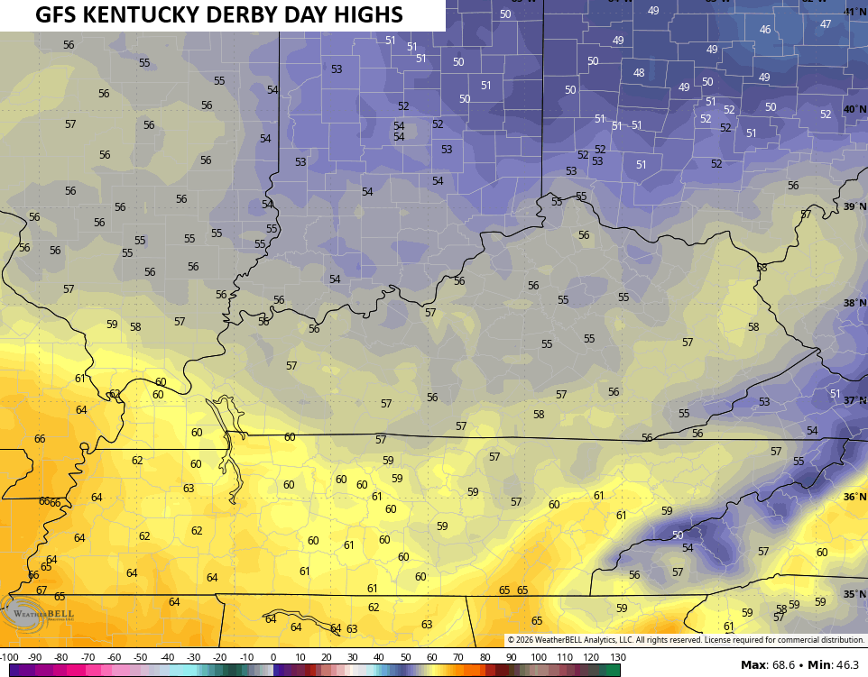
Temps tonight reach the upper 30s in some areas and that will make for one of the colder Derby mornings on record. The rest of the day finds one of the coolest Derby Day highs on record as most of the state likely stays in the 50s.
The EURO and GFS are in good agreement on this…
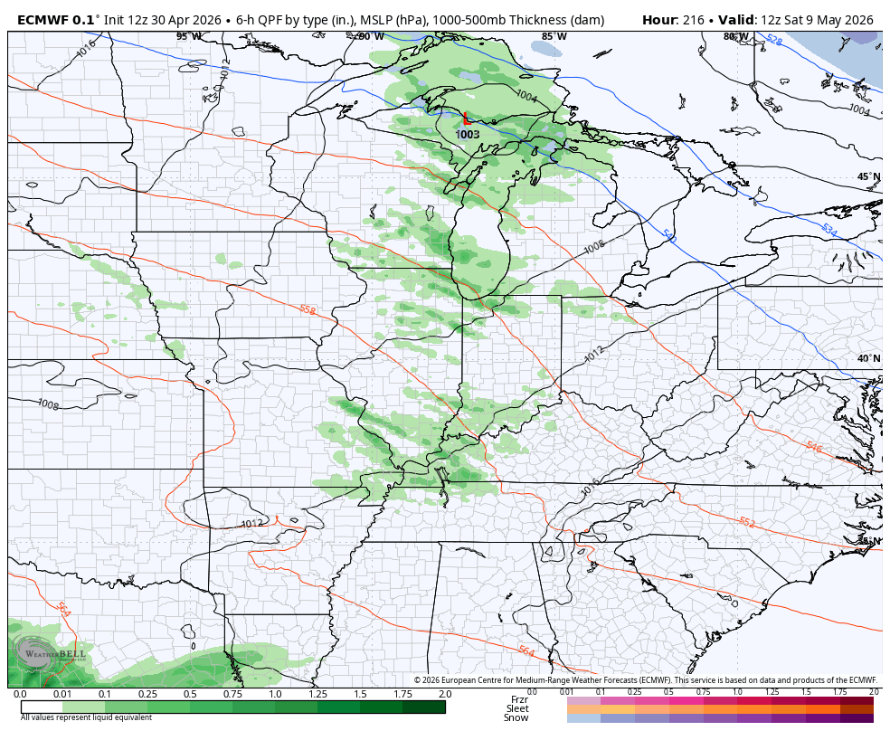
This northwest flow has a weak system embedded within it and this will throw a shower or two into the region. The models are really going out of their way to avoid hitting Louisville with any chilly shower…
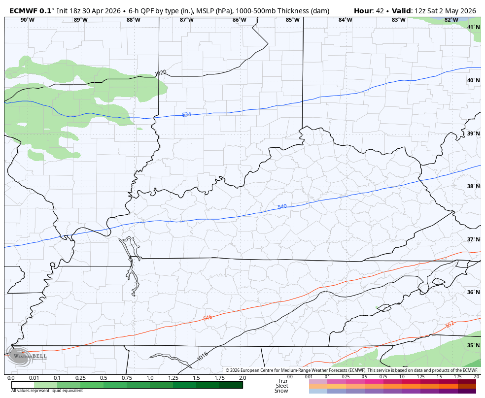
Still, that small shower chance is there, folks!
GREEN THUMB ALERT for Saturday night and Sunday morning as frost is likely. Lows can drop into the low and middle 30s for many areas of central and eastern Kentucky. Any bit of cloud action would keep the temps up a bit.
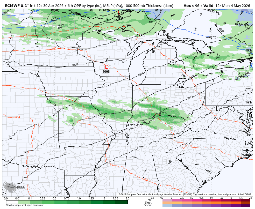
Scattered storms then rumble in for Monday and Tuesday and continue into Wednesday ahead of another big surge of chilly air. That chilly northwest wind may bring some chilly showers in here late in the week.
You can see all this on the EURO from Monday morning through Friday morning..
The active setup then continues from next weekend into the following week…
As you know, I’ve been yelling about a chilly May for a few weeks now and you are seeing why out there on day one of the month. This below normal air looks to dominate the next two weeks…
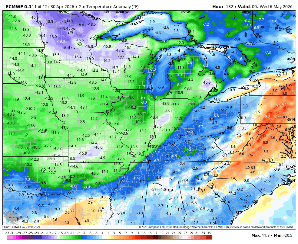
I’d bet we have another frost threat or two with this kind of pattern. Never underestimate blocking in the high latitudes!
I leave you with your Kentucky Weather Radars to track the isolated showers on this Oaks Day…

Make it a fabulous Friday and take care.

This will not last and May will not be overall chilly.