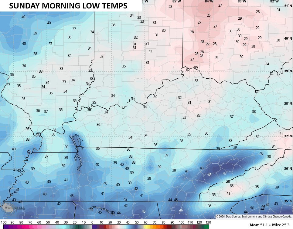
Good Saturday and Happy Kentucky Derby Day. Our incredibly cool start to May continues with a full-blown Green Thumb ALERT for tonight and Sunday morning. Frost and freezing conditions are possible for much of the region.
Temps out there this Derby morning range from the upper 30s to middle 40s. Another weak system drops in from the northwest today and may spark isolated showers with the greatest concentration across the west and south. This won’t last long for any shower that shows up and most areas stay dry.
Highs today generally reach 55-60 degrees, making for one of the coolest Kentucky Derby days on record.
With clearing skies tonight, temps tank and may hit the freezing mark or a touch below in some areas…
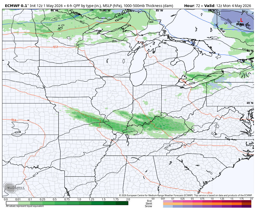
Temps on Sunday reach the low and middle 60s with a mix of sun and clouds. Clouds increase late in the day as we head into a setup that will throw waves of showers and storms at us Monday and Tuesday with a greater wave of rain and storms Tuesday night and Wednesday. Some of these may be strong or severe, so that’s something to keep an eye.
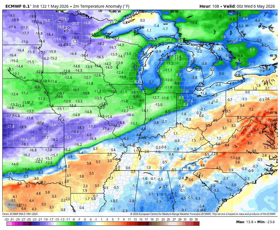
Much cooler air comes in behind this with another system rolling in with chilly showers later in the week and into the start of the Mother’s Day Weekend. This animation from the EURO starts Monday morning and goes through Saturday morning…
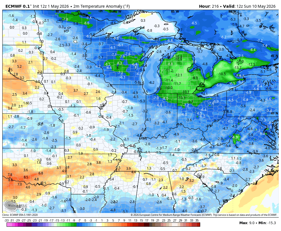
Temps take a big dip once that Wednesday front rolls by and they stay WAY down into Mother’s Day Weekend. Some Barney shows back up…
This below normal pattern then rolls right on into the middle of May…
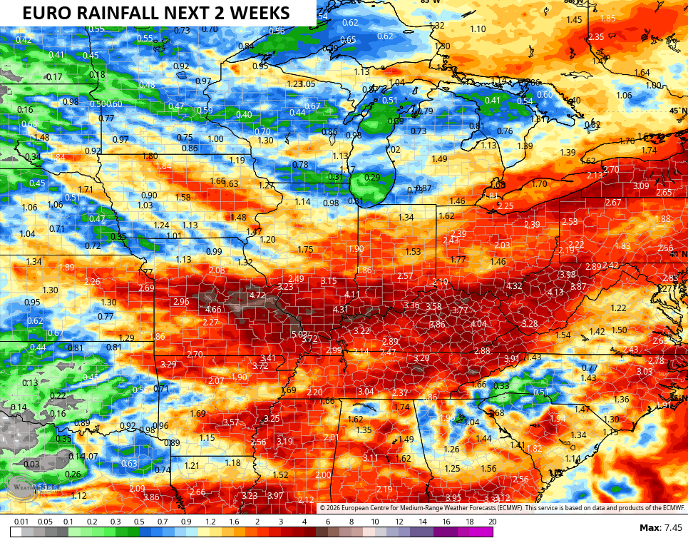
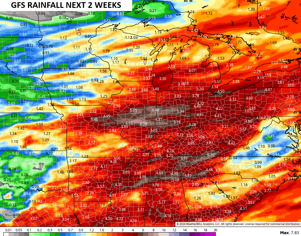
With the cooler than normal pattern, rainfall numbers are above normal during the same two week stretch. The EURO and GFS both show hefty rain totals…
EURO
GFS
I leave you with your Kentucky Weather Radars to track the isolated showers on this Derby Day…

Make it a dandy of a Derby Day and take care.

I’ll wait until less than a week to start believing the rainfall forecasts by the models. They’ve been wrong plenty before. I still see a hot and dry summer coming in.