Good Sunday to one and all. Historic early May cold is out there this morning as many areas deal with a frost and a freeze. The pattern ahead will feature more very cool shots, but the same pattern is also turning pretty stormy and soggy.
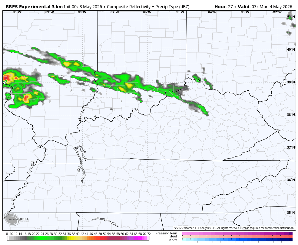
Record lows may be with us this morning before temps recover into the low and middle 60s with a mix of sun and clouds. Clouds will thicken this evening ahead of rounds of showers and storms moving in from late Tonight into Monday. This future radar shows some pretty good storm action through Tuesday…
Some of those storms may be strong or severe. A more potent storm system then sweeps in with widespread heavy rain and strong storms Tuesday night into Wednesday as very chilly surges back in. This big dip in the jet stream will be accompanied by some chilly showers to start Mother’s Day Weekend.
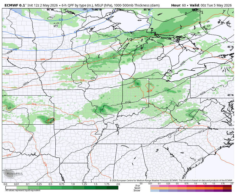
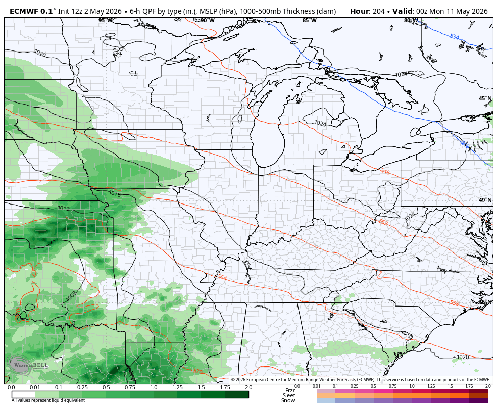
This animation from the EURO starts Monday evening and rolls through Sunday morning…
Now, if you look closely enough at that run, you will find a few areas of blue late next week. That won’t happen, but it’s a good indicator of how wild this cool pattern is.
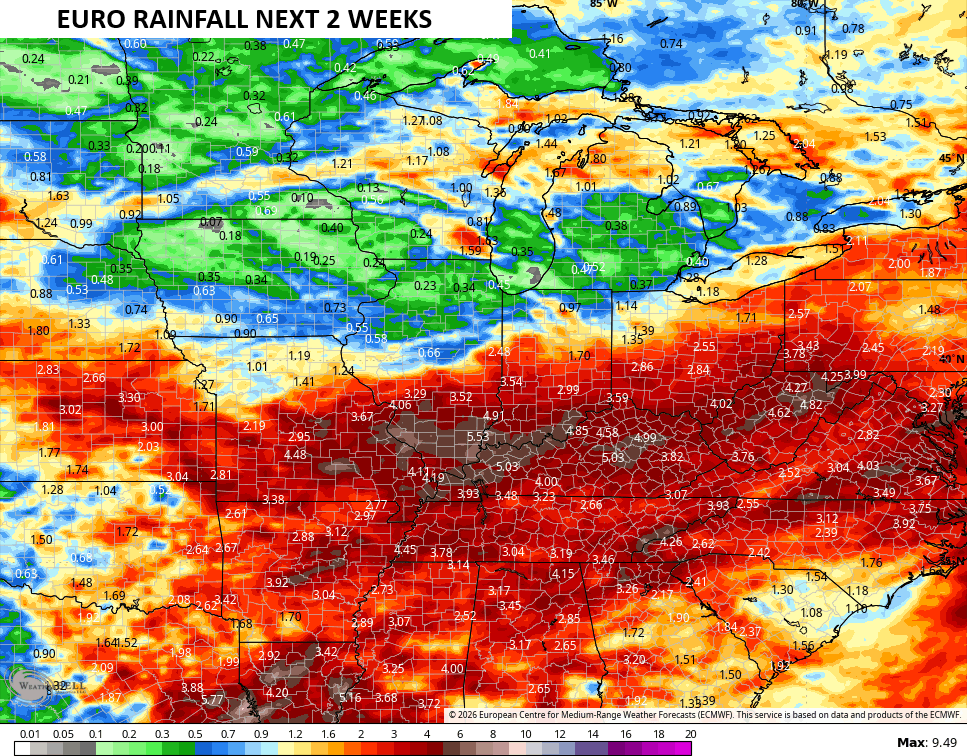
Heavy rains are a good bet this week and the WPC is highlighting the threat for our region…

The setup for the following week will feature more below normal temps and more in the way of active weather…
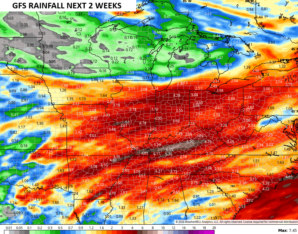
For weeks now, I’ve been warning you guys about a cool and damp May and this looks to be in good shape. The rainfall numbers from the models over the next two weeks are way up there…
It’s been pretty awesome watching the pattern evolve toward exactly what I thought it would. Recognizing blocking patterns and knowing what they mean for this region is the key to any medium range forecasting.
I may throw you another update later today. I leave you with your Kentucky Weather Radars to track some action in tonight..

Make it a great Sunday and take care.

May will not end up cool or damp.