Good Monday, everyone. We are coming off a record cold Kentucky Derby Weekend and we are changing things around a bit. Rounds of showers and storms rumbling out there today are kicking off a rather wet pattern. It’s one that continues to be skewed much cooler than normal.
Showers and storms today are mainly impacting areas of central and eastern Kentucky with a very sharp cut off on the southern edge of this. Locally heavy rains are likely in a northwest to southeast corridor with very little if any rains fall across the south central and west.
This action won’t be all day, but a few of the storms may be strong. It looks like the greatest severe threat is to our west and northwest…

Most of the state hits the 70s today as the storms wind down. A few more storms return for Tuesday with the severe risk mainly to our west and southwest…

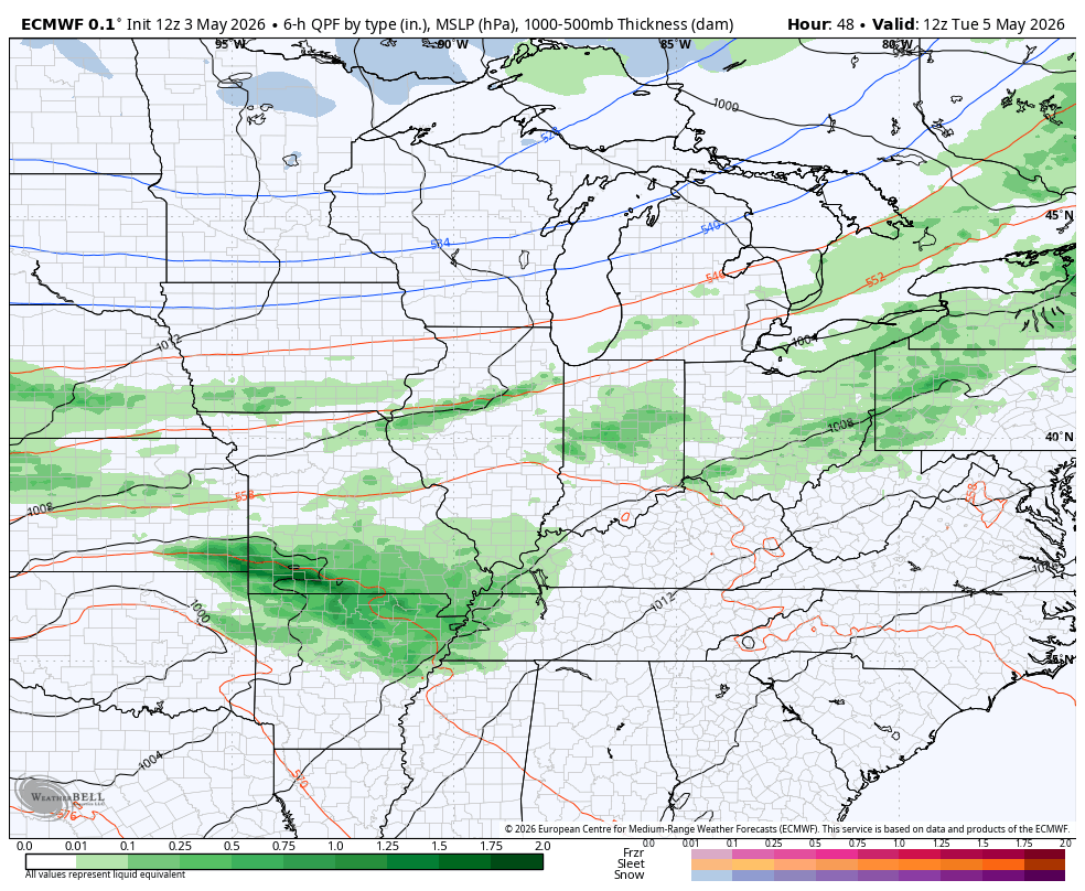
A much stronger cold front brings widespread rain and a few storms in here Tuesday night and Wednesday as another deep trough sweeps into the eastern half of the country. This may spawn another low that tracks to our south and east, bringing some more rain in here Thursday. Another system or two then drops in from the northwest late Mother’s Day Weekend into early next Week.
The EURO shows it all on this animation from Tuesday morning through next Monday…
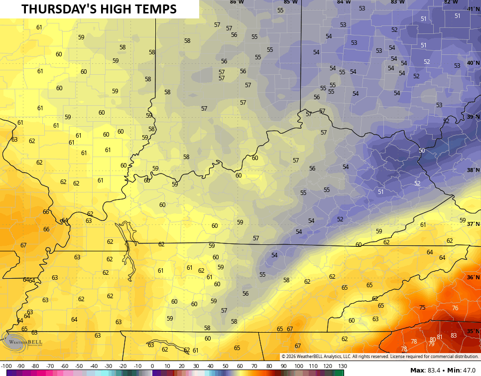
Temps turn much cooler than normal Wednesday and Thursday with highs possibly staying in the 50s again on Thursday…
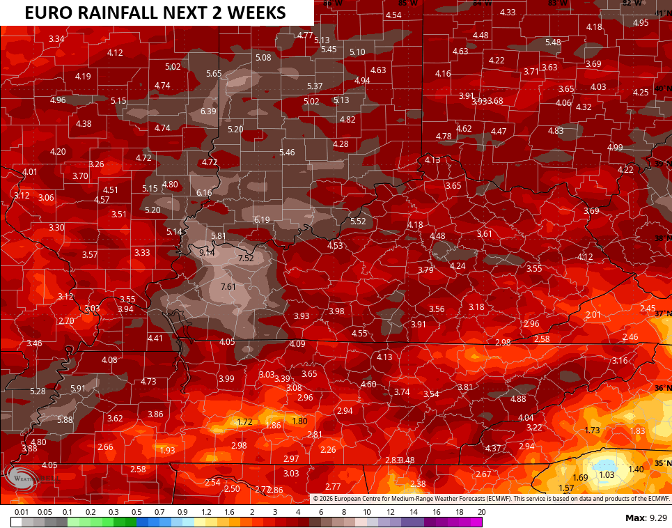
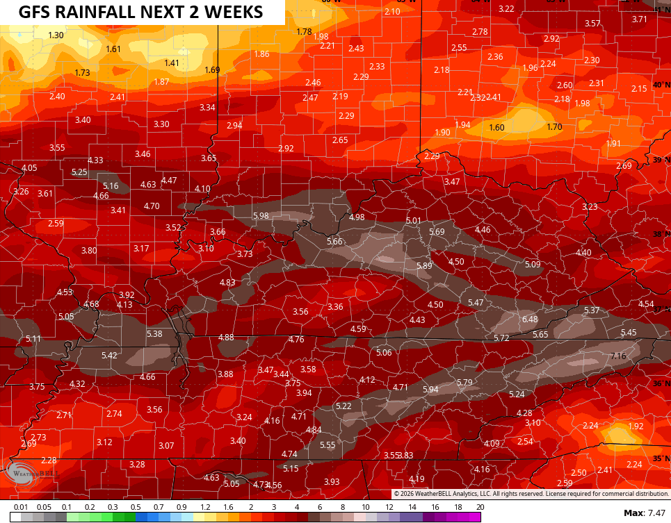
This pattern will turn pretty stormy next week into the middle of the month, likely increasing our risk for severe weather. This will also bring quite a bit of rain over the next few weeks…
I’ll have the latest on WKYT-TV and WKYT+. Until then, I leave you with the tools you need to track any shower or storm going up out there today…


Current watches

Possible Watch Areas

Make it a magnificent Monday and take care.
