Good Sunday and Happy Mother’s Day to all the moms of the world. On this big day, we are dealing with mild winds and the chance for a shower or storm going up. All of this is ahead of another chilly shot to begin the new week. That leads us into a pretty big back and forth pattern through the rest of May.
Temps today hit 75-80 in most areas with the chance for a shower or storm going up late in the day into tonight. This stuff continues to look pretty darn wimpy with many areas not seeing much at all.
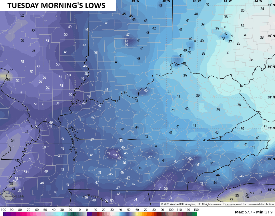
As the front drops in tonight, cooler winds kick in with highs in the low and mid 60s for Monday. That sets the stage for the potential for some frost Monday night and Tuesday morning. The best chance is across the central and east, where temps hit the upper 30s…
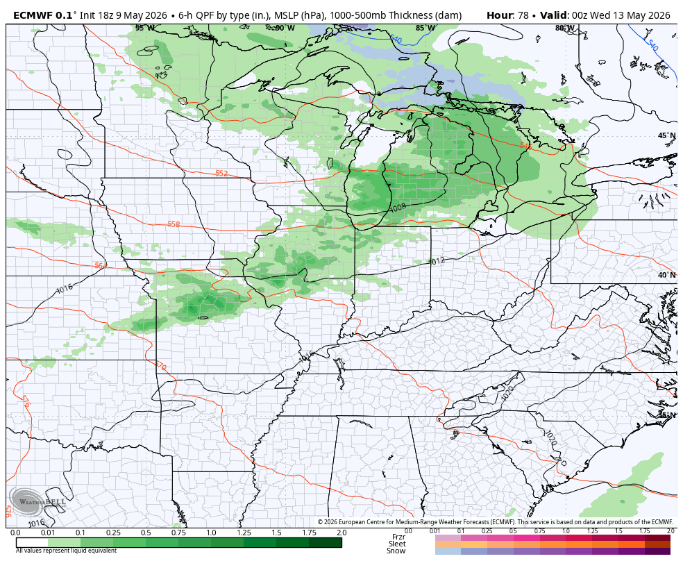
Temps should reach the 70s Tuesday and Wednesday ahead of another cold front dropping in. This brings a few showers and storms on Wednesday with falling temps behind it…
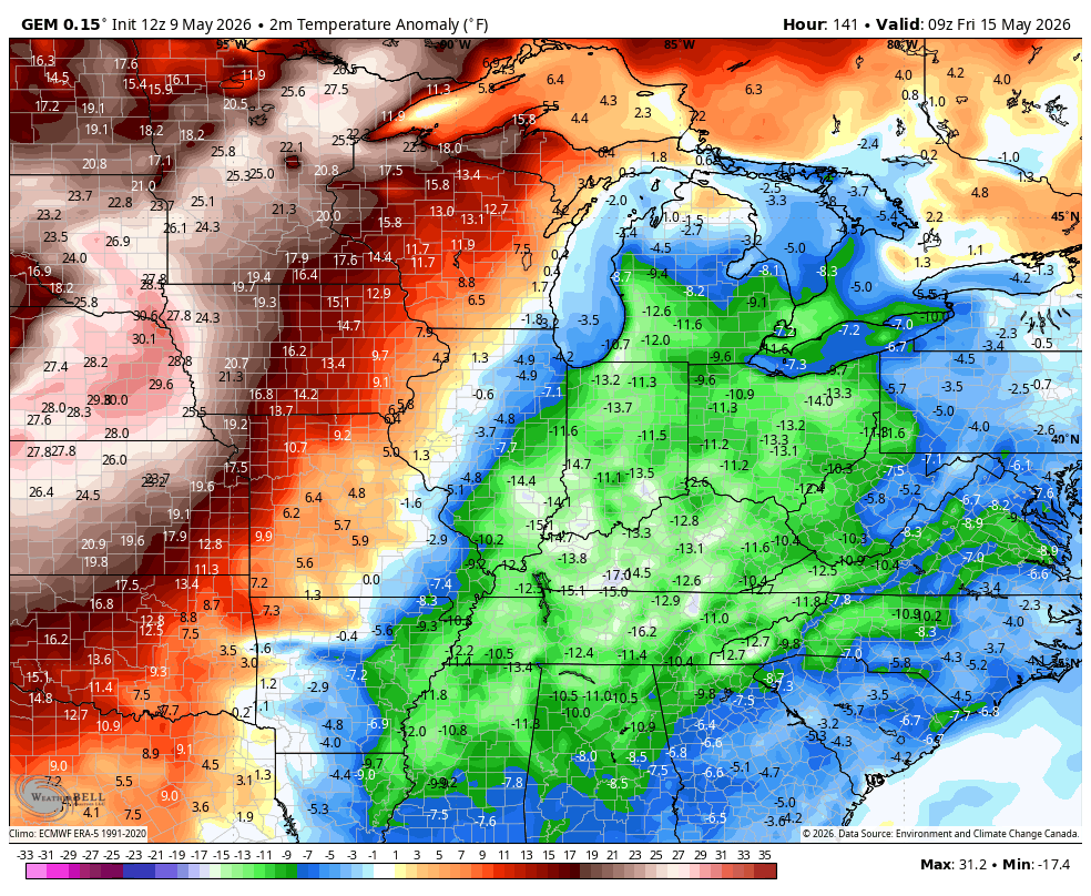
Temps are well below normal again Thursday into early Friday, but a quick jump to above normal should take place late Friday through the weekend. Look at this turn around from Friday morning through Sunday afternoon…
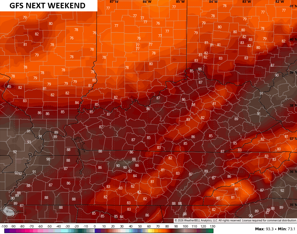
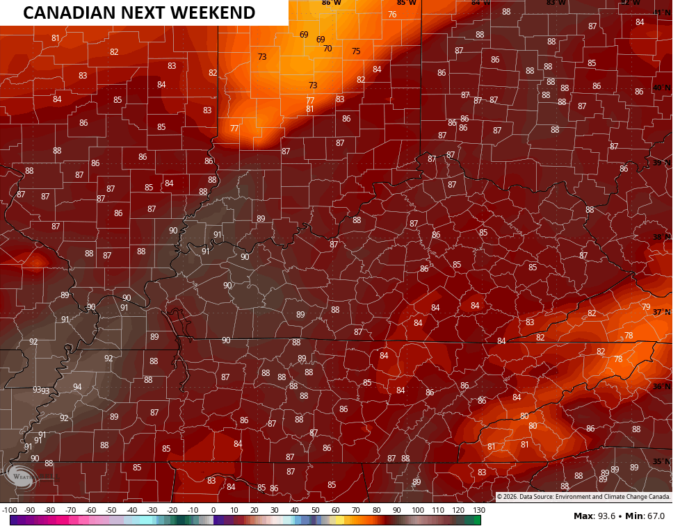
Several of the latest model runs are showing a taste of summer temps…
I leave you with your Kentucky Weather Radars to track the early day showers and storms out of the state…

Make it a great Mother’s Day and take care.

Bring on the heat