Good Saturday, everyone. Some big storms are rumbling across Kentucky through tonight as this action fires up on the leading edge of some early summer sizzle. Temps will flirt with record highs Sunday and Monday with another active setup waiting in the wings.
Here’s a breakdown of our busy weekend of weather:
- Storm clusters develop and roll across the state from west to east today and tonight.
- A few of these storms may be strong or locally severe.
- Pockets of damaging winds and large hail will be possible.
- This will not be a widespread event.
- Any storm that’s out there will be very noisy with a lot of thunder and lightning.
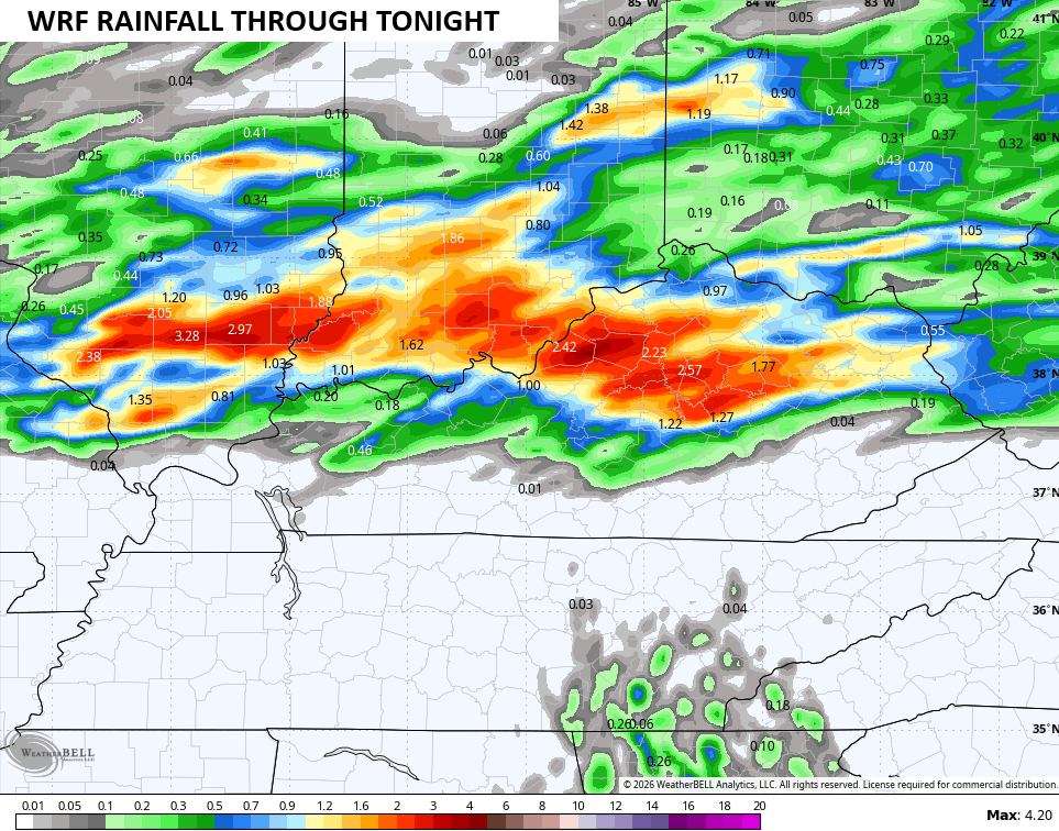
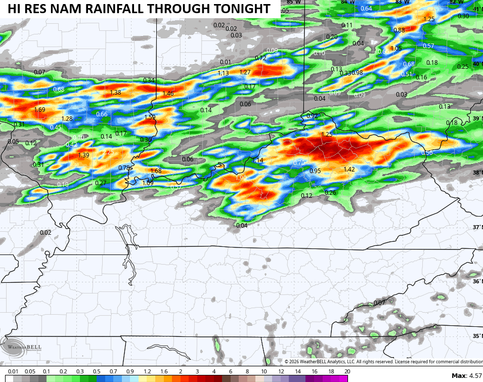
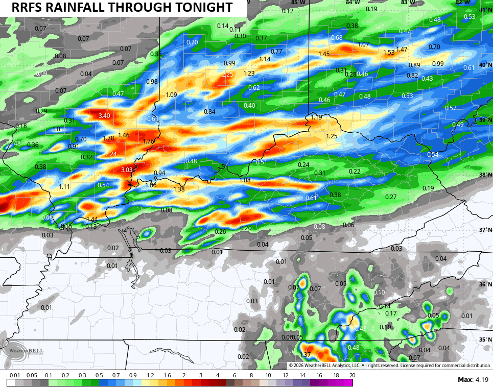
- The potential for heavy rainfall is there, especially if storms move across the same area.
- This action winds down early Sunday as temps surge into the 85-90 degree range for many.
- I could still see isolated storms going up Sunday afternoon.
In terms of the potential heavy rains, the hi-res models are seeing the possibility, but they vary on placement…
The Storm Prediction Center has a low-end risk for severe storms out there today…

As mentioned, damaging winds and large hail are the primary players. Here’s a look at the specific threats from the Storm Prediction Center…


Monday is a toasty day with upper 80s to low 90s in many areas. If we are to break a record or two, Monday offers the best chance at that.
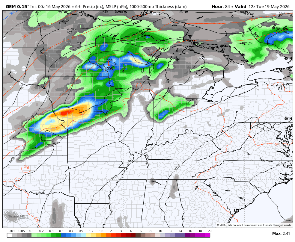
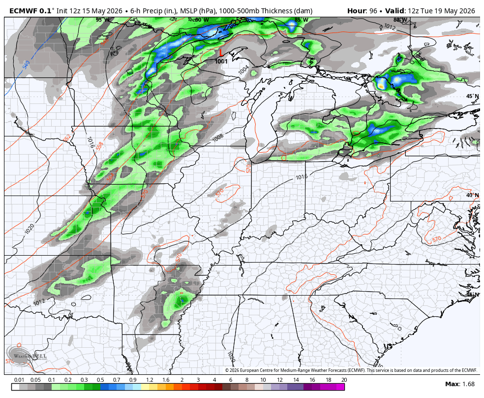
Tuesday is toasty, but thunderstorms start to show up as a cold front rolls in from the west. This boundary moves through the slows down, giving us the potential for a slow-moving upper level system to develop to our south and roll through here later next week into Memorial Day Weekend.
The Canadian seems to have a pretty good handle on this possibility…
The EURO has been showing a version of this off and on for the past few runs…
I leave you with your storm tracking tools for the day…


Current watches

Possible Watch Areas

Make it a sensational Saturday and take care.

The Storm Prediction Center has upped the risk for severe storms to a level 2 out 5 for much of Kentucky. Strong wind gusts remain the chief risk, although a brief tornado spin up will be possible. In South Central Kentucky, we can expect to see storms reach the I-65 corridor during the late afternoon/evening hours.
https://www.spc.noaa.gov/products/outlook/day1otlk.html
The Climate Prediction Center has issued its ENSO report for May, and indicates that there is an 82% chance for El Nino development by late May, and there is a 90% chance that it will remain in effect through February of 2027. However, most indicators that monitor the transition to El Nino, including sea surface temperature anomalies and trade wind direction shift have already taken place, so the question now is how much and how quickly will it strengthen. The consensus among climatologists is that this will be a Super El Nino event, they believe that it will be the strongest on record. This is not hard to believe when you consider how much our atmosphere has warmed sense that last large-scale El Nino took place in 2015. But that same atmospheric warming makes it difficult to predict the effect that this Super El Nino will have on our local weather.