Good Sunday, everyone. Summer air is surging into the Commonwealth today, bringing the chance for a few spots to hit 90 degrees. While Monday looks even hotter, the pattern is about to turn rather wet as we head toward the unofficial kickoff to summer that is Memorial Day Weekend.
Temps today reach 85-90 in many areas under a mix of sun and clouds. There’s the slightest chance for a storm or two going up, especially in the east and southeast, but most will stay dry.
Upper 80s and low 90s will be common on Monday and this may put some thermometers within reach of records. Once again, isolated showers and storms will be possible.
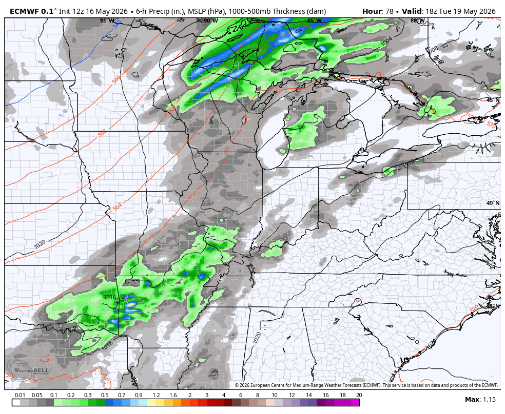
Tuesday is another toasty temp day as a cold front makes a run at us from the northwest. This arrives Tuesday night into Wednesday with an increase in showers and thunderstorms, some of which may be strong or severe.
This front sags to the south and slows down as waves of low pressure form along it. The potential for these slow moving lows to impact our weather is there for the end of the week into Memorial Day Weekend.
The EURO looks pretty wet on this animation from late Tuesday through Memorial Day…
The same model then throws more in the way of showers and storms at us to close out the month…

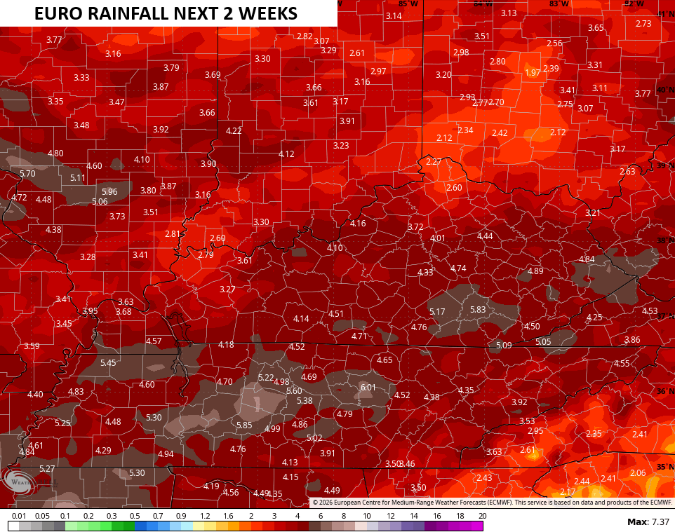
The EURO rain totals during this next two week span…
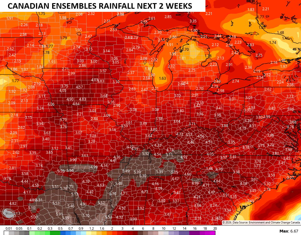
Many of the Ensembles are pretty wet looking for our region and much of the eastern half of the country during this same time…
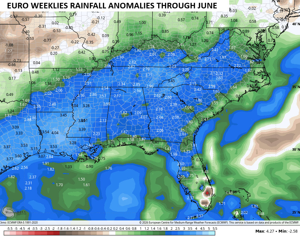
The EURO Weeklies now go through the entire month of June and have well above normal rainfall from our region into the deep south…
I leave you with your isolated storm tracking tools for the day…


Current watches

Possible Watch Areas

Make it a sensational Sunday and take care.

As much as we can use the rain, I don’t see these models verifying.
I have absolutely no confidence in the Euro’s rainfall forecasts, or the GFS for that matter, and I can’t remember the last time the actual rainfall totals ended up anywhere near the forecasted quantities. Where the models miss big time is in available moisture, and yesterday was a perfect example. Yesterday afternoon, when convection was expected to generate strong storms, my local temperature was 85°F, but the dewpoint was only 58°F. Most of Warren County has
…the appearance of August, not May.