Good Monday to one and all. Summer temps steamed into the Commonwealth on Sunday and continue out there today. This toasty temp setup is ahead of a much wetter pattern that will likely feature rounds of storms through Memorial Day Weekend.
Highs out there today are mainly in the upper 80s and low 90s, with the chance for a few record highs to fall.
While we are baking, storms are cranking to our west with the Plains and Mississippi River Valley under the gun for severe weather. This threat is largely to our west and northwest today…

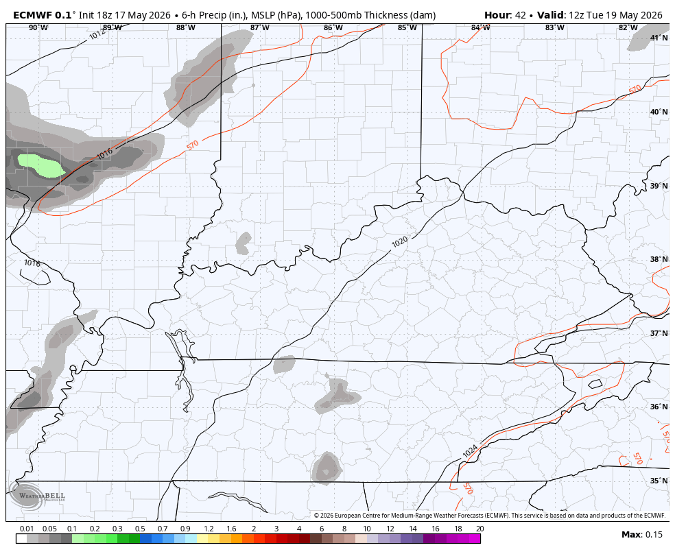
A few strong to, potentially, severe thunderstorms roll into western Kentucky later this evening and tonight. This is ahead of a cold front working into Kentucky late Tuesday into Wednesday. Rounds of showers and storms are likely along this slow-moving boundary and some of these may be strong or severe.
The Storm Prediction Center shows the Tuesday threat moving edging into Kentucky…

This animation shows the waves of storms rumbling across the state from later Tuesday through Wednesday…
This boundary slows down, allowing for waves of low pressure to develop and roll through our region from the southwest. This brings additional rounds of showers and storms through the unofficial kickoff to summer that is the Memorial Day weekend…
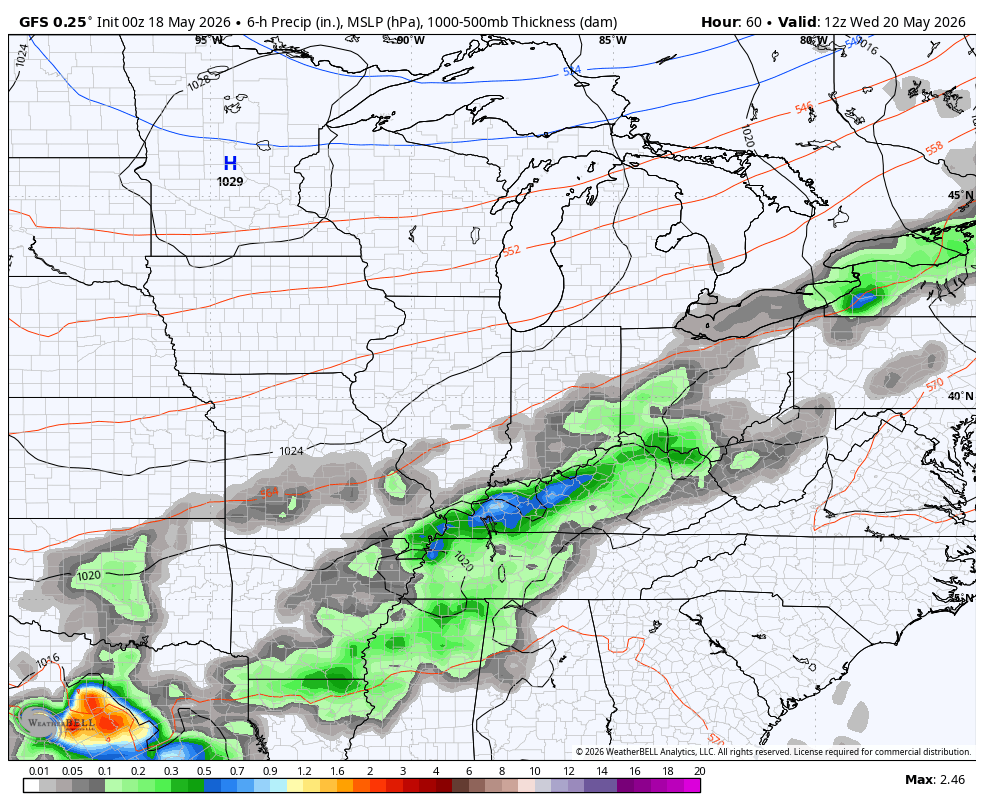
The models are in pretty solid agreement on some healthy rains across our part of the world…
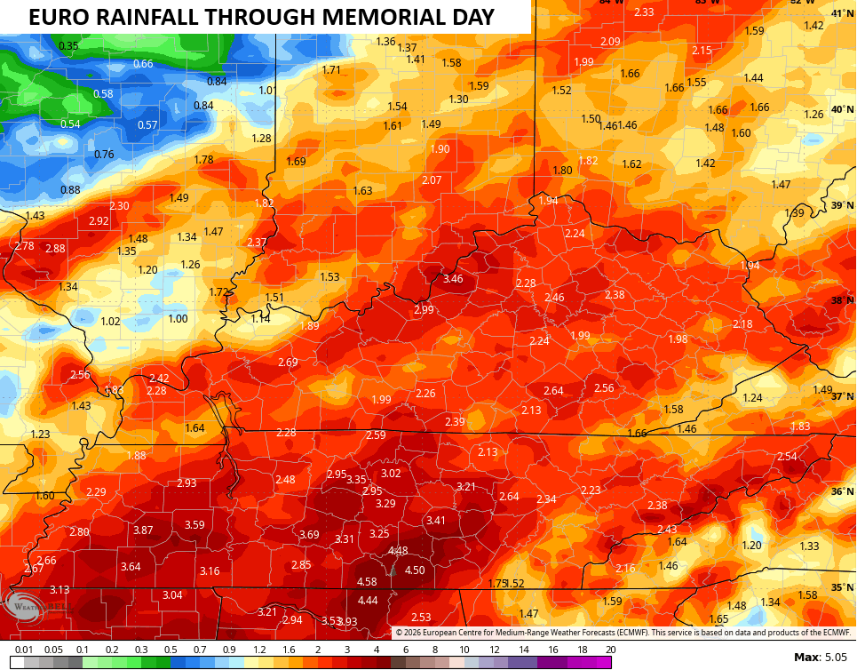
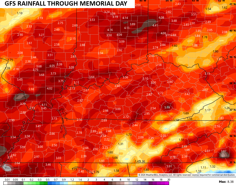
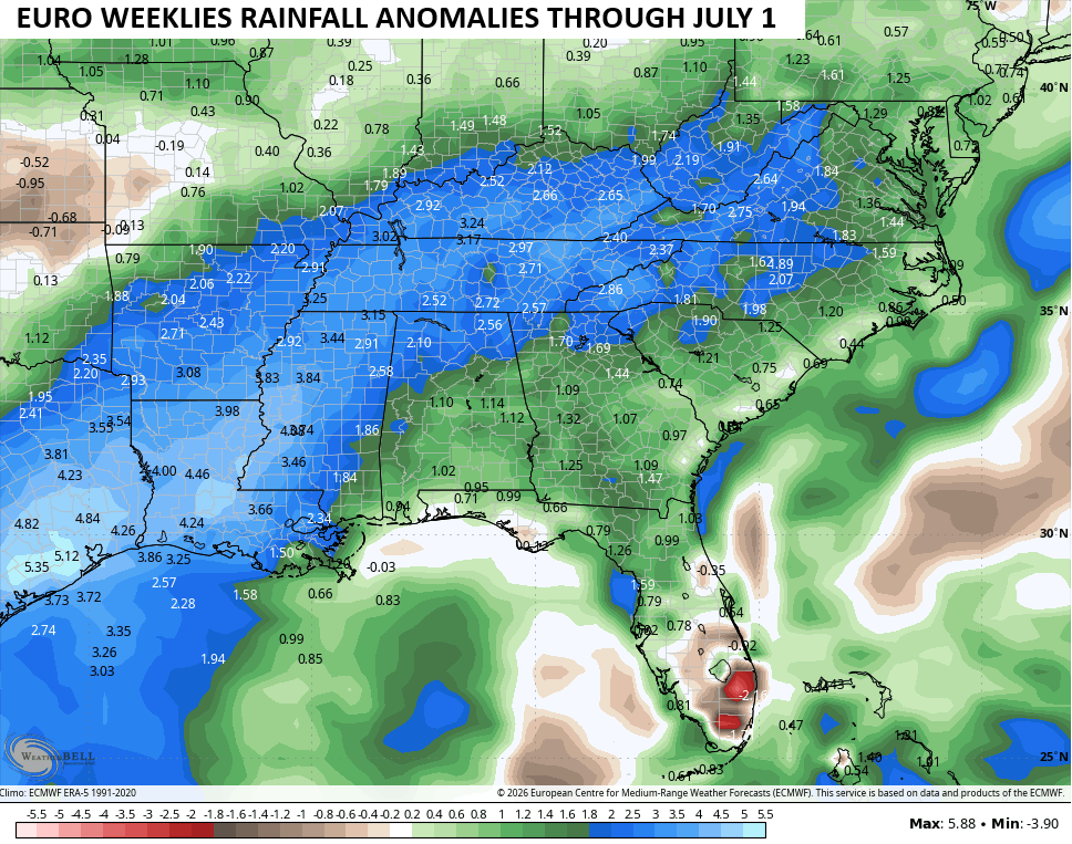
This likely kicks off a wetter than normal pattern that may feature quite the swath of rains setting up from the lower Mississippi Valley into our region into June. The EURO Weeklies are well above normal for rainfall from now through the first day of July…
I’ll have the latest on WKYT-TV and on WKYT + later today. Until then, here are the tracking tools you need for the day…


Current watches

Possible Watch Areas

Make it a magnificent Monday and take care.

I’ll believe it when I see it. #rain
Thanks Chris. After six weeks of absolute hell, I’m back posting my ” two cents worth. ” Still weak from the chemo / treatments, so bear with me. Cancer, hopefully will be rid from my body in about three months, then I will begin to feel like my old self again.
As with the weather, this has been a very pleasant month of May ( temperature wise. ) Never in my 75 years have I ever seen a drought start this early. My theory is that the Bermuda High pressure system has been amplified by the on going negative Pacific Decadal Oscillation. Where it’s raining on the northern edge of the high pressure, the air is rising ( condensation. ) Where it’s not raining, south of the Ohio River, the air is sinking ( no condensation. ) Hoping this changes soon, and everyone receives good soaking rains before Summer arrives in a couple of weeks.
Welcome back, Schroeder!
Thanks Jeff, great to be back ! I want to thank everyone for their prayers.
SO happy to see you back on here Schroeder, you were missed!
Thanks Dottie. Being back posting means so much to me. I really love this forum.