Good Tuesday, everyone. It’s Election Day and our weather feeling more like summer with toasty temps and a few storms. This stormy setup will really ramp up later this week into Memorial Day Weekend and beyond. Things can get pretty darn wet around here.
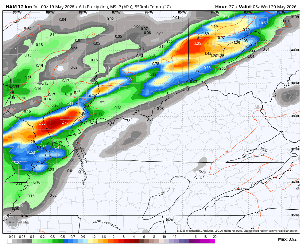
Temps out there today generally range from 85-90 with a mix of sun and clouds. Winds will be gusty with the chance for isolated showers and storms going up. As a cold front inches closer, the potential is there for an increase in thunderstorms from west to east this evening and tonight.
The Storm Prediction Center continues to highlight the severe risk across the west with a lower threat getting into parts of central Kentucky…

Showers and storms then work across the state from late tonight into Wednesday with the potential for some lingering action into Thursday…
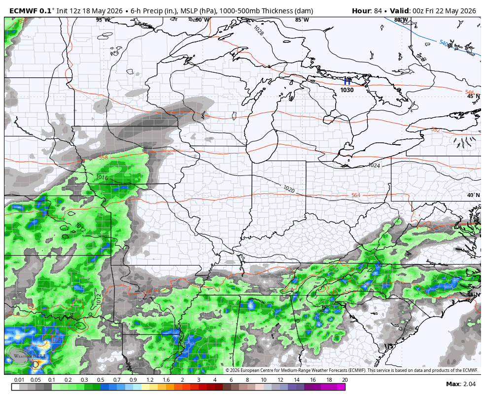
From there, we watch additional rounds of showers and storms targeting the region over the Memorial Day Weekend. This animation starts Friday and runs through Memorial Day…
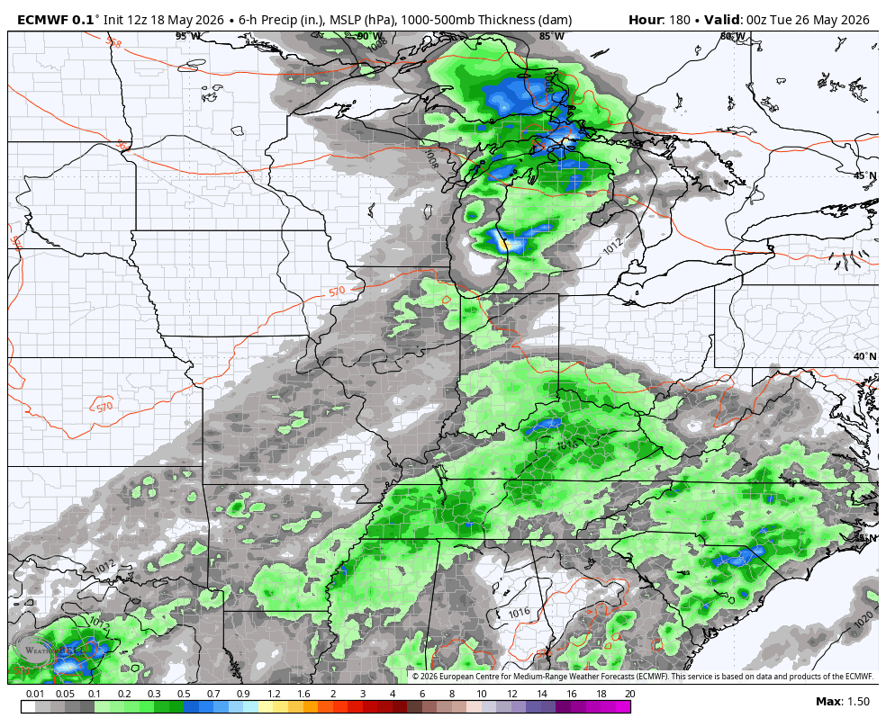
This wet pattern looks to stick around for much of next week with the models keeping the rounds of showers and storms going through the start of June…
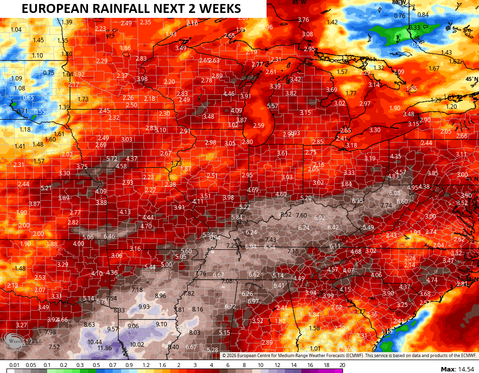
Those animations are from the EURO which is showing a lot of rain over this 2 week span…
The Canadian doesn’t go out as far in time, but the 10 day rainfall forecast is robust…

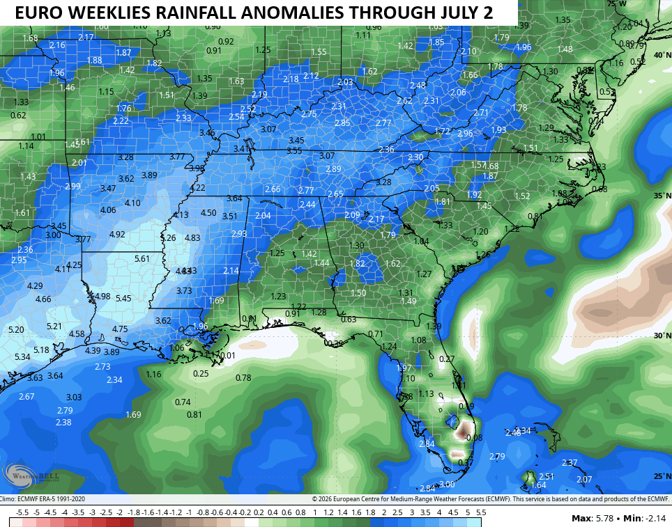
All of this is playing right into the pattern the EURO Weeklies have been showing and continue to show. The Weeklies are growing even wetter from now through July 2nd with well above normal rainfall…
I’ll have the latest on WKYT-TV and on WKYT + later today. Until then, here are the tracking tools you need for the day…


Current watches

Possible Watch Areas

Make it a terrific Tuesday and take care.

Thanks Chris. Hope the forecast holds true, for wetter days ahead.
Good to hear from you Schroeder. Hope all is well with you
Thanks Winterlover, Better, but I have more cancer treatment in the coming days.
Got much needed rain here in my neck of woods yesterday afternoon. Hopefully more to come.
Latest trends show that the models will fall short yet again.
Watching storms develop in far western Kentucky, but I fear that it will not deliver to the Bowling Green area. Recent history has shown that the region to the west of BG has earned a reputation as the place where storms come to die. Year to date rainfall in Warren County is 8.5 inches below normal, and I just saw a report that Nolin Lake is at winter pool level, which is about 12 inches below where it should be at around Memorial Day.
It’s currently 93°F at my PWS, but the dewpoint is a relatively dry 65°F.