Good Wednesday to one and all. Rounds of showers and storms continue to press across the region today and this is a sign of things to come. As a matter of fact, we have a lot of rain on the way in the coming days and the next few weeks. It’s a pattern that can cause some high water concerns.
Rounds of showers and storms are rumbling across Kentucky today as a cold front moves in. Some of these storms may be strong or locally severe, especially in the east. This is where the Storm Prediction Center has that low-end risk for a few severe storms…

Areas of damaging winds may show up across parts of central and eastern Kentucky. Locally heavy rains will also be noted and may cause some hit and run high water issues in a few spots.
Lingering rain and some thunder takes us through tonight into the first half of Thursday as much cooler air moves back in. This brings some drying by the end of the day and that lasts into Thursday night.
This boundary becomes active again Friday as low pressure rolls into our region with the increasing potential for waves of rain and storms through the Memorial Day Holiday Weekend. While it won’t rain the entire time, things look pretty wet.
Here’s the EURO from Friday morning through Memorial Day…
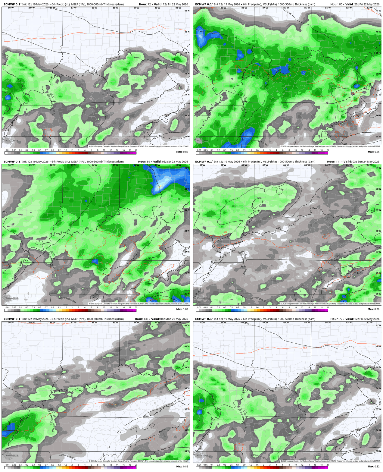
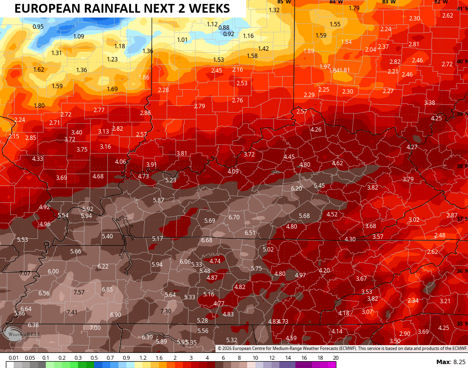
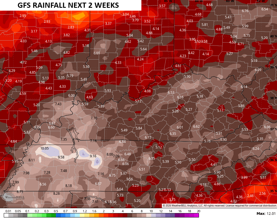
More in the way of showers and storms will be noted after that into the close of May. The forecast models continue to advertise a lot of rain during this time…
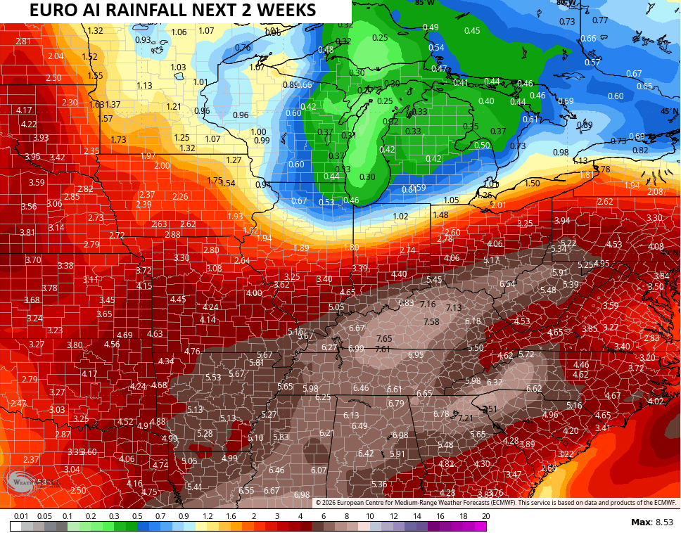
The AI models are also putting a bullseye on top of us…
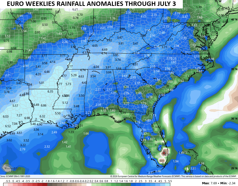
It’s interesting to watch the EURO Weeklies increase the rainfall numbers through June into the first few days of July. Well above normal rainfall continues to show up during this time…
I’ll have the latest on WKYT-TV and on WKYT + later today. Until then, here are the tracking tools you need for the day…




Current watches

Possible Watch Areas

Make it a wonderful Wednesday and take care.

Which would mean CLOUDS/ LESS heat. I’m not surprised because we can be stuck in a pattern for so long and then when it flips it’s almost always the other extreme. It just happens to be flipping in the summer instead of spring being wet, then summer being bone dry/hot. At least I HOPE that’s the way it works out.
It won’t.
Based on latest trends, these forecasts will fail.
Thanks Chris. I wouldn’t mind if ( June – July – August ) turn out wet and cooler than normal. We really need an end to this awful drought.
El Nino has formed in the Tropical Pacific, but will it react with the atmosphere ? Not until the Pacific Decadal Oscillation phases to positive. Sometimes the ( PDO ) will lag behind ENSO and will phase to the positive months later. We shall see. Hope it phases to the positive during our Winter months to give us a colder, snowier scenario like we had in 2014 – 15.