Good Saturday, everyone. Our super soaker of a weather pattern continues with scattered showers and thunderstorms rolling across the region over this holiday weekend. Unfortunately, this means we have additional waves of heavy rain with more waiting on us into next week.
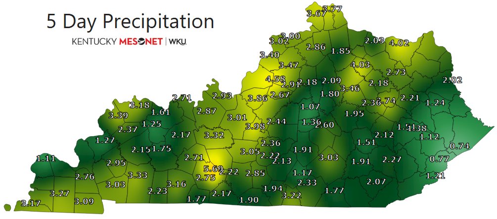
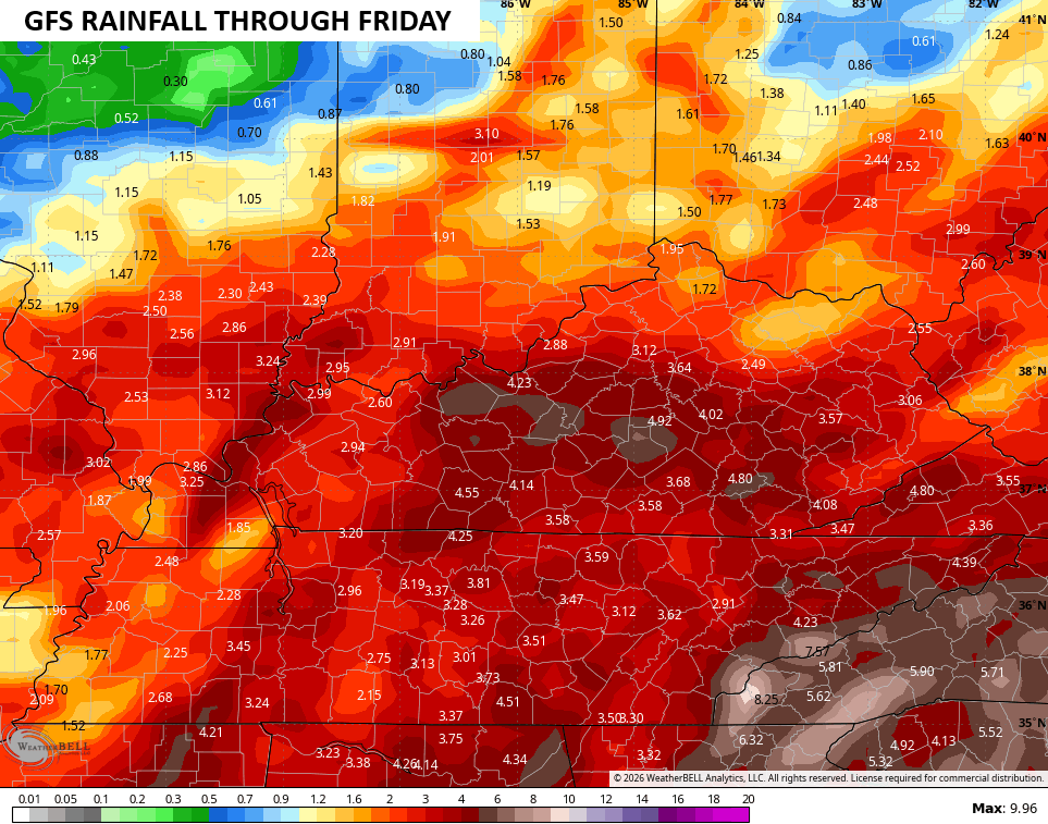
We have picked up a ton of rain over the past few days with a general 1″-4″ for many, with locally higher amounts. Take a look at the rain totals through Friday from the Kentucky Mesonet sites…
More in the way of showers and storms rumble across the state today, especially central and eastern Kentucky. This won’t be as widespread with many dry hours showing up. Still, slow-moving storms may put down torrential rains in some areas.
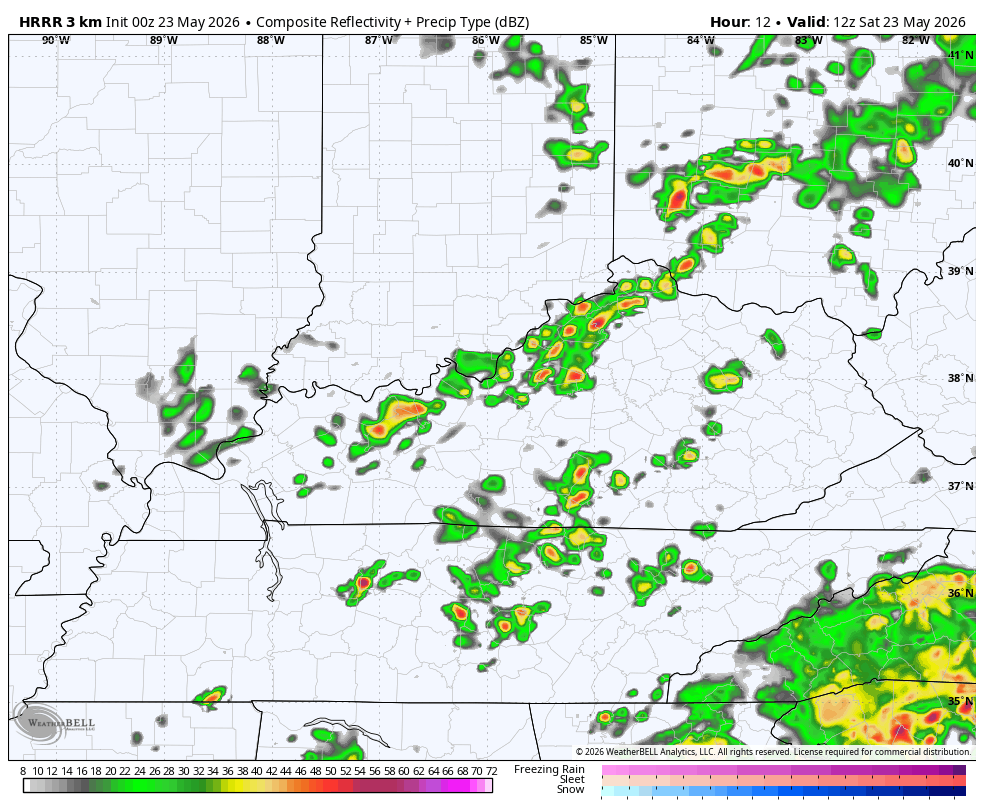
Another big wave of showers and storms arrives Sunday and may bring more in the way of heavy rains. This future radar from the HRRR runs from this morning through Sunday evening and shows all this…
There’s another low end chance for a few spinning storms out there today. Here’s the Severe Weather Outlook from the Storm Prediction Center…

Memorial Day finds more in the way of showers and storms going up with a boundary that looks to hang tough through most of next week. This leads to additional waves of rain and storms through the end of next week…
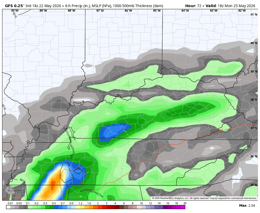
Additional heavy rains are likely with several more inches possible…
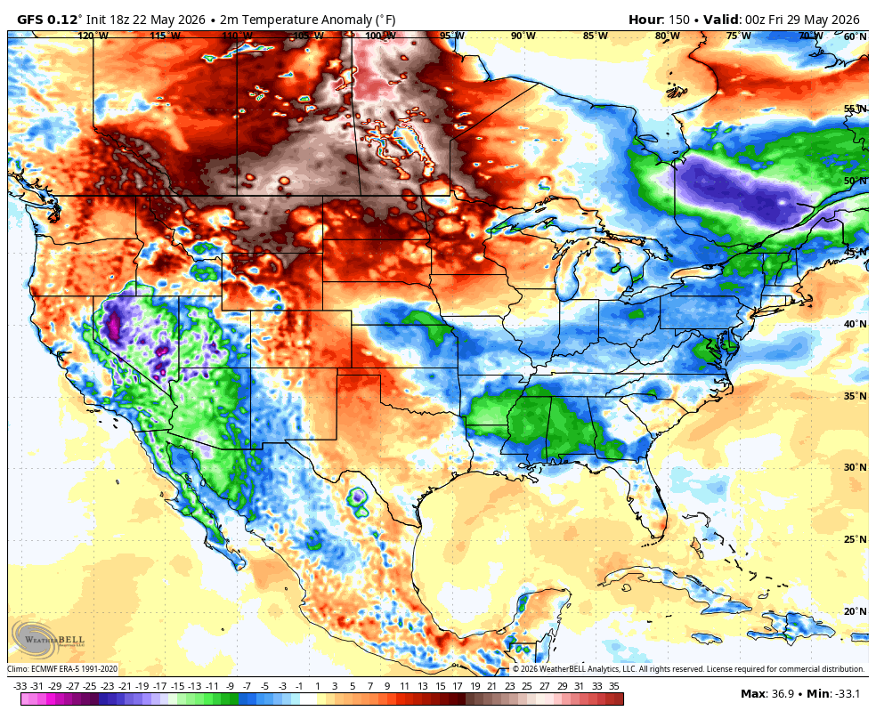
This pattern may also turn cooler again to end the month and begin June. Check out the GFS during that time frame…
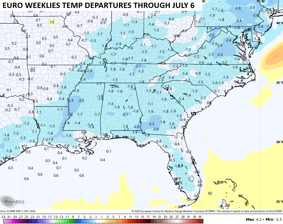
This cooler air is being matched by the EURO Weeklies which show an overall below normal temperature pattern through the start of July…
That goes along with the same model showing well above normal rainfall during this same time period…
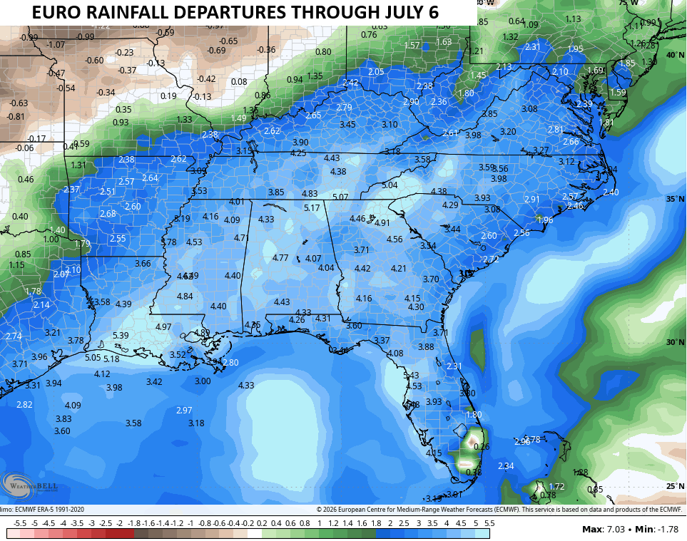
Both of those match what we typically see in the summer months during a developing Super El Nino.
Until then, here are the tracking tools you need for the day…


Current watches

Possible Watch Areas

Make it a sensational Saturday and take care.

The CPC had predicted an 80% chance that El Nino would manifest by end of May, and that prophecy appears to have been fulfilled. What remains to be determined are its ultimate strength and lifespan. The most recent Sea Surface Temperature Anomaly chart clearly shows that above normal water temperatures stretch from South America across to the Philippines. And El Nino’s arrival is very much apparent in the current pattern change, as if someone had thrown a light switch!
https://www.ospo.noaa.gov/products/ocean/sst/anomaly/
Joe, Read this article on the changes in the PDO. Like you said yesterday, it’s effects on ENSO phases no longer applies due to a very pronounce warming of the upper atmosphere. Here’s the link : )
https://climateimpactcompany.com/pacific-decadal-oscillation-outlook-are-we-due-for-a-cycle-change-of-the-pacific-decadal-oscillation-2-2/
I kind of wonder now if we will have four seasons anymore, and if we will see anymore major snowstorms ?
Adding to the above: ) the Earth will still shift into each season, but the weather one would expect will not.
I really doubt that we get a bunch more rain or cooler temps.
That’s what you being saying every day. Chris has been pretty spot on his forecast.
I don’t believe anyone is complaining about the good rains we are receiving.
We won’t be getting anything like those EURO weeklies suggest. I get that there’s a bias towards cool and wet, but sometimes I think Chris only posts models that tells what many on this blog want to hear.
I would not be complaining if the EURO weeklies were correct. We had a long dry Spring and ones that are in the Agricultural industry are very thankful for the amount of rain we received. I just wish the whole area received such.
Incorrect take
Incorrect opinion, but you are entitled Jeff.
I only speak truth.
Weather forecast for Memorial Day weekend by the Climate Impact Company : )
https://climateimpactcompany.com/u-s-early-notes-wet-weather-south-and-east-through-the-memorial-day-weekend-2/