Good Sunday to one and all. Rounds of showers and storms are rumbling across the Commonwealth again today, putting down enough rain to cause hit and run issues. This is part of our “making up for lost time” rainy pattern as we get ready to close out the month of May.
Today’s showers and storms increase quickly from west to east as another low pressure moves into the Ohio Valley. This future radar shows the waves of rain and storms that take us into tonight…
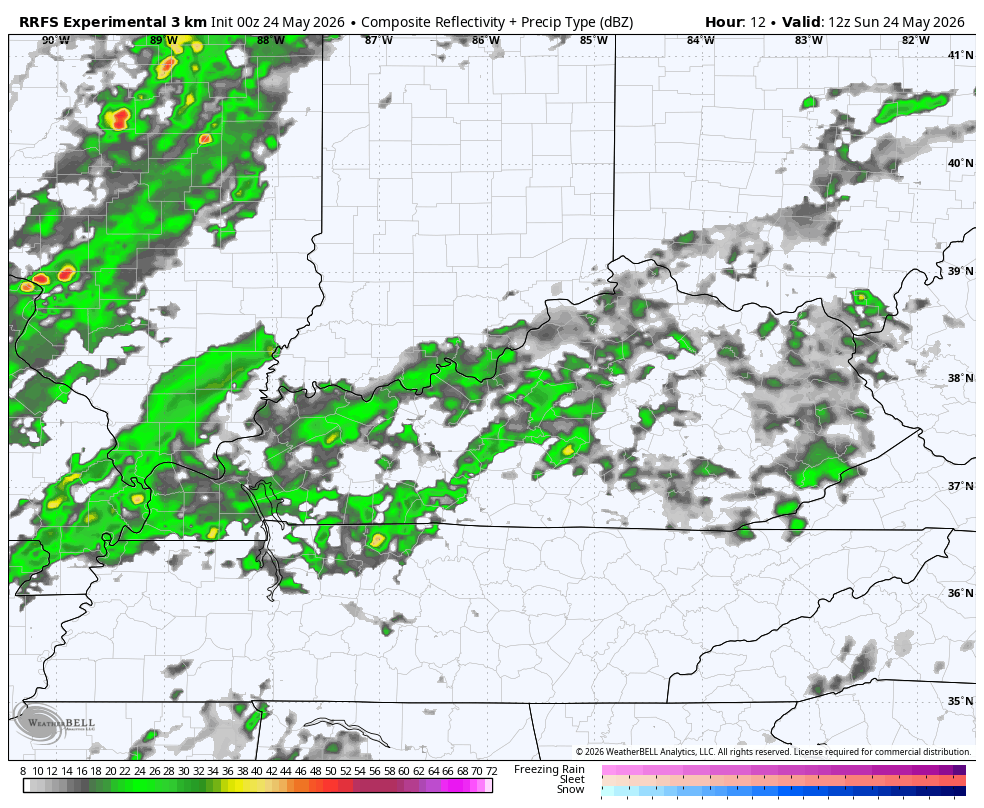
Another 1″-3″ can fall in some areas, leading to local flash flooding.
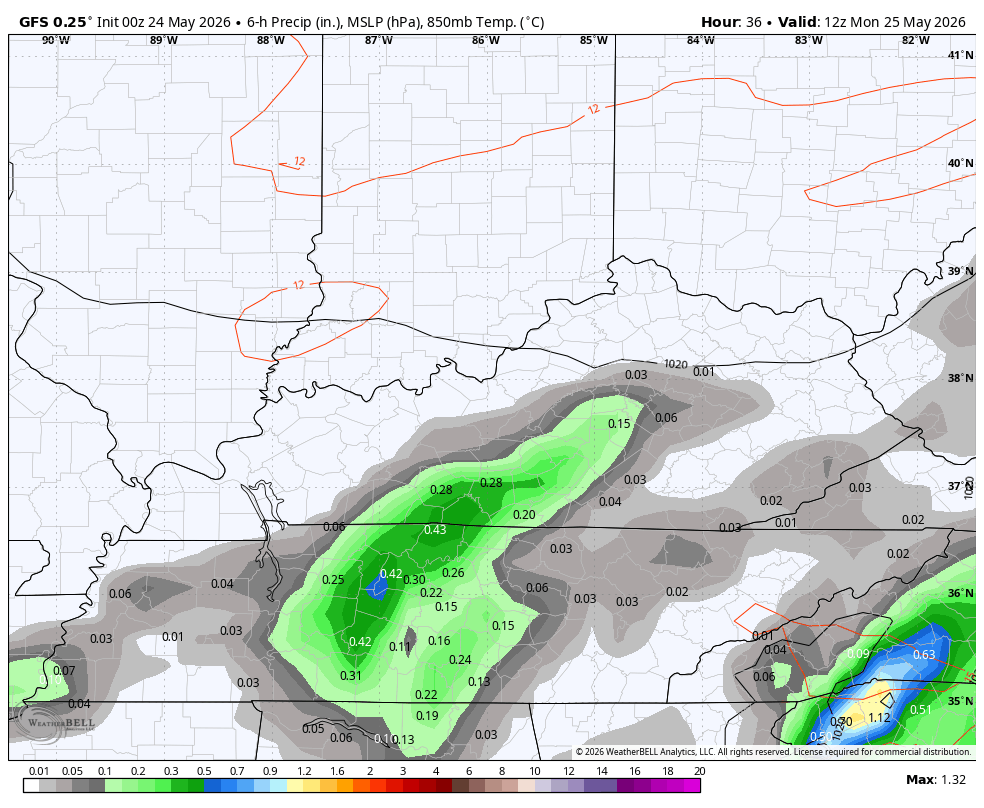
A break in the rain should take place for the first half of our Memorial Day before more in the way of scattered showers and storms show up. This action may be more prominent across the southern half of the state. This action then spreads out to cover much of the region from Tuesday through Thursday, at least.
This animation shows the increase in rain and storms from Memorial Day through the end of the week…
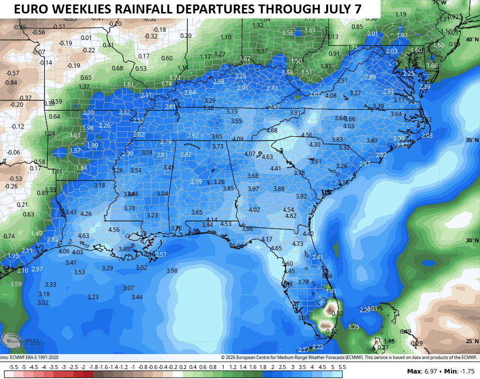
The EURO Weeklies sniffed out this wet pattern a few weeks back and they continue to go for an above normal rainfall setup through the first week of July…
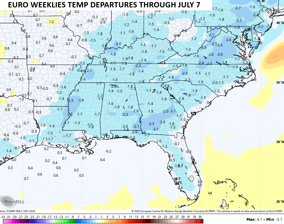
With the wetter pattern, the Weeklies also see temps averaging below normal through the same time period…
I may drop by for another update later today. Until then, I have you all set to track today’s waves of rain and storms…


Current watches

Possible Watch Areas

Make it a great Sunday and take care.

I predict this summer turns out exactly like last year.
Jeff I can’t remember the weather we had last Summer. You will have to refresh my memory. Or I could look it up.
https://www.weather.gov/pah/Summer2025ClimateSummary
Basically it was really wet in the first half and very dry the other.
Thanks Jeff
So if this year hasn’t been ANYTHING like last year, what makes you think summer will be the same as last year? Just curious…
Also… Schroeder .. are you ok?
Just a hunch of mine.
Mark. No I’m not okay. Been very tired here lately. May be due to the Cancer treatments. Don’t really know. Thanks for caring Mark.
Thanks Chris. We had over 3.50 ” in my rain gage. These off and on rain events will eliminate the Spring drought, but I bet drier weather will return within a month or so.
Only mother nature knows what weather we will have and it can a wet aand cool summer .