Good Monday, everyone. On this Memorial Day, we remember and honor those who have sacrificed so much for our country. Their service will never be forgotten. This day also serves as the unofficial beginning of Summer, but Mother Nature has other plans for some areas.
The past week’s work of rainfall has put a major dent in the drought that was forming in our region. Several inches of rain have fallen in the 7-day period ending at 7pm Sunday…
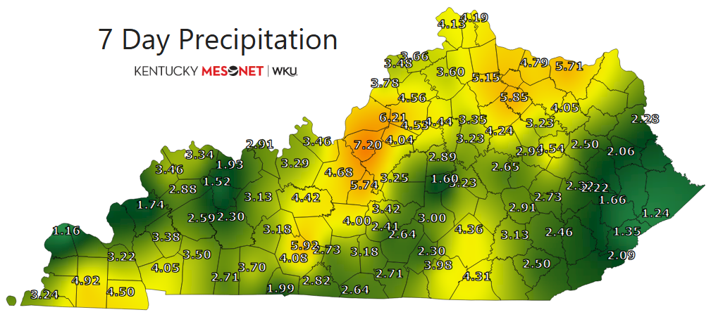
This did come along with some areas of flash flooding and the timing could have been better, but we sure needed the rain. And, we have a lot more on the way over the next week.
Let’s begin with this Memorial Day and work forward. Some dense fog is out there this morning with some scattered showers and storms lingering across the south and southeast. This action will lift northward later in the day, meaning the chance for some showers and storms will be noted for many as the day wears on.
Additional rounds of showers and storms then show up Tuesday through Thursday. The future radar from the RRFS starts this afternoon and rolls through 8am Thursday…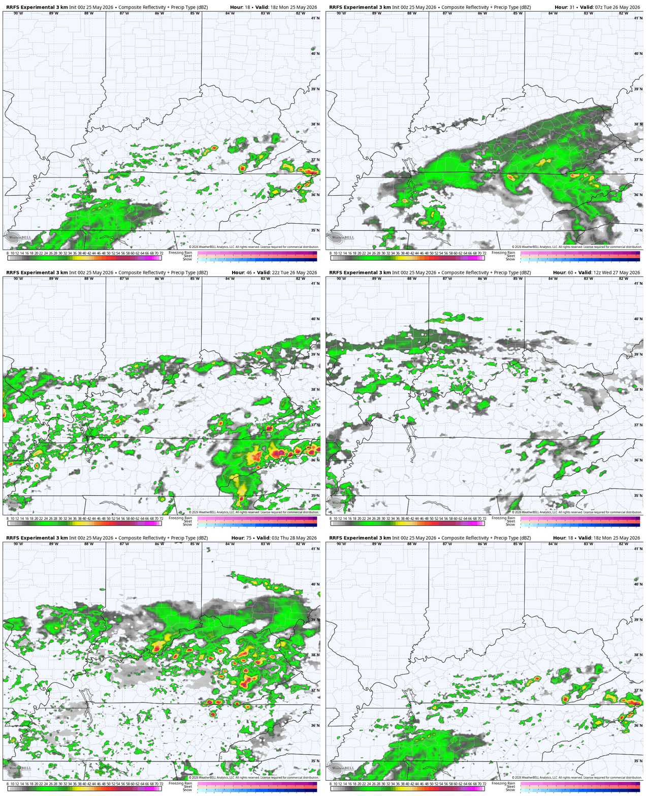
Locally heavy rains may cause additional hit and run high water issues during this time.
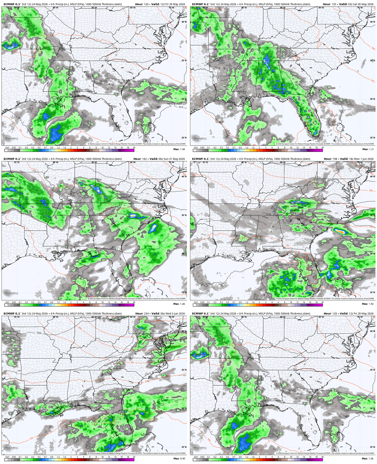
From there, the models diverge a bit with the EURO bringing a slow-moving upper level low far enough north to bring more rain in here this weekend into the first few days of June…
The GFS is farther south with this…
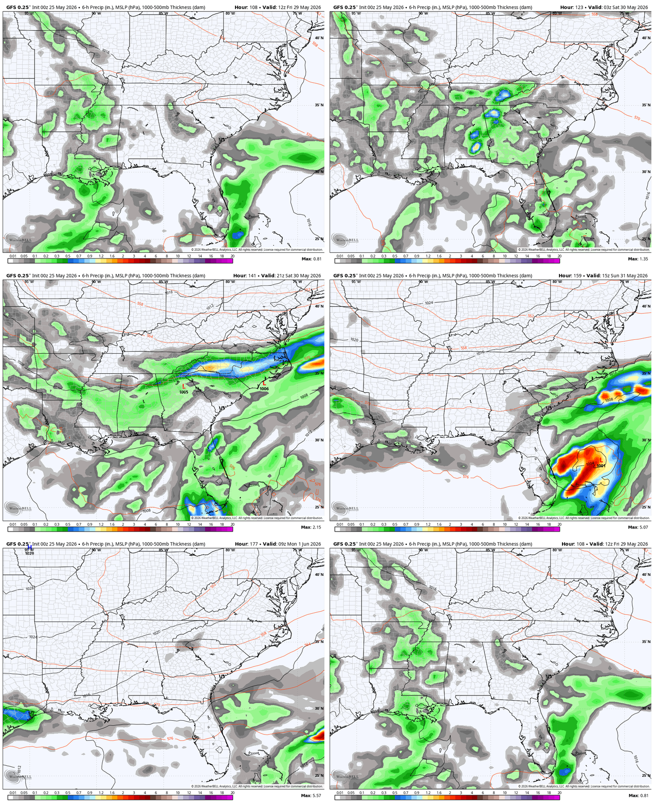
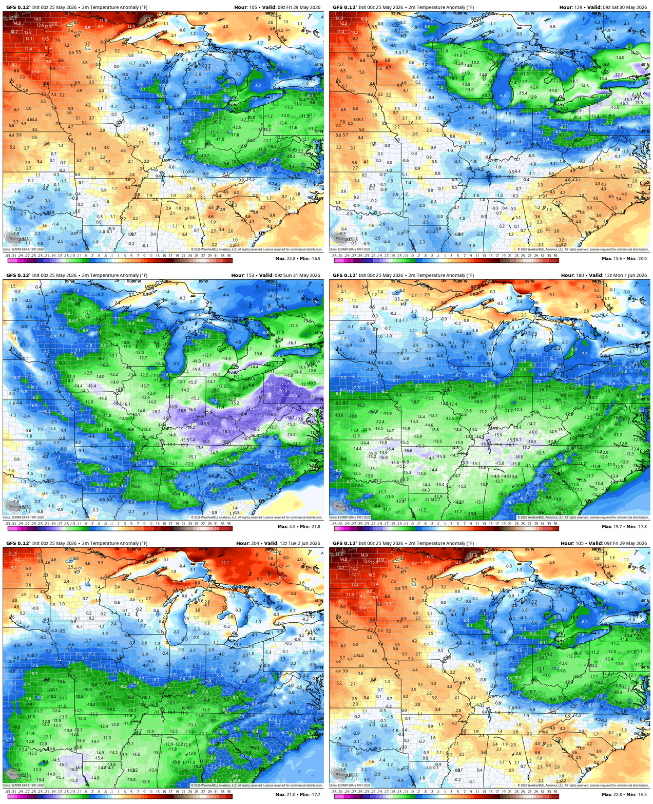
The reason it’s farther south is it brings a big push of cool Canadian air into the eastern part of the country. With the upper low to our south and a high to our northeast, the gradient brings below normal temps in here. The GFS even brings some Barney in here…
That’s all I have for you crazy kids right now. I leave you with your daily rain and storm tracking tools…




Current watches

Possible Watch Areas

Make it a great Monday and take care.

The tap will shut off soon enough, so be prepared.
Or the tap may stay open who knows
Preferably somewhere in between.
Thanks Chris. Great rains over the past few days, but now hoping for a drying trend. As we all know, the area of the country we live in is of extremes in both precipitation and temperatures. Too wet, or too hot and dry, and sometimes too cool.
Latest long range ( June forecast ) from the Climate Impact Company : )
https://climateimpactcompany.com/ag-sunday-global-weather-climate-report-u-s-d2-d4-drought-covers-whopping-44-5-of-u-s-latest-15-day-and-16-30-day-u-s-precipitation-forecasts-indicate-rapidly-drying-soils-north-central-u-s-and-2/