Good Tuesday, everyone. Rounds of showers and thunderstorms are ramping back up out there today, leading to another local flash flood threat. This likely carries us into Wednesday and early Thursday before a drying trend ushers in another much cooler than normal setup.
Today’s rain and storms will cause issues as they can drop a quick 1″-3″ in some areas. With this falling on top of the general 3″-8″ of rain we’ve had in the past week, folks will need to watch for possible flooding.
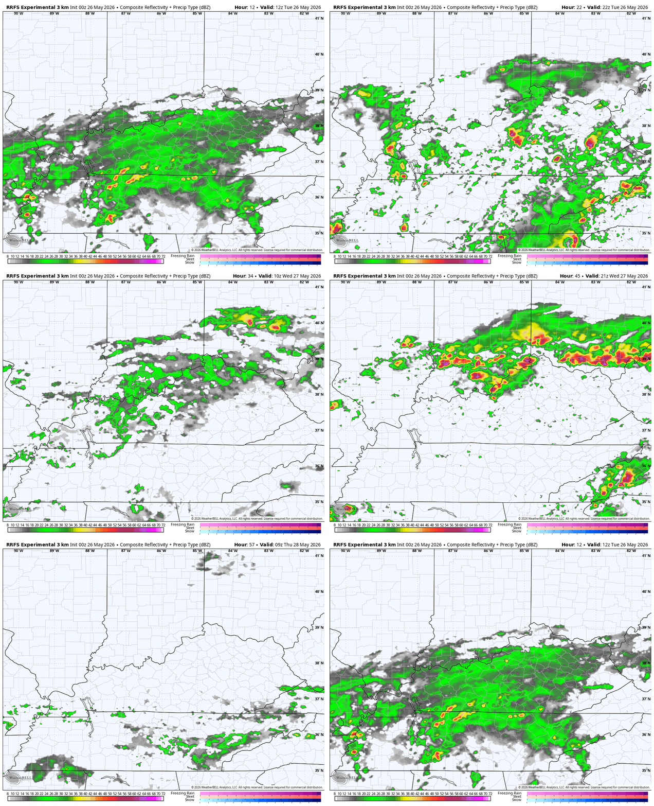
Additional showers and storms will be noted Wednesday with the potential for more hit and run high water issues. This stuff lingers into, at least, early Thursday. Here’s the future radar from this morning through Thursday morning…
A significant blocking pattern shows up to push the extensive rains to our south by Friday. This is a classic Omega Block showing up across North America…
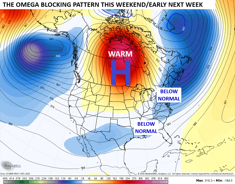
It gets the name because of the resemblance to the Greek letter Omega…

That massive ridge over Canada is something we’ve seen from time to time in recent years and is one that absolutely bakes our neighbor to the north.
While that’s happening to our north, we get colder than normal temps to close out May and begin the month of June. This animation shows the well below normal temps…
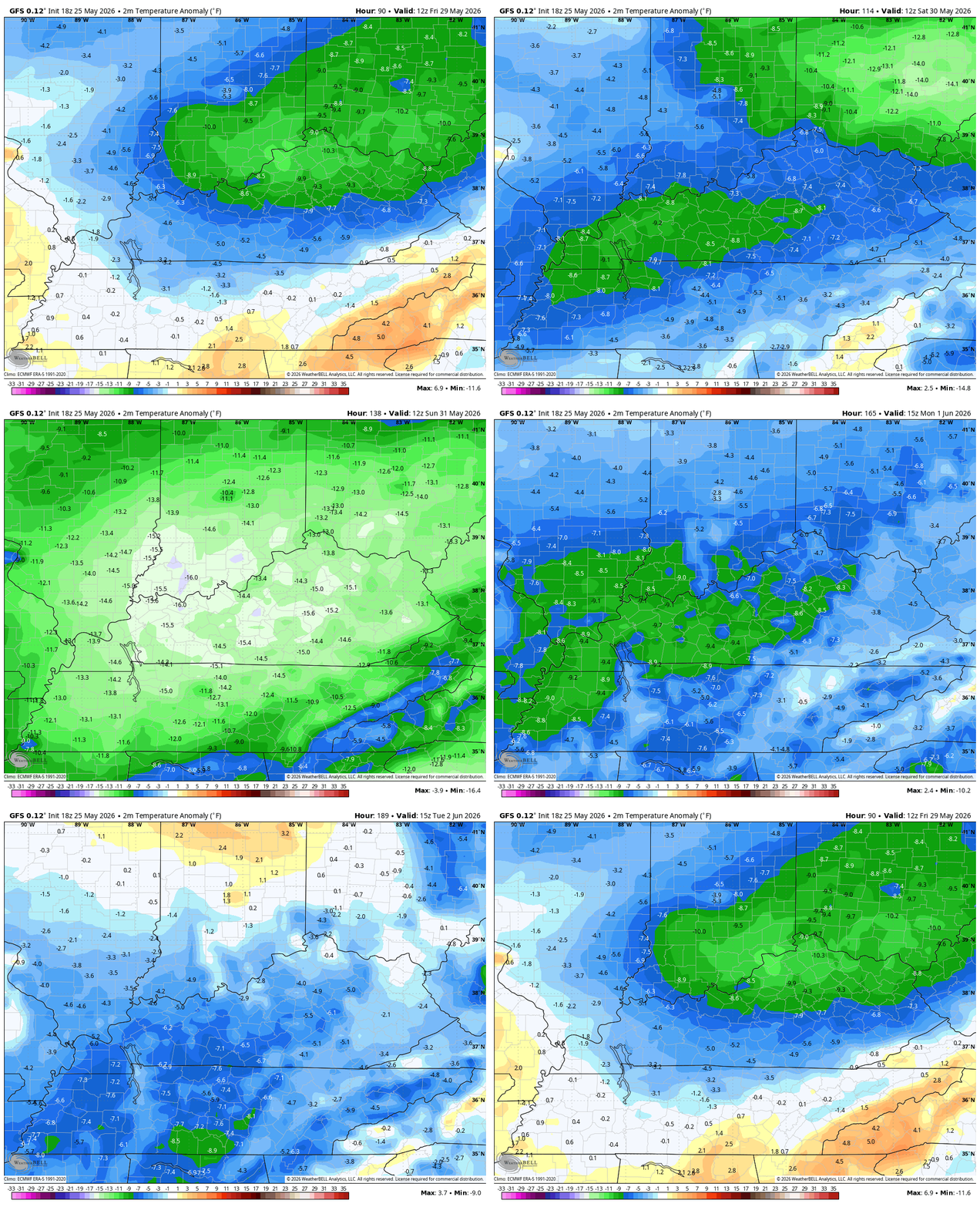
A few mornings in the 40s will likely show up to end May and begin June.
I leave you with your daily rain and storm tracking tools…




Current watches

Possible Watch Areas

Make it a terrific Tuesday and take care.

Thanks Chris. The Omega Block forecast pattern may be due to a long – going negative PDO, which has kept a La Nina like weather pattern locked in over the Pacific, despite the formation of a predicted El Nino. El Nino is present, but not reacting to the atmosphere.
https://climateimpactcompany.com/ag-sunday-global-weather-climate-report-u-s-d2-d4-drought-covers-whopping-44-5-of-u-s-latest-15-day-and-16-30-day-u-s-precipitation-forecasts-indicate-rapidly-drying-soils-north-central-u-s-and-3/
My question : ) Is this negative Pacific Decadal Oscillation ( PDO ) permanent to bring on Climate Change ? I don’t think anyone can answer that question.
Over the past four days, or when the rains started, my rain gauge recorded well over four inches. Good timing by Mother Nature going into the most likely dry Summer months.
Latest on the ” super El Nino ” : )
https://climateimpactcompany.com/weekly-enso-diagnostics-report-caveats-are-emerging-in-the-strong-el-nino-forecast-forecast-confidence-of-historical-el-nino-intensity-decreases-2-2/
Well below normal? Yeah, right…..
Temperature extremes are difficult to predict. Especially during the Summer months.