Good Thursday, everyone. Our super soaker of a pattern is slowly winding down with better weather moving in today. This better weather means more in the way of dry conditions to go along with some very pleasant temps to end May and begin the month of June.
Some fog will be noted early today with a mix of sun and clouds taking over through the day. There’s still the chance for a shower or storm across the southern half of the state, but this won’t be anything like what we’ve had recently.
Cooler winds kick in from the north late today with overnight lows heading toward the upper 40s and low 50s for parts of central and eastern Kentucky…
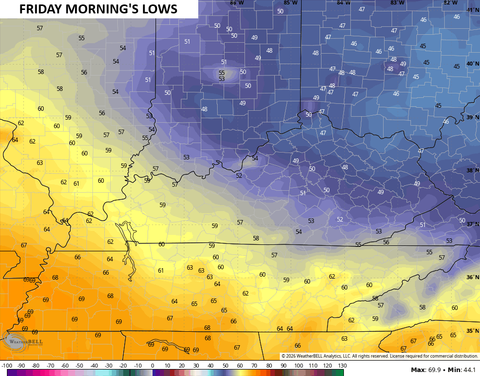
That’s a really nice start to what looks like a fantastic Friday with highs ranging from the middle 70s to low 80s.
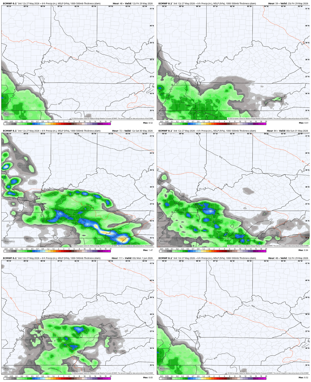
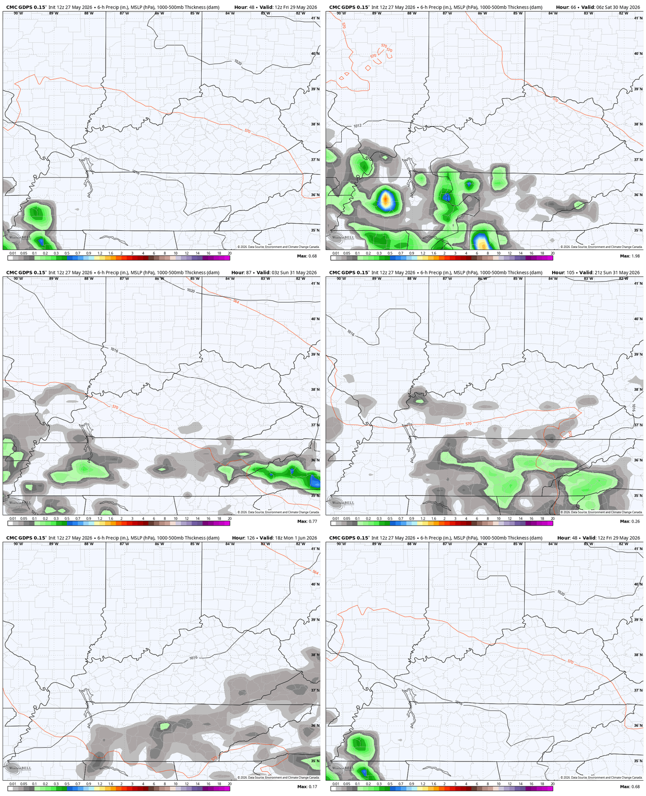
The boundary to our south may drift back to the north a bit Friday night into early Saturday, bringing the chance for some showers and storms to the southern half of the state with another shot in the south late weekend.
The EURO has been the most aggressive with this setup and continues to be with this animation that runs from Friday morning through Monday…
The Canadian isn’t as jazzed up with rain, but it’s also targeting the southern half of the state with some scattered action during the same time…
That’s all I have today and will do better tomorrow. Until then, I leave you with your daily rain and storm tracking tools…




Current watches

Possible Watch Areas

Make it a great Thursday and take care.

Thanks Chris. I’m ready for some ” real deal ” Summer weather. Sunny skies with high temperatures 85 to 90 degrees and morning lows in the mid 60’s. Save the cooler weather for late August. I hope we will have some rainy days, but with no prolong drought.
For me, a perfect summer day is upper 50s lows and mid 90s highs and just enough rain to avoid drought.
That sounds great too Jeff. I’ll take it !