Good Friday, everyone. It’s the final weekend of May that’s upon us and we have some pleasant temps pushing in. Unfortunately, the potential for some heavy rain producing showers and storms is back for the southern half of the state.
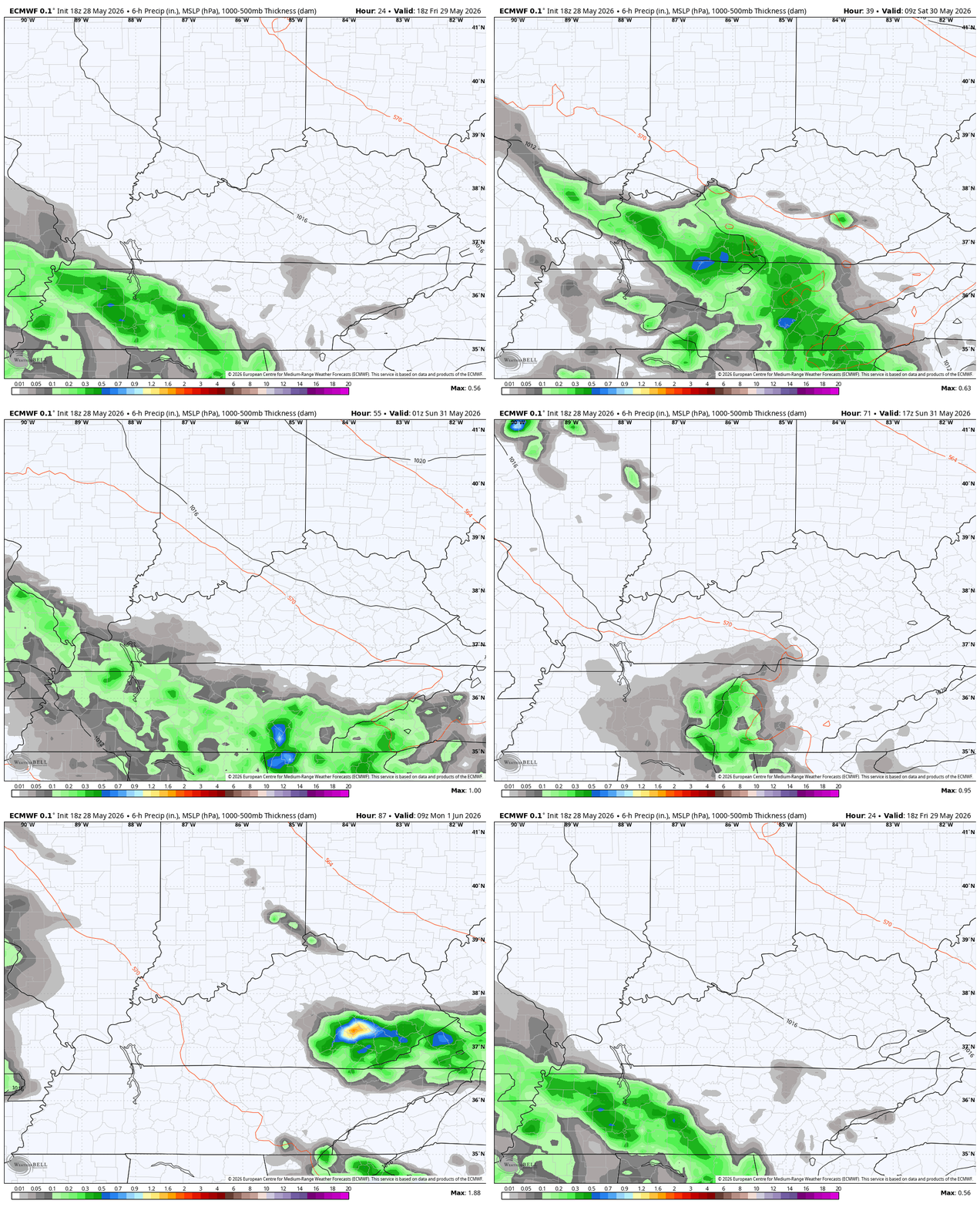
These rains won’t be constant, but we will see a few waves impacting the southern half of Kentucky through Monday. The first round shows up in the west this afternoon then spreads to the east tonight and early Saturday with that diminishing by the afternoon.
Another period of scattered stuff shows up Sunday afternoon into early Monday in some of the same areas.
Watch the EURO progression from this afternoon through Monday night…
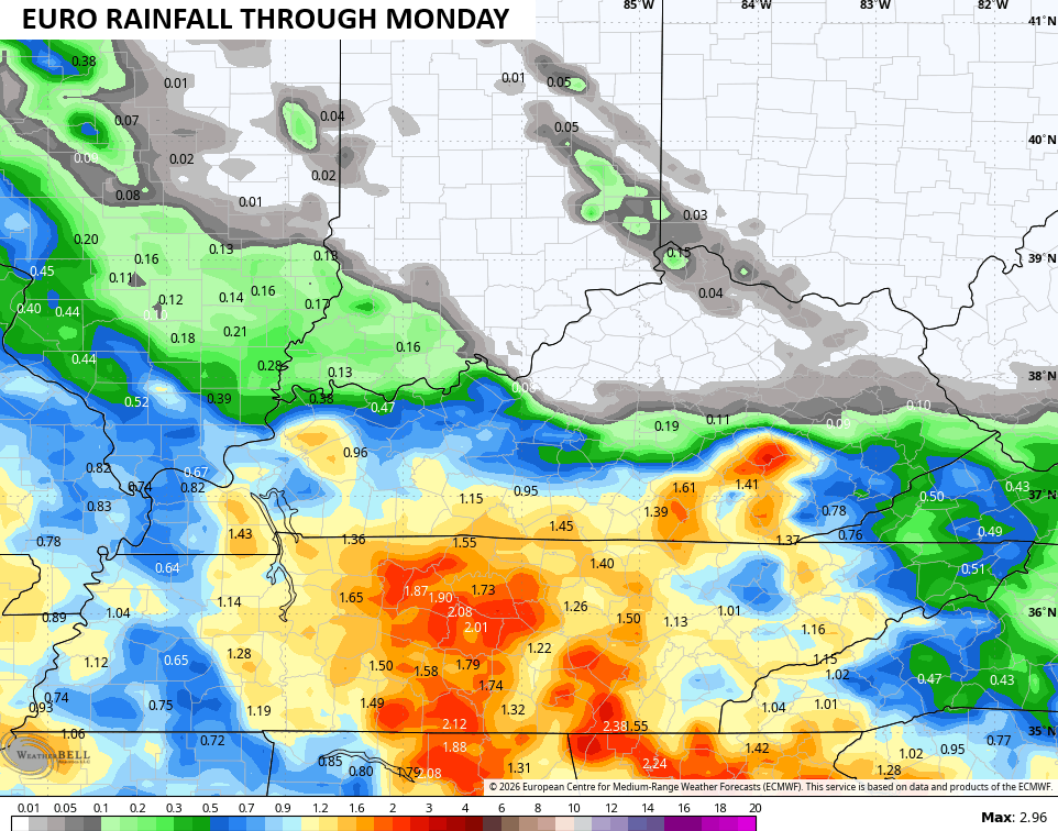
The chance for a few inches of rain is there across the southern half of the state with a sharp cutoff on the northern edge…
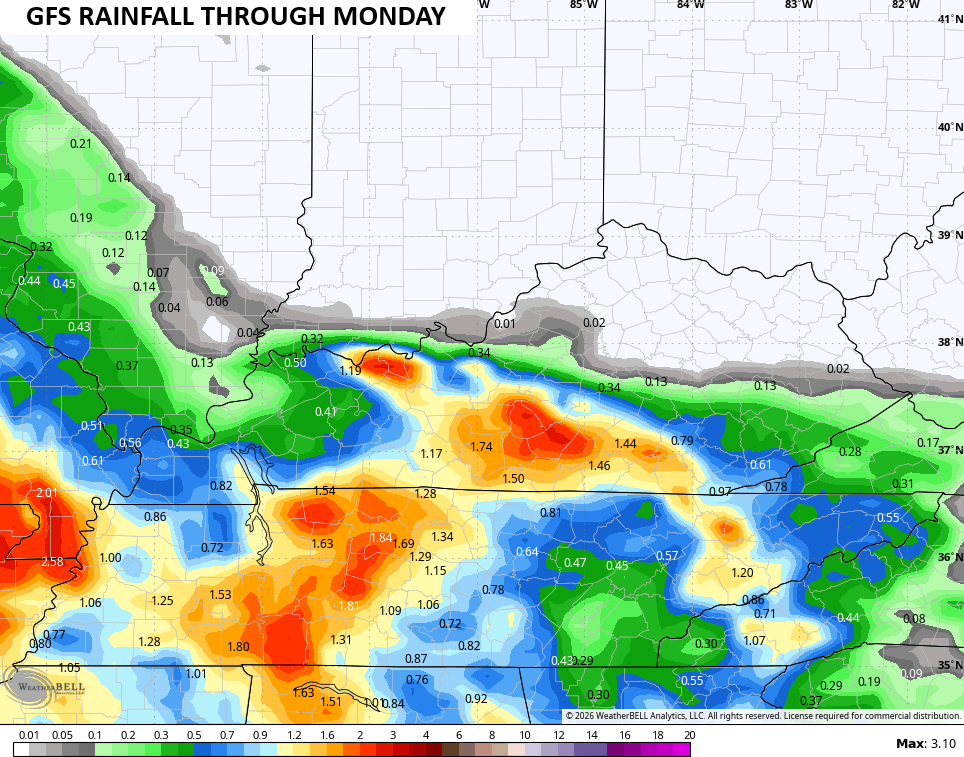
The GFS is similar…
If you recall, the EURO was suggesting this very scenario several days ago when other models were taking this well south.
Cooler winds then push this mess to our south and southwest into the first few days of June. Highs in the 70s and lows in the upper 40s look to be a good bet.
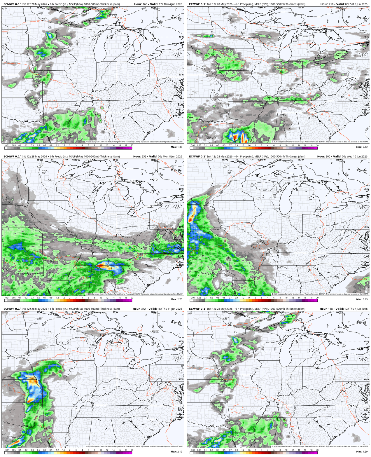
The EURO is trying to rev the pattern back up late next week into the following week with several systems rolling through…
I will have the latest on WKYT and WKYT+. Until then, I leave you with your daily rain and storm tracking tools…




Current watches

Possible Watch Areas

Make it a fantastic Friday and take care

Not buying the models hype.
EURO and GFS weather models are the best in short ranged forecasting, but one may elect the golden rule of meteorology : ” Take the weather models with a huge grain of salt. “
EURO and GFS weather models are the best in short ranged forecasting, but one may elect the golden rule of meteorology : ” Take the weather models with a huge grain of salt. “
Please omit one of the above comments.
Models 4
Jeff 0
False