Good Saturday, everyone. We have a few booming storms starting the day across the southern half of Kentucky with a few more on the way in this same area. Once we get rid of this action, some very comfy air will be with us to start Meteorological Summer on Monday.
The storms across the south may produce enough rain to spawn some high-water issues. This action will taper off throughout the morning with drying settling in. For the rest of the state, things are dry with temps generally in the upper 70s to around 80.
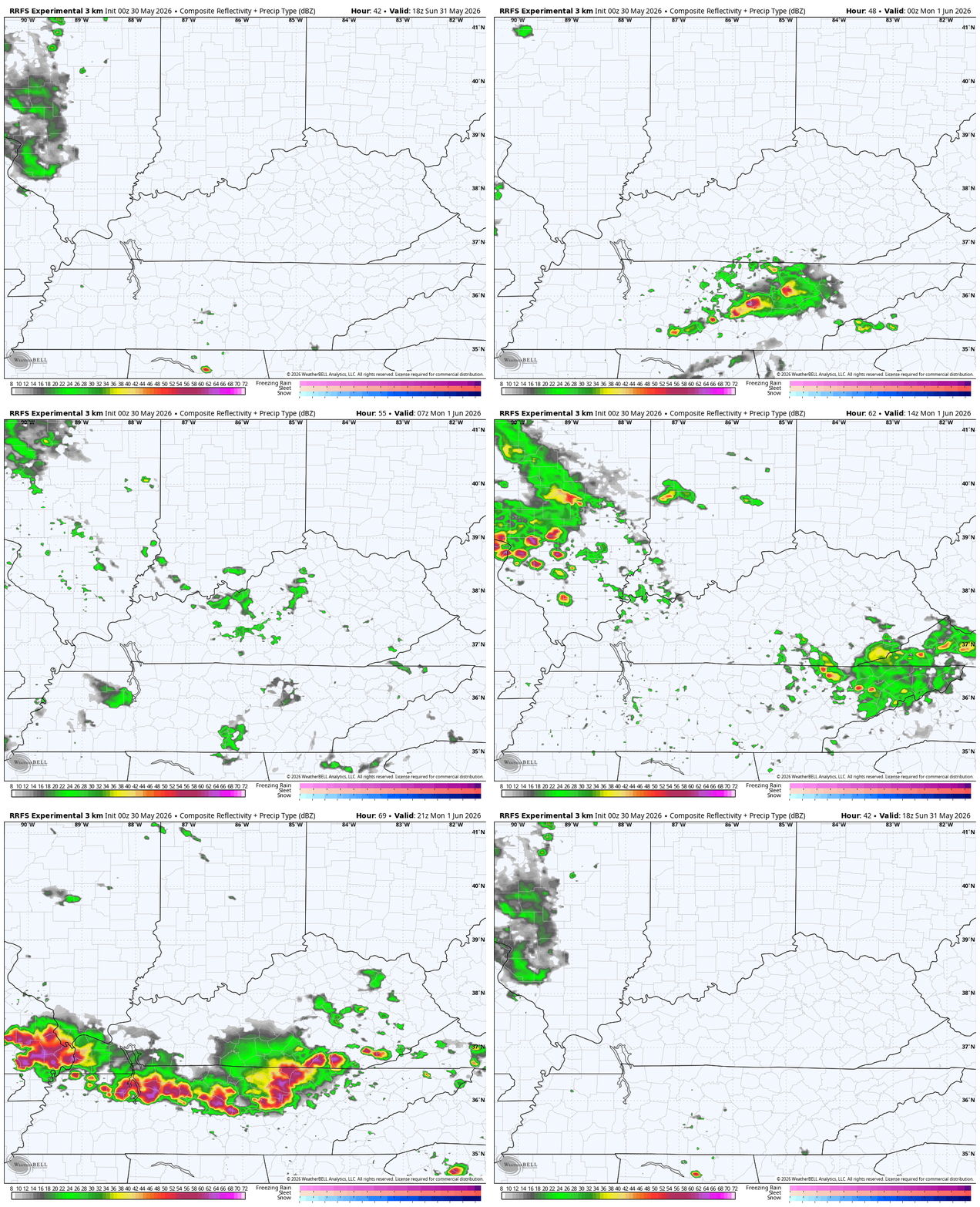
Similar temps will be noted on Sunday with just an isolated shower or storm going up in the south. I’m going to watch Sunday night into Monday for a sneaky setup that may overperform in terms of a line of storms. Some of the short-range forecast models are starting to see this and that includes the RRFS. Here’s the future radar from that model from Sunday afternoon through Monday evening…
Calm and pleasant skies take control from that point, giving us some wonderful weather Tuesday through Thursday with highs mainly in the 70s and lows reaching the upper 40s in some spots.
The EURO is looking a little blocky as we head into late next week into the following week. This isn’t exactly a summertime looking upper-level anomaly animation…
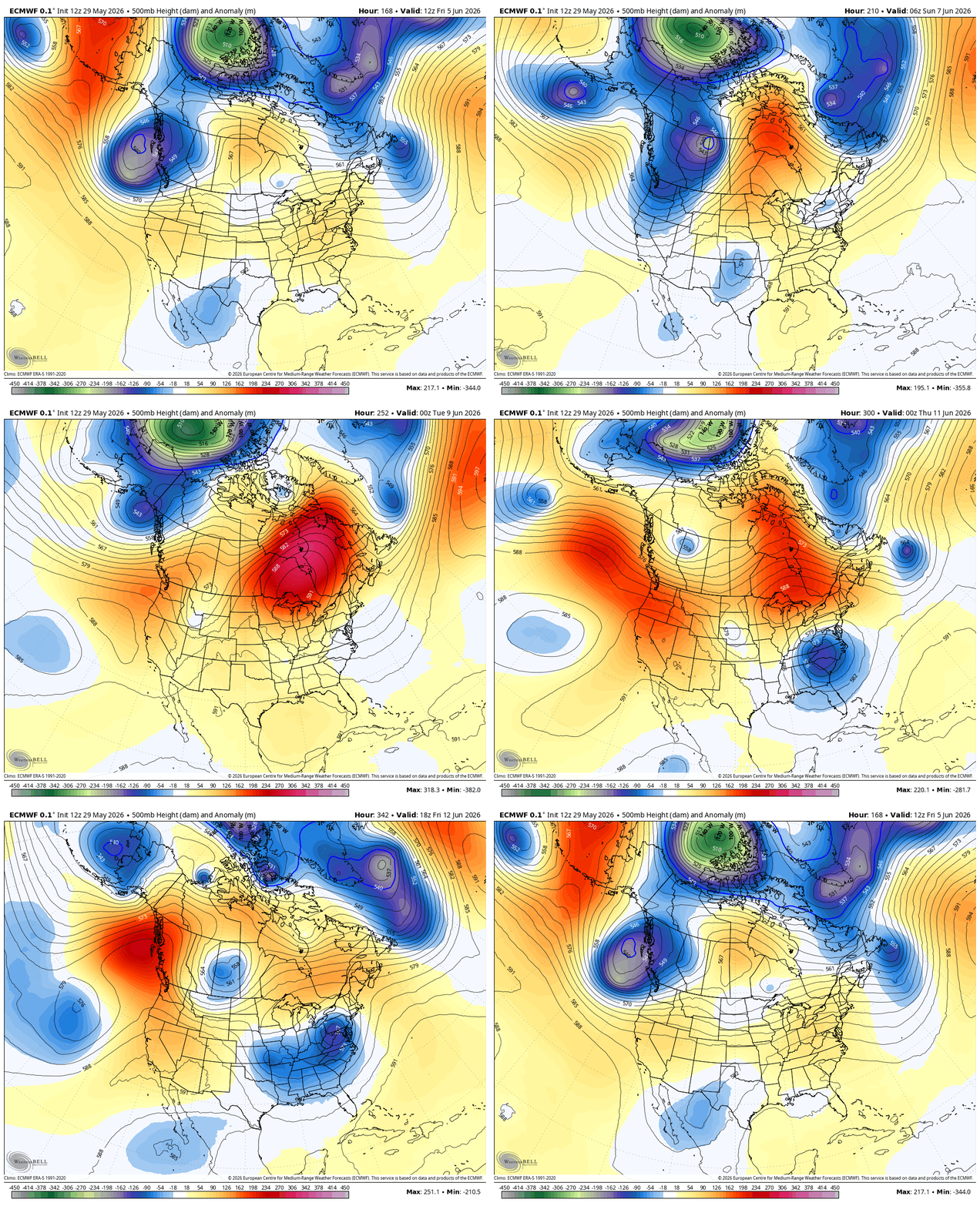
That would be a healthy upper low spinning across the east.
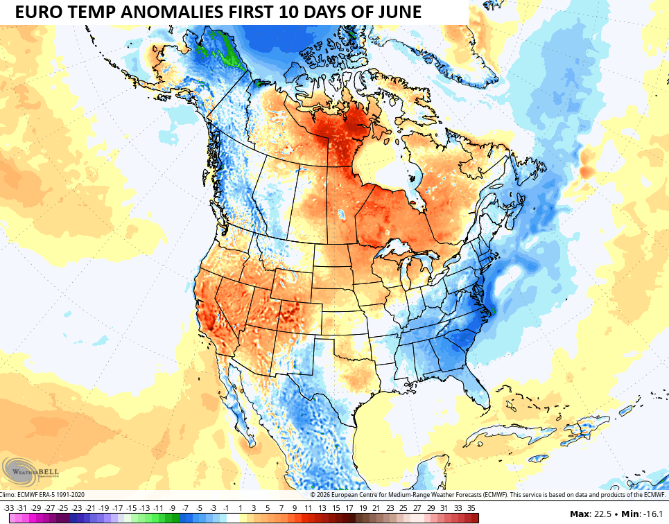
That same run shows a lot of below normal temps in the eastern half of the country for the first 10 days of June…
Until then, I leave you with your daily rain and storm tracking tools…




Current watches

Possible Watch Areas

Make it a sensational Saturday and take care

Summer is ready to lay the hammer down.
Thanks Chris. Looking like a nice start to Summer. Be patience Jeff, the real deal heat will be here soon enough.
We’re in the midst of a gorgeous stretch of weather here in the Chicago Metro Area. There hasn’t been any rain since last Sunday, with the next chance not until next Friday at the earliest. Daily highs have been in the 70s and low 80s, with sunny to partly cloudy skies, and several days featuring nice breezes from the NE off Lake Michigan.
Highs will be warming to the upper 80s for several days here beginning next Wednesday. We’ll be warmer than you guys in KY!
Having been to Chicago for work yesterday and Wednesday, I can confirm this.
I know you prefer it warmer, but nice you were able to experience our very comfortable late spring temps.
Mike, Good to see you back posting. After a very warm and dry April, the weather has turned around to a more normal pattern here in the lower midwest. I would be surprised if it continues through the month of June. I hope it turns warmer with highs ( 85 – 90 ) as we approach mid – July. I like the seasons to be what they should be.
It must be nice to have those cool Northeast breezes off of Lake Michigan to buffer the heat and humidity, until the wind comes out of the High Plains.
I will return to my Cancer / chemo treatments Monday, so I will not be posting for quite a while. I sure hope I make it through this awful period in my life. Doctor says my age ( 75 ) is against me. Hope Not !
Even though I’m about 40 miles SW of Lake Michigan, you can still feel the coolness of the NE winds off the Lake. Obviously, the closer you are to Lake Michigan, the cooler it is. Lake water temps are still only in the 50s.
Right now, it’s 77 degrees, but with the wind blowing from the NE around 15 MPH, it feels a few degrees cooler.
All the best to you and hope your treatments go well, Mr. Schroeder!