Good Sunday, everyone. It’s the final day of May and we’re wrapping things up on a mainly dry note with just a storm or two going up in the south. June starts with a quick-hitting round of storms for some as very pleasant air controls the start of Meteorological summer.
Temps today generally range from the mid 70s to low 80s depending on where you are. Skies will be partly sunny with a few storms going up across the south.
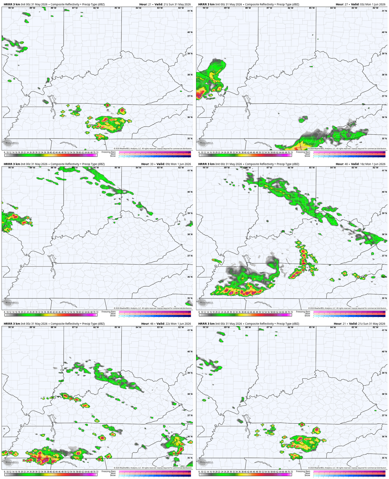
A better shot for scattered showers and storms rumbles in for Monday with the opportunity for a bigger cluster of storms impacting parts of western and southern Kentucky. Here’s the future radar from the HRRR starting this evening and running through Monday evening…
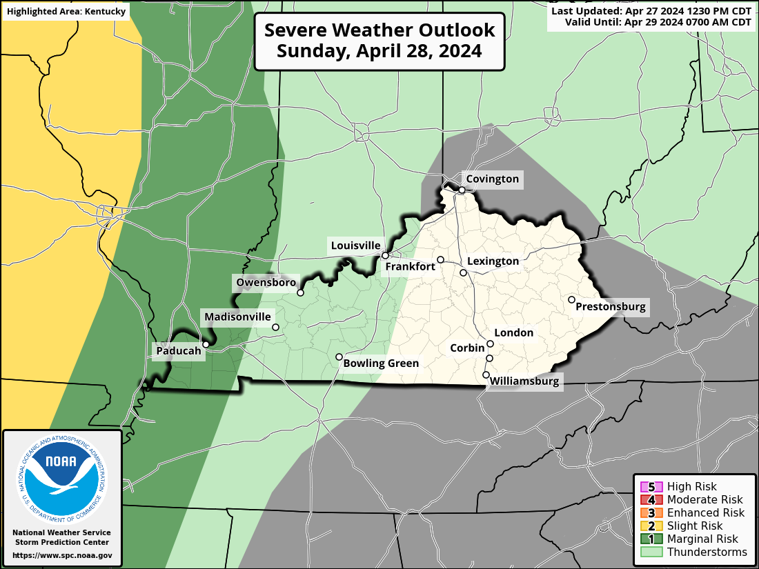
The risk for a few strong to severe storms is there in some of these same areas of the west and south. Here’s Monday’s Severe Weather Outlook from the Storm Prediction Center…
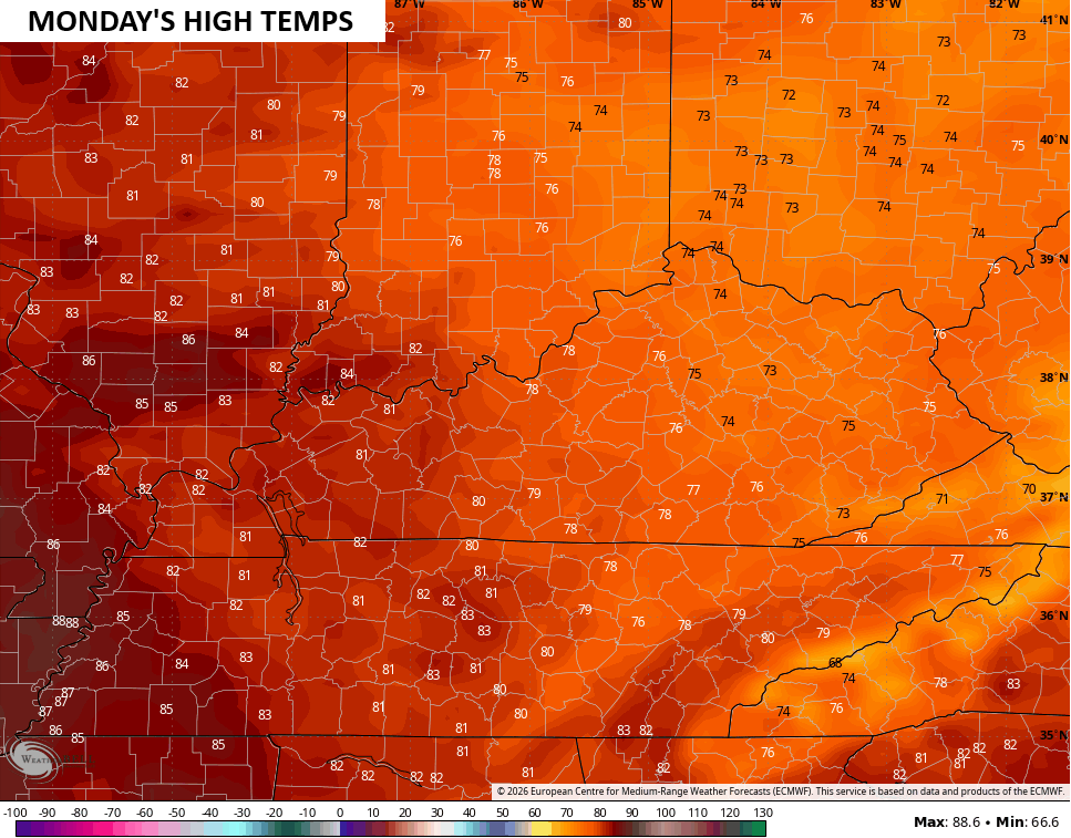
Highs Monday will be in the low 80s to the west with 70s for the central and east…
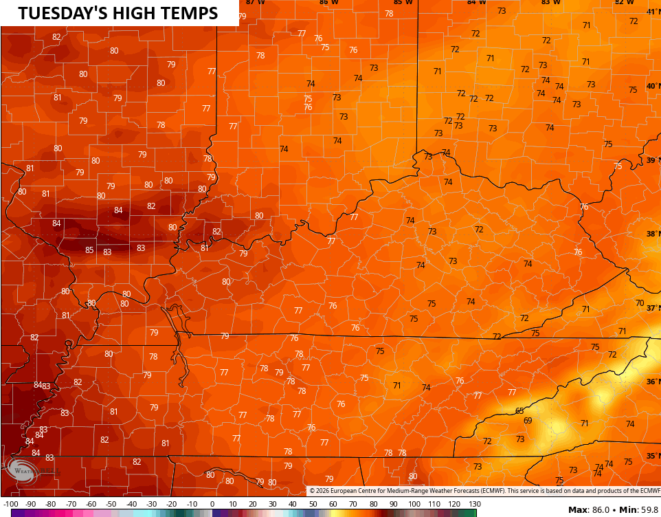
Highs for Tuesday and Wednesday may come down a few degrees for the entire region, making for some absolutely awesome days…
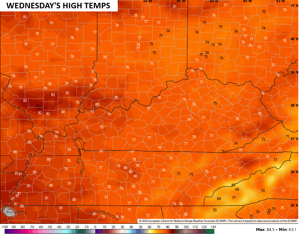
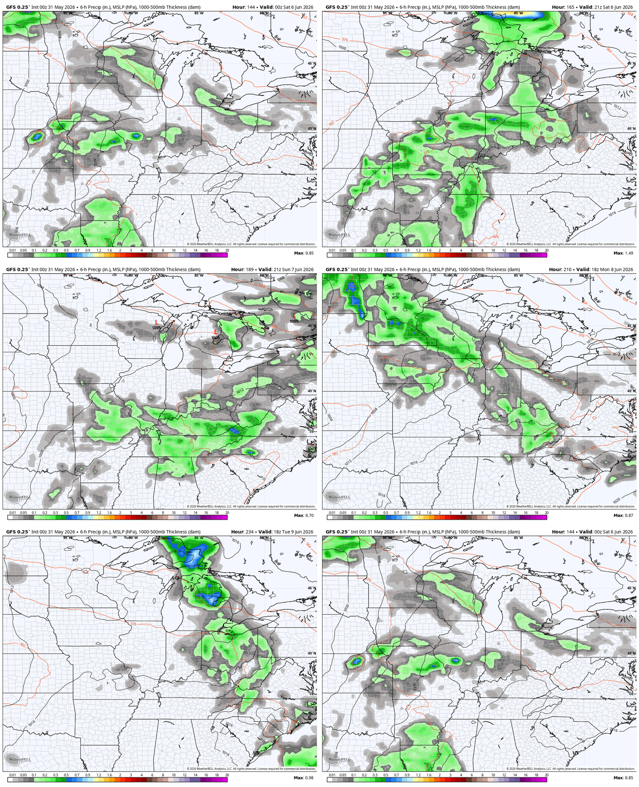
Temps surge back into the 80s by Thursday and Friday ahead of a setup likely to throw some decent clusters of storms at us next weekend into early the following week…
The pattern continues to look rather blocky through the middle of June with the models showing some pretty big run to run swings because of it. The latest run of the EURO goes with one of the deeper troughs you will ever see on a model forecast during the summer months…
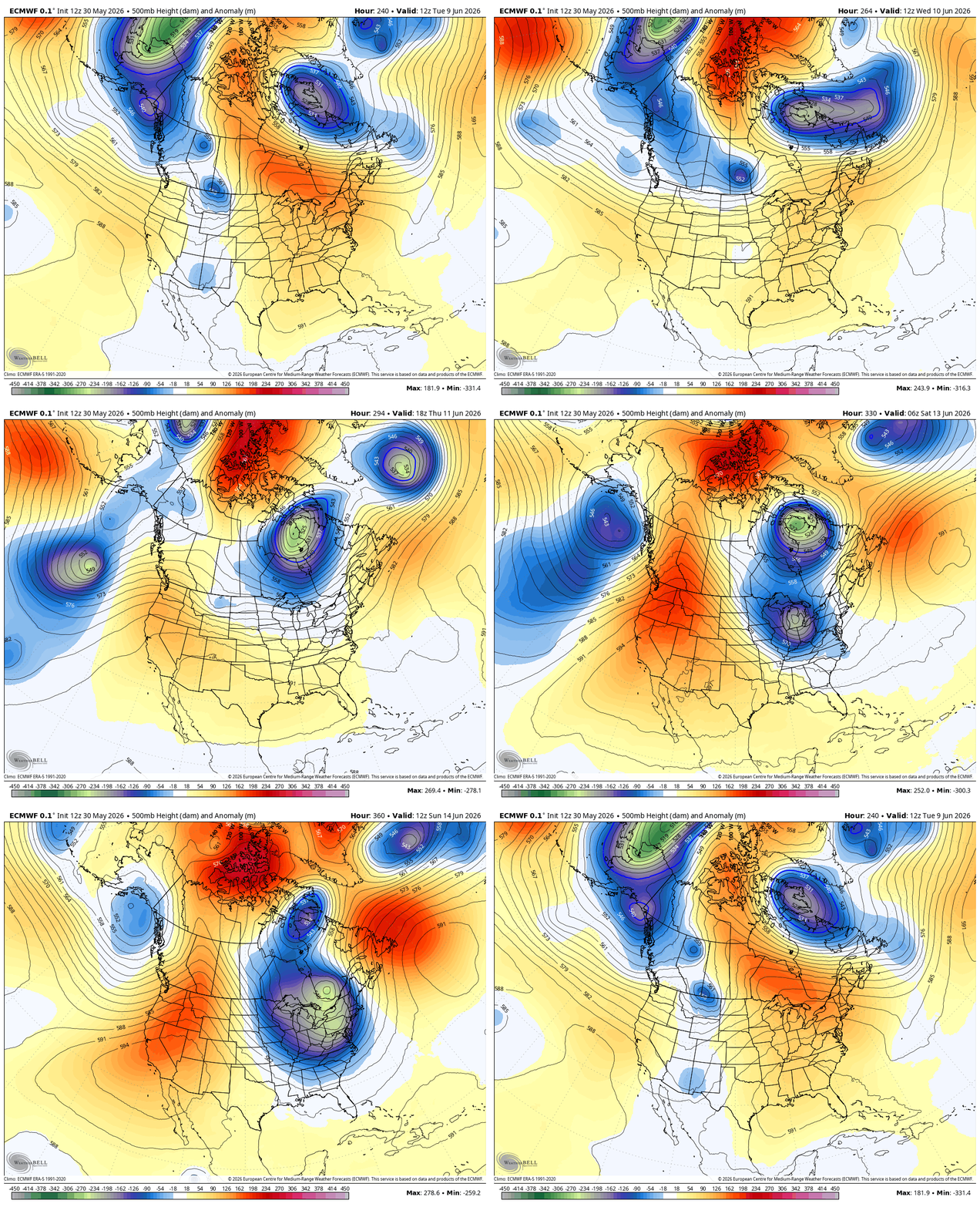
That’s still way out there so take it with a grain of salt, obviously. But, it’s an indication of the potential dips in the jet stream that can lead to a pretty active month of June in terms of storms across the country.
Just look at the rainfall forecast from the EURO for the next two weeks…
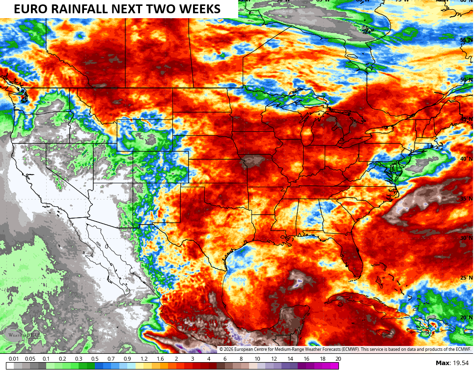
That’s a lot of the country showing some up with healthy rains.
The latest EURO Weeklies continue to indicate an above normal rainfall June…
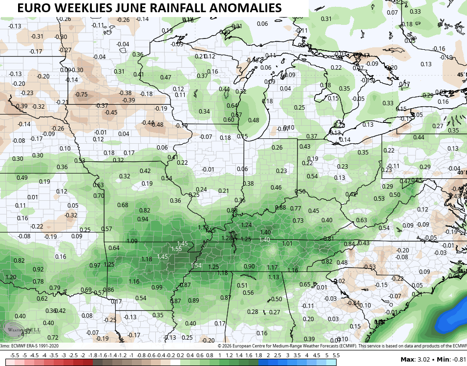
The same EURO Weeklies continue to indicate a slightly cooler than normal June…
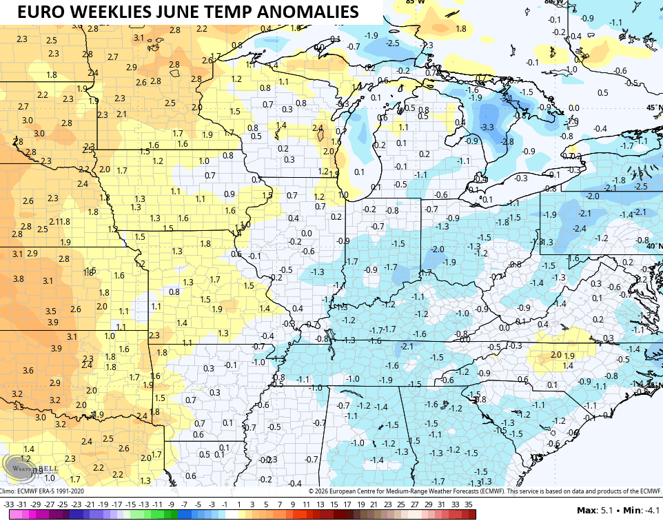
Both of those fit with what we would typically expect around here during a developing strong to super El Nino like the one that’s currently blossoming.
I leave you with your daily rain and storm tracking tools…




Current watches

Possible Watch Areas

Make it a sensational Sunday and take care

Yesterday I read a post the upcoming super El Nino will be a bit stronger than the previous record 1977-78 one. But it stated we will be in a warmer than colder upcoming winter. I disagree on that that 1977-78 one gave us one of the coldest and snowy winters on record. It was so cold the mighty Ohio River froze up you could walk on it . Those winters in the late 70’s were the most brutal ones in my lifetime.
I always take models with a grain of salt. 🙂