Good Monday and welcome to June. It’s the start of Meteorological Summer and things are beginning on a very pleasant temperature note with just the chance for a storm or two. A more typical June air mass moves in later this week, setting the stage for a stormy pattern.
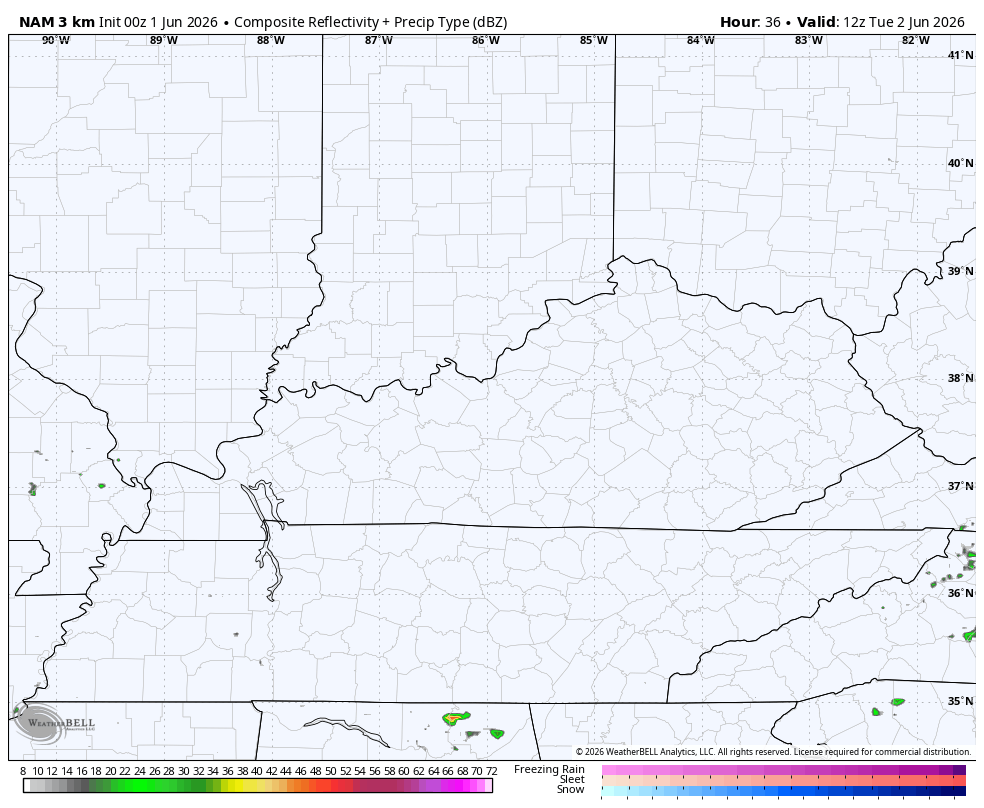
Let us, as always, begin with today. Highs range from the upper 70s to low 80s across the state. A boundary is sliding through and is touching off isolated showers and storms for many with a greater storm concentration in the west.
That’s where we have to be on guard for a line of storms racing in from northwest to southeast and some of these may be strong or severe. This continues to be the area being highlighted by the Storm Prediction Center in today’s Severe Weather Outlook…

Pleasant temps in the 70s for highs take over Tuesday into Wednesday with mainly dry skies. I say “mainly dry” because there’s a small little upper level system moving across the southern Appalachian Mountains late Tuesday. This may bring an against the grain shower or storm into eastern Kentucky.
Watch how this isolated stuff spins in from the east into the eastern half of the state…
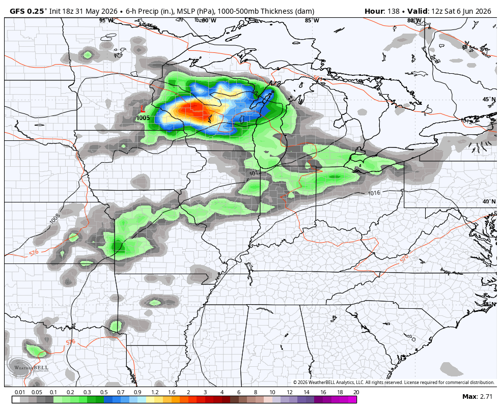
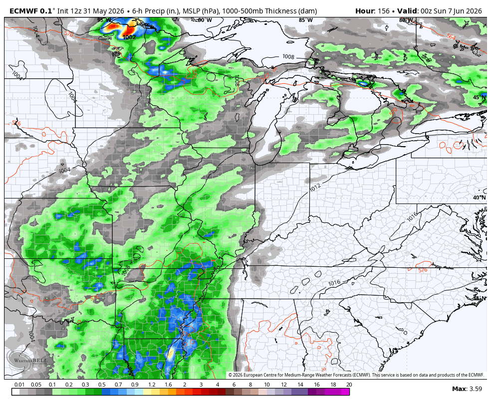
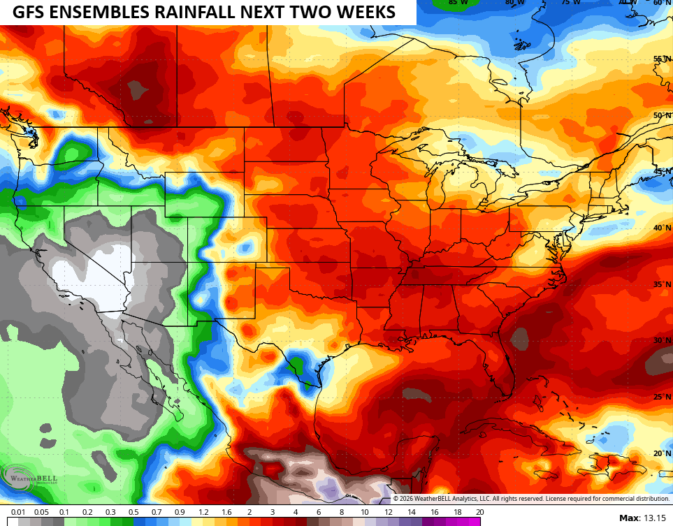
Pleasant temps hang tough through the end of the week as the numbers climb into the 80s. Seasonable warmth then takes over this weekend, but it comes with a price as rounds of showers and storms kick in. That look continues into next week and the models are in decent agreement on this.
Here’s the GFS…
And the EURO…
This stormy setup is also showing up on the Ensembles…
I leave you with your daily rain and storm tracking tools…


Current watches

Possible Watch Areas

Make it a magnificent Monday and take care

We’ll see