Good Saturday, everyone. The weather pattern taking shape for the next few weeks isn’t one very typical for this time of year. Well below normal temperatures and above normal rains look to be the rule for much of this region.
Let’s begin with today and hit the fast forward button.
Temps start in the upper 50s to low 60s this morning with the pleasant air hanging through the afternoon highs in the low and mid 80s.
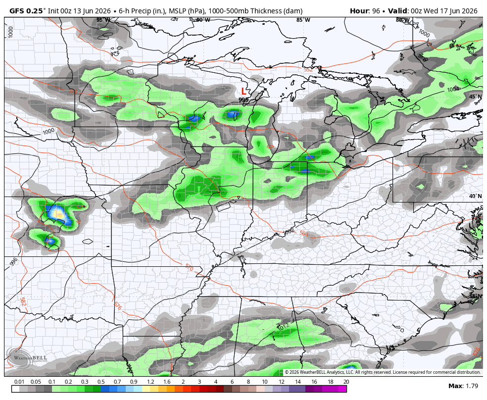
A stout cold front is rumbling across the Mississippi River Valley today, bringing widespread rain and storms to our west. Some of this action sneaks into western Kentucky this evening with the bulk of the state getting in on some storms later tonight and Sunday.
Just like in previous days, the best chance for strong to severe storms is to our west with a smaller risk extending into western Kentucky today. Here’s the Severe Weather Outlook from the Storm Prediction Center…

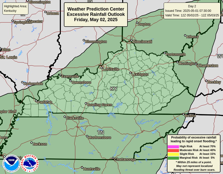
These storms will also be efficient rainmakers and may cause pockets of flash flooding in the west. The Weather Prediction Center is highlighting this chance with today’s Excessive Rainfall Outlook…
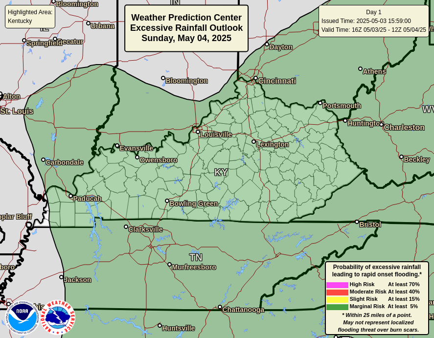
The threat for excessive rains moves east later tonight and Sunday and the overall threat likely lowers…
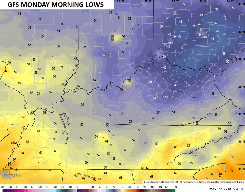
Once the Sunday front moves through, the weather is straight out of September for the week ahead. Highs Monday and Tuesday are in the 70s with lows that can drop deep into the 50s…
With an overall trough in the mean getting established across the eastern half of the country, several additional potent cold fronts will likely sweep through here. This animation from the EURO starts Tuesday night and goes through the 22nd and highlights the potential for some big storms…
The GFS during the same time is even stormier…
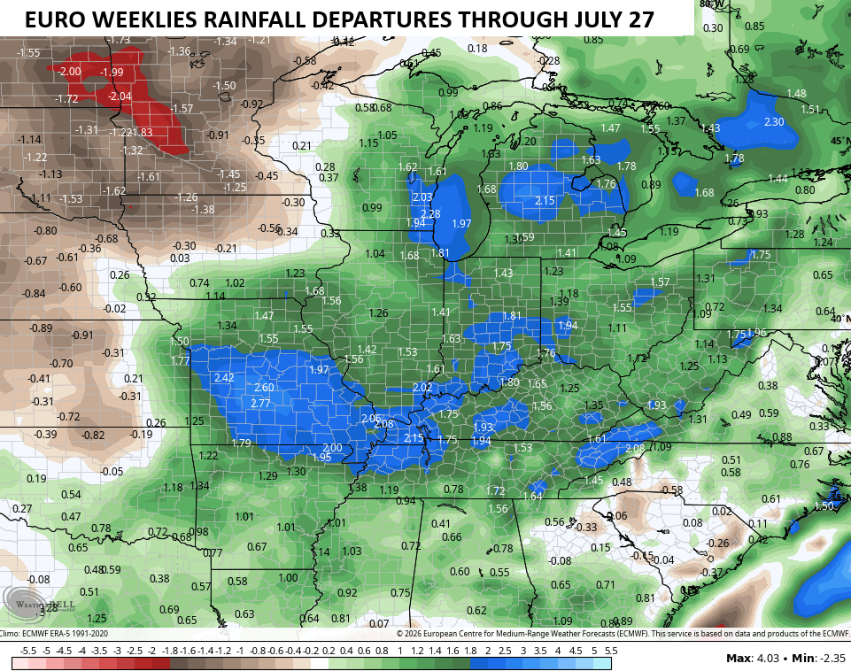
While not all of Kentucky has picked up a ton of rain over the past few weeks, it’s easy to tell that the overall dry pattern from the spring has flipped around for our entire region. This looks to continue through much of the summer months and the latest EURO Weeklies keep beating the drum about above normal rains through most of July…
It’s also growing cooler by the run as it’s just beginning to grasp the cool blast for the week ahead…
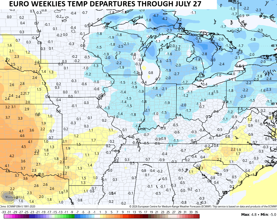
Of course, this does not mean you won’t see some steamy days because we all know we will. This is just showing average departures for a roughly 6-week period.
As always, I leave you with your daily heavy rain and storm tracking tools…


Current watches

Possible Watch Areas

Make it a sensational Saturday and take care.

The forecasted highs are maybe 5° below average. Not really “well below normal” nor a cool blast. More comfortable, sure.
Thanks Chris. It’s beginning to look like the cooler, wetter Summer weather may happen, due to the influence of the Oceanic El Nino. Just learned that some impact will occur, but it will be reduced due to the long ongoing negative PDO. It’s going to be very interesting how this Fall and Winter will turn out, if the AO and the NAO become strongly negative, with the El Nino climate prevailing. Could be great if you are a Snow lover.
The Climate Prediction Center is upping their confidence levels regarding the likelihood of a Super El Nino event for the balance of this year, into 2027. They are now stating that there is a 63% chance of a very strong El Niño during November-January that would rank among the largest El Niño events in the historical record, going back to 1950. We are already seeing its effects with a strengthening of the west to east trade winds, and the latest Sea Surface Temperature Anomaly chart show a significant warming across the entire Pacific, especially in the east, with temperatures rising in subsurface levels.
https://www.ospo.noaa.gov/products/ocean/sst/anomaly/
Thanks Joe, I also notice that warmer waters on the SST map link you sent is beginning to invade the coastal areas. It will be exciting to see how all this unfolds.
I’m expecting a pattern flip in early July with some big time heat hitting the country. West of the Mississippi will get the worst of it, especially the west coast from Baja into Canada, which could lead to another severe wildfire season, with smoke-filled skies for us, once again. Our temps should average above normal, but probably on the fringe of the worst heat. Topical activity in the Gulf could send some moisture our way, but the Atlantic hurricane season will be far below normal.
Joe, I’m still concerned about what may happen in the Gulf of America / Mexico. We still have a La Nina climate ( negative PDO. ) With El Nino’s weak impact anything could happen. I don’t ever remember seeing this scenario before. I’m going to predict at least one major Hurricane that may hit somewhere along the Gulf Coast. Hope my prediction is wrong.
Here are the links to the summaries of the destructive severe weather the Chicago Metro Area saw on Wednesday and Thursday:
https://weather.gov/lot/2026_06_10_Derecho
https://weather.gov/lot/2026_06_11_SevereWeather
There have been at least seven confirmed reports of tornadoes from Thursday in the NWS Chicago County Warning Area, ranging from EF-0 to EF-3.
Thanks for the links Mike. That large tornado looks to be an F-5 in Rdk, Il. No news here on the tornadoes in your area. Hope there wasn’t any fatalities.
This could be happening ” El Nino Modoki. ” Which is warming concentrated near the central Pacific while other parts of the Pacific may be cooler than average. Just a thought I had.