Good Saturday and welcome to the weekend. Rounds of showers and storms were common across the region on Friday and we have a few more to rumble through this weekend. This is ahead of a front dropping in ahead of a more prominent cold front arriving Tuesday.
Temps out there today will range from the mid 80s to low 90s depending on where you are. Scattered showers and storms will be noted as well, especially across central and eastern Kentucky. These storms will produce hit and run heavy rains.
A broken line of storms then drops in late this evening into the overnight hours, bringing the low-end potential for a few strong to severe storms. The greatest severe risk is to our north and northeast and this shows up well on today’s Severe Weather Outlook from the Storm Prediction Center…

This line will be losing steam as it crosses the Ohio River tonight but may refire a bit across far southern Kentucky later Sunday. The future radar from the HRRR looks like this through Sunday evening…
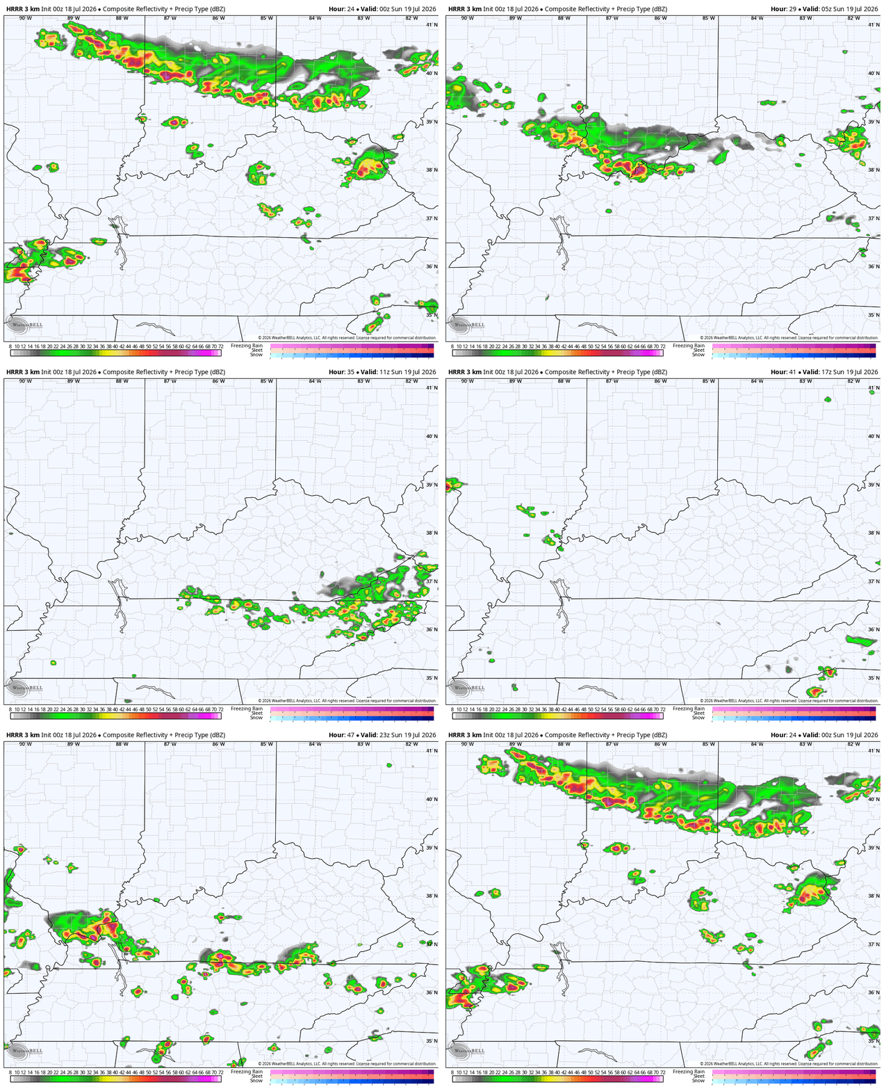
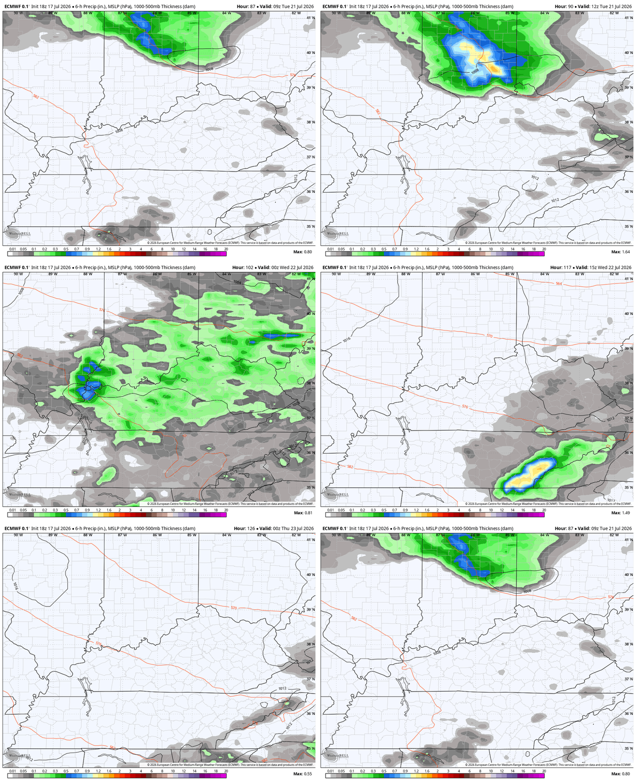
A better brand of air comes in behind that line with Sunday feeling pretty decent for this time of year. Temps should surge back to steamy range later Monday and Tuesday ahead of the next front that drops in here later Tuesday and Tuesday night. Some strong storms are possible along and ahead of this…
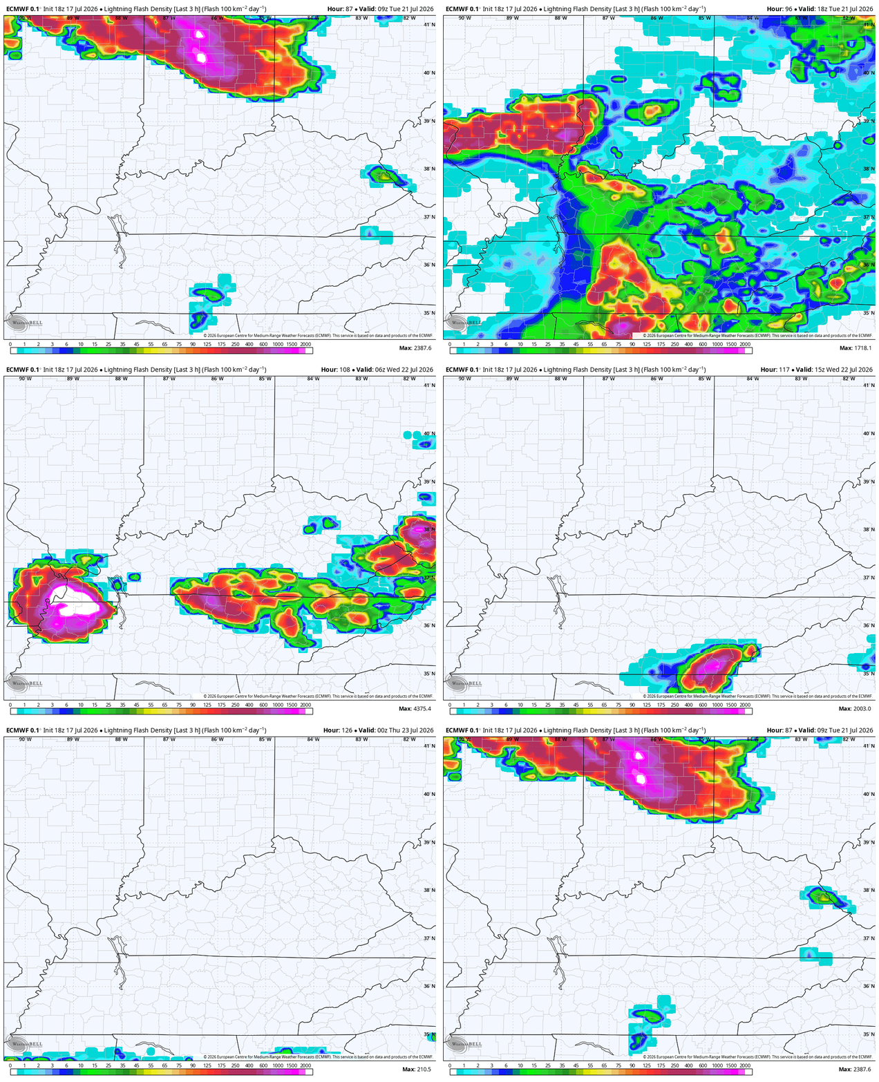
Here’s the lightning tracker from this same time…
This unleashes a September blast of air starting Wednesday running through next weekend. Below normal temps show up in pretty dramatic fashion on this animation from Tuesday night through next Saturday…
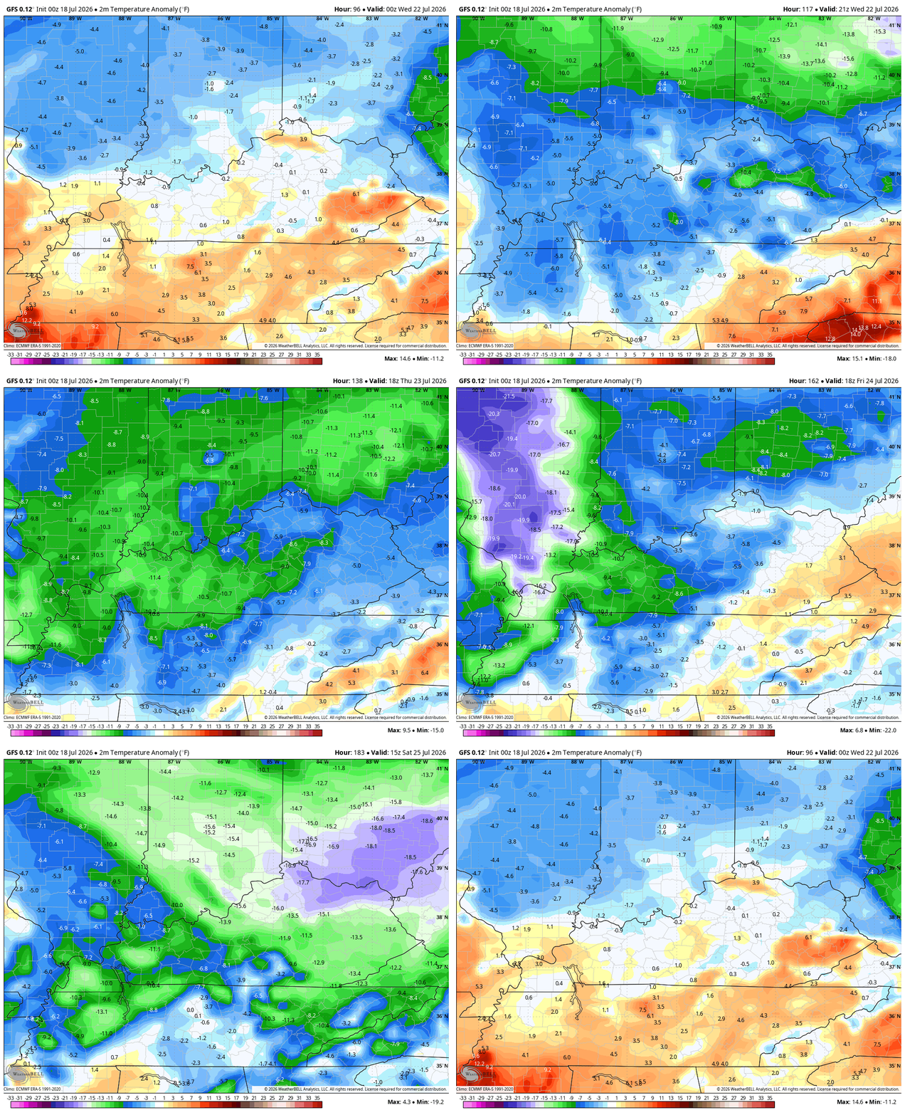
Highs in the upper 70s to low 80s should be common with a few mornings with lows reaching deep into the 50s.
As always, I leave you with your daily storm tracking toys…




Current watches

Possible Watch Areas

Make it a great Saturday and take care.

Thanks Chris. Late yesterday, we had an intense thunderstorm. Lots of vivid cloud to ground lightning, along with loud thunder, and very heavy rains. Haven’t been out to read my rain gauge, but guessing about an inch. Looking forward to the cooler temperature mid week.
Adding to the above, dump out 2 inches from my rain gauge. Soil moisture very good going into the usual dry month of August.
Thanks, Chris.
Are able to provide a forecast of the Canadian smoke for our region?
Looks like the smoke from the Canadian forest fires won’t have any major effect on KY at all, like it has in the Upper Midwest and Great Lakes region the last several days.
The tap is about to shut off. Bring on upper 90s! 🙂
No Way Jose !
I don’t think the temperatures next week will be as much below normal as the GFS suggests. It’s still going to be at least 80 degrees – maybe even a few degrees higher – every day next week here in the Chicago Metro Area. Normal high for this time of year is 85.
I’m ready for early Fall high temperatures in the 70’s and lows in the lower 50’s. Sick of Summer !
I like the idea of low 50s for Summer mornings.
Jeff, that’s the climate of Phoenix, Az.
I was wrong on the temperatures in Phoenix, Az. The highs in July are 100 degrees plus. Lows are in the 80’s. No thanks.
Schroeder, I recently saw a video of Marcia Yockey doing the weather forecast in her bathing suit in July, beside poolside, don’t know what year it was but at the time the whole country was blazing in a heat wave. Now a days some people think when gets hot in the summer act like it’s about warmer climate.
I remember as I saw her live, that was a weather cast that she made back in the 1960’s. I never heard her saying anything that the climate is changing. Let me tell you that there is NO CLIMATE CHANGE, and I’m getting tired of hearing this political crap.
Our climate IS undergoing change, and I have a big problem with it being politicized. We’ve blown opportunities galore to minimize humanity’s contribution.