Good Sunday, everyone. The first of two cold fronts is crossing the region today bringing a few more storms with it. The next front arrives later Tuesday with a round of severe storms with a surge of September coming in behind it.
Today’s storms will mainly fire up across the southern half of the state and could put down some locally heavy rains again. Pockets of flash flooding will be possible. Temps won’t be as steamy as the past several days and may even feel pretty good for most.
A storm or two will be with us again on Monday with temps back into the 85-90 degree range.
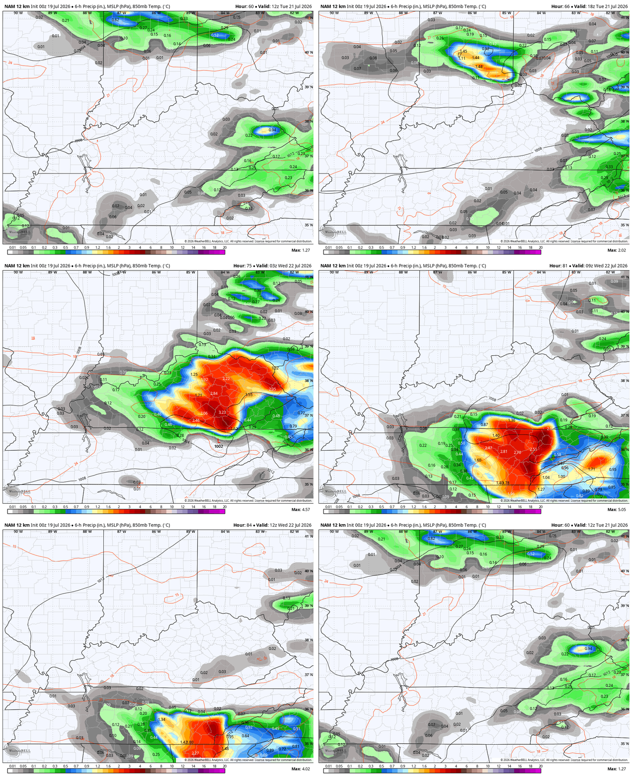
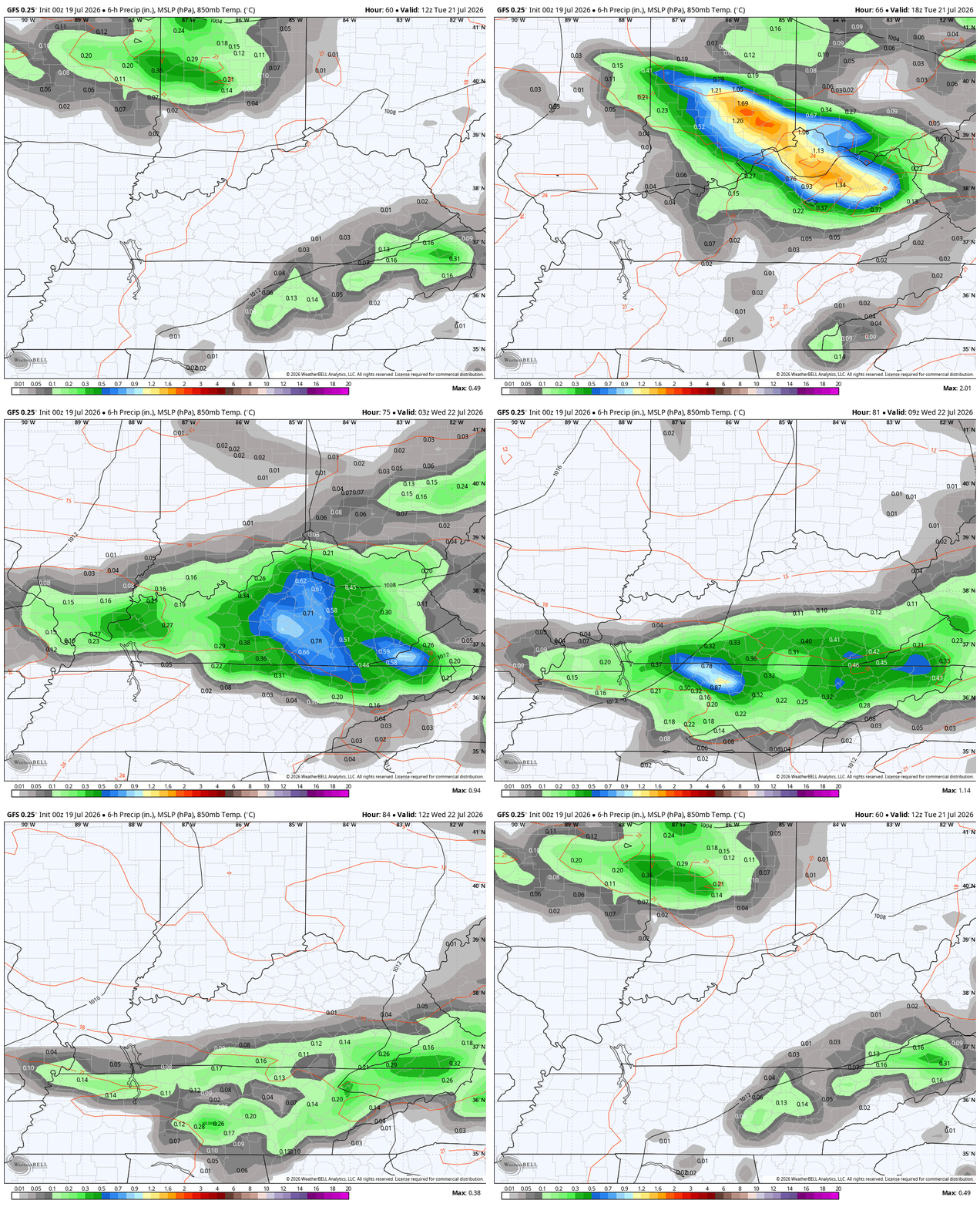
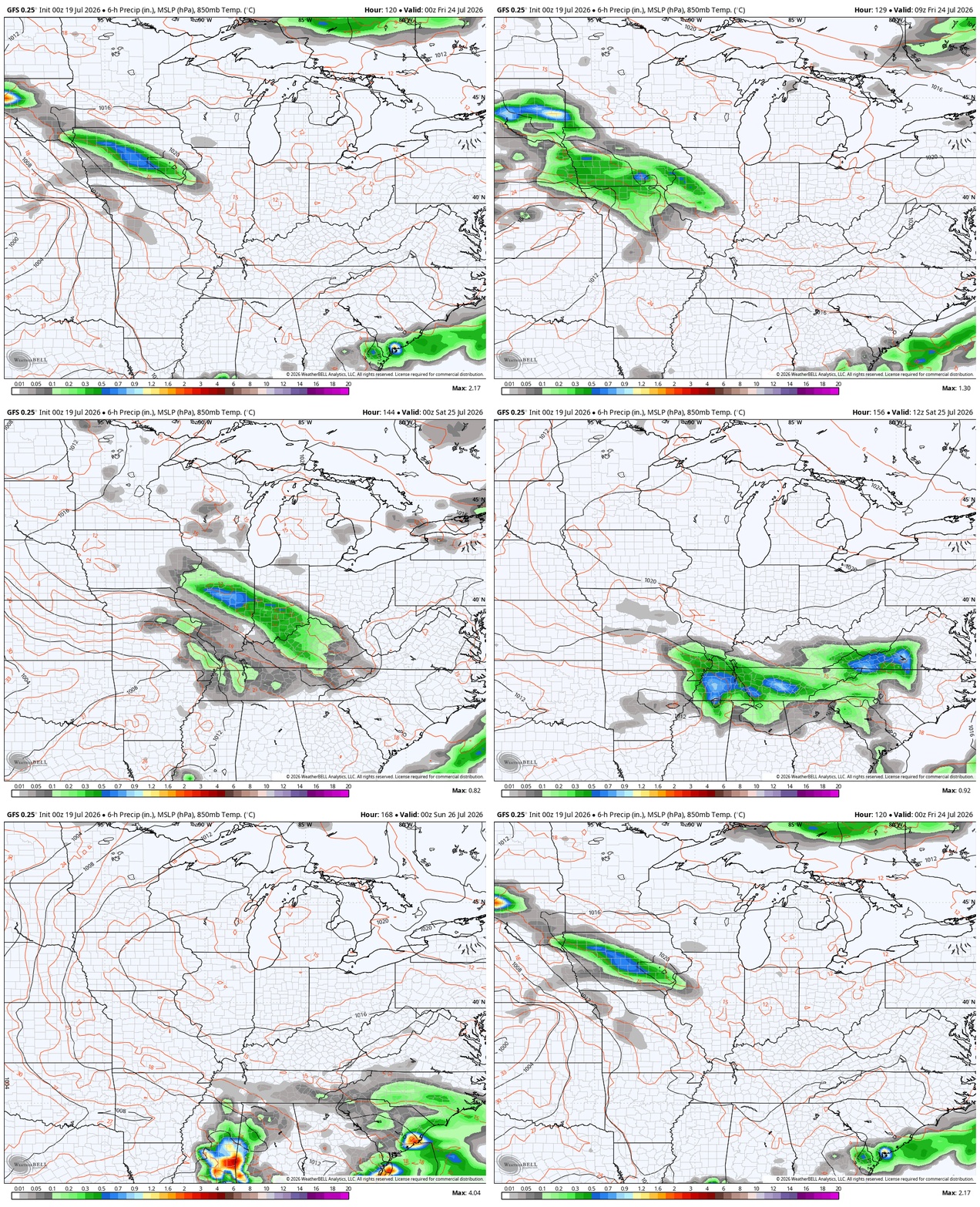
Strong to severe storms are a good bet with the front dropping in here Tuesday and Tuesday night and the models are in pretty good agreement on this potential…
NAM
GFS
The Storm Prediction Center is already putting the severe weather bullseye on top of us during this time…

Flash flooding may also become an issue with these storms, especially if we can get some training going.
Much cooler than normal air surges in behind this front for the middle and end of the week. This means high temps from the upper 70s to low 80s with lows that can reach deep into the 50s for a few mornings…
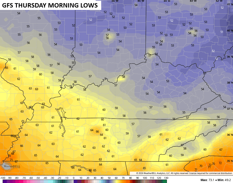
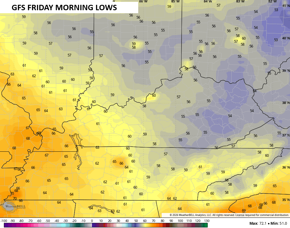
Lows like that are more normal for the second half of July and could put a few locations in the ballpark of record lows, especially Thursday night.
Another northwest flow type of a system may drop in with some showers and storms later Friday into Saturday…
With a September looking pattern taking shape, I guess it’s appropriate we have a potential tropical system to track down in the northern Gulf…

The National Hurricane Center is monitoring this for possible development…

As always, I leave you with your daily storm tracking toys…




Current watches

Possible Watch Areas

Make it a great Sunday and take care.

“Much cooler than normal” is way overblown.
I hope the cooler than normal pans out, but that’s just me. I’ll bet there are plenty of hot and humid days down the road.
Yesterday evening, we had one of the heaviest downpours in recent memory at my location south of Bowling Green. During the first 10 minutes, my PWS recorded 1.05 inches of rain, with a rainfall rate indicated of 4.94 inches per hour. That disturbance in the Gulf of Mexico has a real chance for future development. Both shear and vorticity maps favor development, and the Sea Surface Temperatures in the area are averaging 85°F.
Speaking of SSTs, the following graph shows why the current El Nino could reach unprecedented heights.
https://climatereanalyzer.org/clim/sst_daily/?dm_id=nino3.4
An explanation of what is displayed on the graph link from my previous post:
The red line on the graph shows Sea Surface Temperatures for 2026 in the Nino 3.4 area, and preliminary data for the current years are displayed as dots. The gray lines display values from 1982 through 2025.
Very interesting Joe. Thanks for sharing.
Latest from the Climate Impact Company on the Tropical Storm Bertha : )
https://climateimpactcompany.com/u-s-sunday-report-hotter-but-not-east-wet-southwest-gulf-states-and-east-coast-second-tropical-storm-ahead-this-week-turns-westward-on-gulf-coast-3/
yesterday AC went out… 🙁 I was waiting for it honestly… why? because in January, I said to myself, this July, in the MIDDLE of the month it’s going to go out. Watch…. and viola!
I think, I HOPE it’s the capacitor as it’s been six years or more since the last one… right now using a small window AC in my bedroom. I had it unboxed for like 4 years for just this issue… and I gotta say, I wish I could leave it in ALL of the time but the HOA doesn’t allow it only for emergencies.