Good Tuesday to one and all. Severe thunderstorms are likely across many areas of the region today as a September cold front drops in. This abrupt change of the seasons will also bring the possibility of flash flooding across central and eastern Kentucky.
With a lot of typical July steam along and ahead of the front, the September temps surging in behind the front spells trouble.
Here’s an updated breakdown on how things may play out today:
- Rounds of strong to severe storms develop just to the north of the Ohio River early this morning.
- The leading line dives into northern Kentucky by early afternoon then impacts central and eastern Kentucky during the afternoon and evening.
- This line should slow down with the overall forward speed, allowing for the back edge of the line to develop farther west across Kentucky.
- Damaging winds and a few tornadoes will be possible.
- The potential is there for a few wind gusts to approach hurricane force in isolated cases.
- This also has the look of a potential significant flash flood maker for some areas of central and eastern Kentucky.
- The exact locations won’t be known until we see where the storms decide to slow down and, potentially, train over the same areas.
- Much of the severe threat diminishes from north to south during the evening hours.
The Storm Prediction Center continues with a Enhanced Risk and Slight Risk for severe storms across most of the region…

Here’s a look at the area with the greatest risk for a tornado or two to spin up…
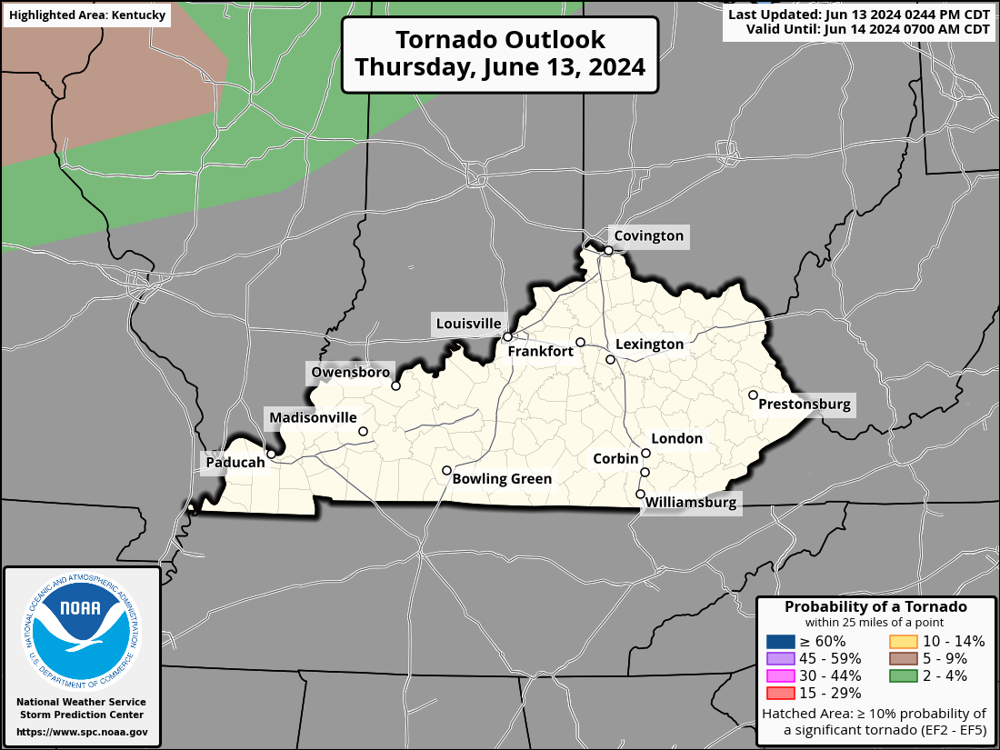
The damaging wind threat is by far the biggest threat of the day…

Areas of large hail will also be possible, but the threat is lower…

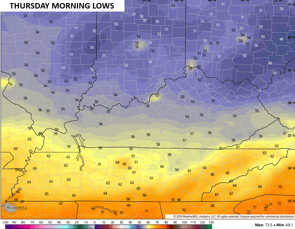
Awesome are flows in behind this boundary on Wednesday as linger showers end early on. Highs Wednesday through Friday are generally in the upper 70s to low 80s. Overnight lows hit the 50s as early as Wednesday night and Thursday morning…
Another system then drops in with the chance for a shower or storm late Friday into Saturday. That’s ahead of another cold front that drops in early next week…
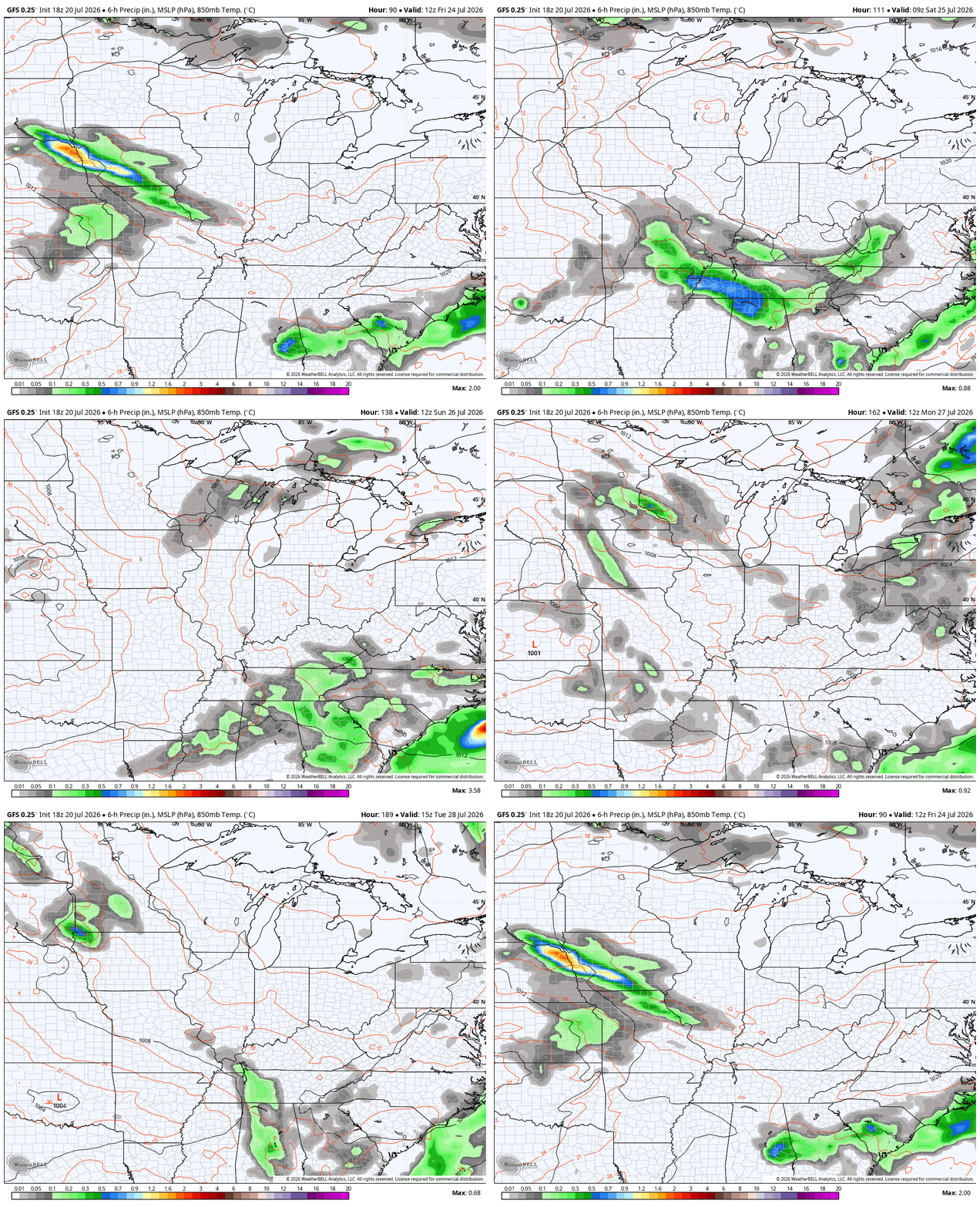
This is in response to another blast of September air coming from a deep trough diving back in to close out July and begin August. Here’s the GFS…
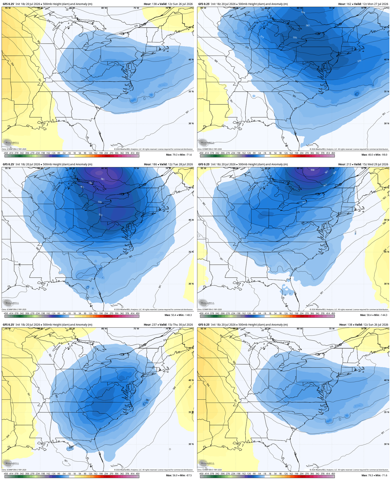
And the EURO…
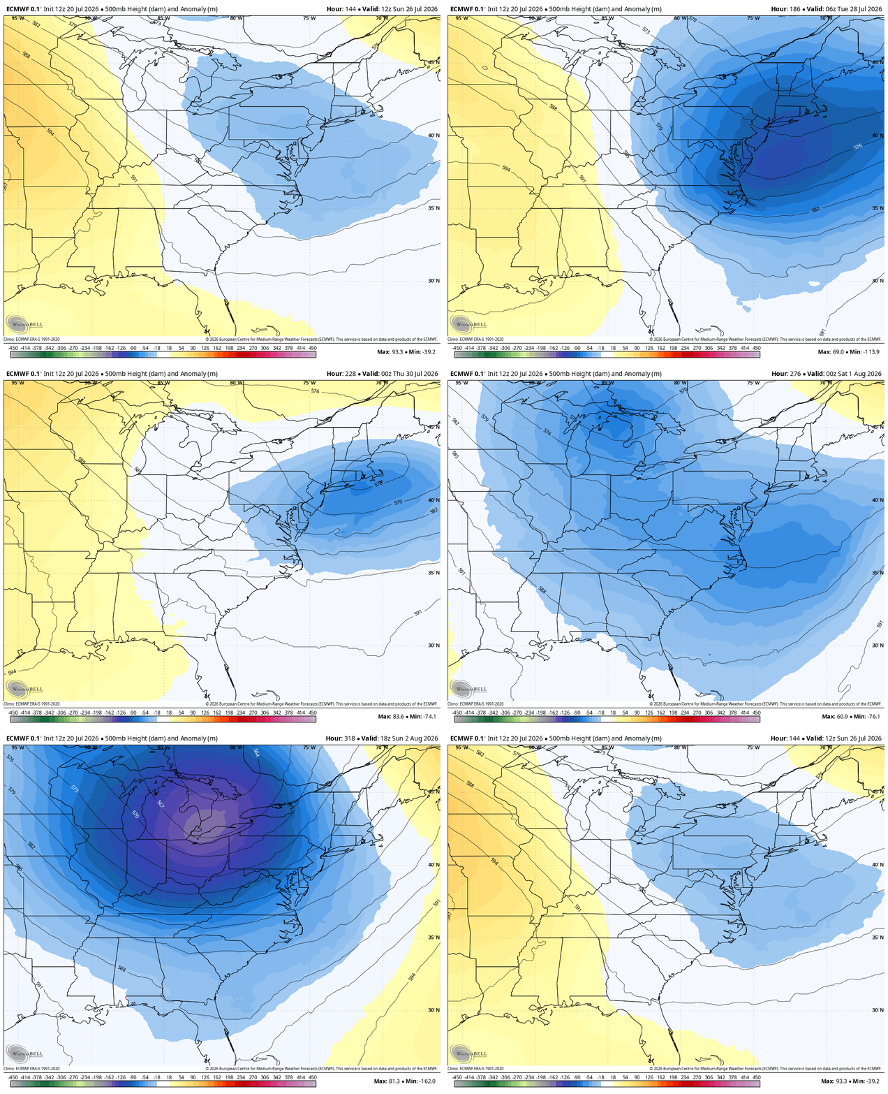
As we talked about in the last few posts, it’s appropriate this September looking pattern is spitting out a tropical system in the northern Gulf. Bertha is rolling toward the west…


I’ll have coverage on WKYT-TV and WKYT+ throughout the day. As always, I leave you with your daily storm tracking toys…




Current watches

Possible Watch Areas

Make it a great Tuesday and take care.

Thanks Chris. The American model and the European model are in agreement as to how far south the troughs will go. This is significant in determining what the long range forecast For Fall And Winter.
Hoping the severe weather doesn’t have the predicted winds and tornadoes. Flash flooding in some areas is not what we want to happen.
Tropical Storm Bertha on the satellite looks to be forming an eye wall ?
We didn’t have any severe weather, just a good soaking rain here in Taylor County. Just to my North, I heard there were tornadoes that touchdown, and cause much damage. I hope and pray that everyone is Okay.
Only a heavy shower and a bit gusty in Richmond. At least it saved me from having to water my plants! LOL
The latest update from the Storm Prediction Center is out, and I’m really surprised that the enhanced area hasn’t been pushed further west. Chances are good that we could see significant instability in that area, especially during the mid afternoon hours.
It’s obvious in southern Ohio (Gallipolis) that the low level jet is really energetic this morning. Clouds moving at a very rapid pace right above head.
It’s overblown to call this a “blast of September air”.
I hope we get barely a drop out of this.