Good Friday, folks. We are rolling into the final weekend of July with the weather continuing to look and feel more like September. Some changes will show up this weekend and early next week as storm chances creep back in along with more typical late July temps.
Temps range from the mid 50s to low 60s to start the day with afternoon highs back into the upper 70s and low 80s. We will see a little more in the way of clouds out there and these clouds may spit out a shower or storm.
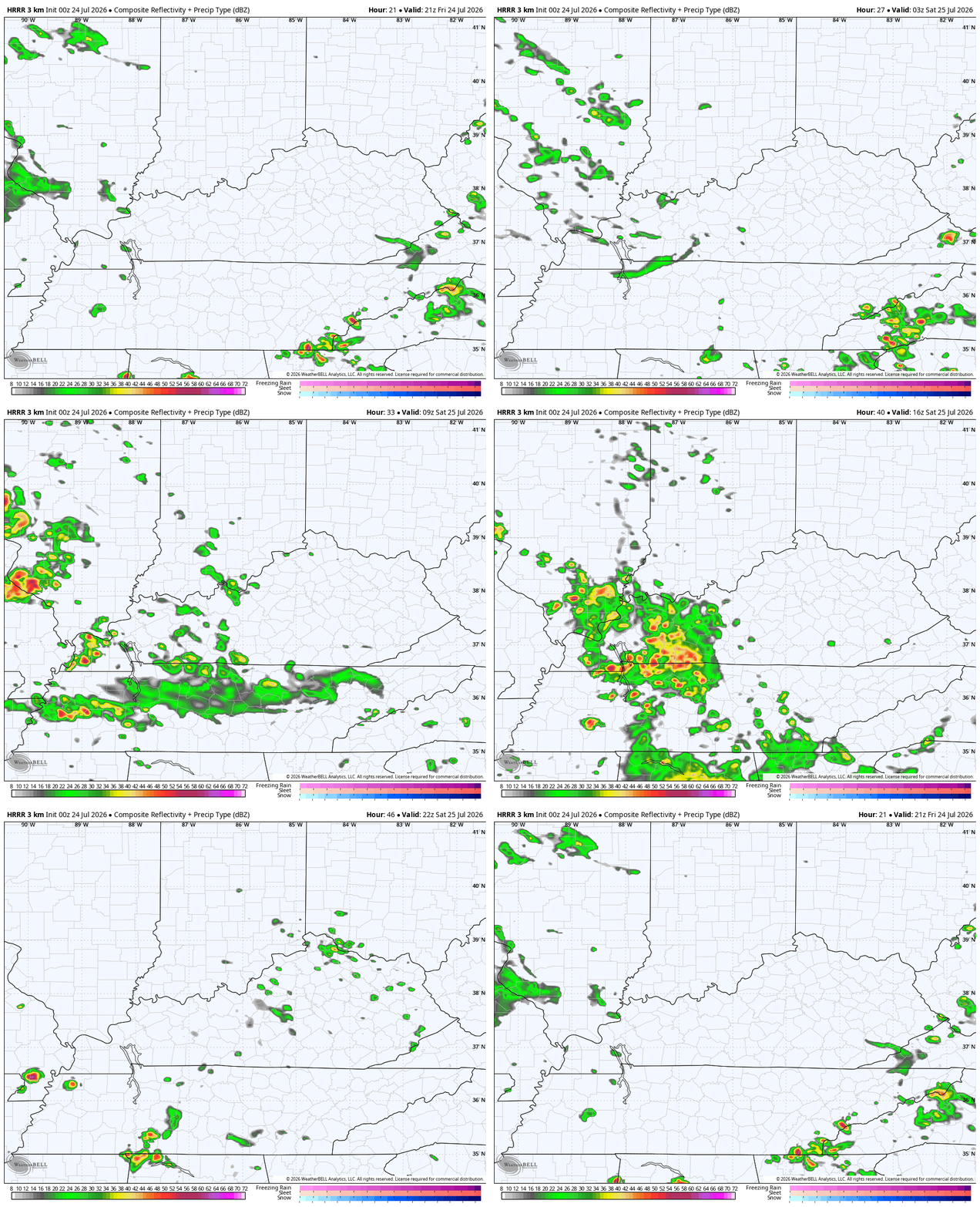
A better shot for a scattered storm will be with us on Saturday. This animation shows the potential from this afternoon through Saturday evening…
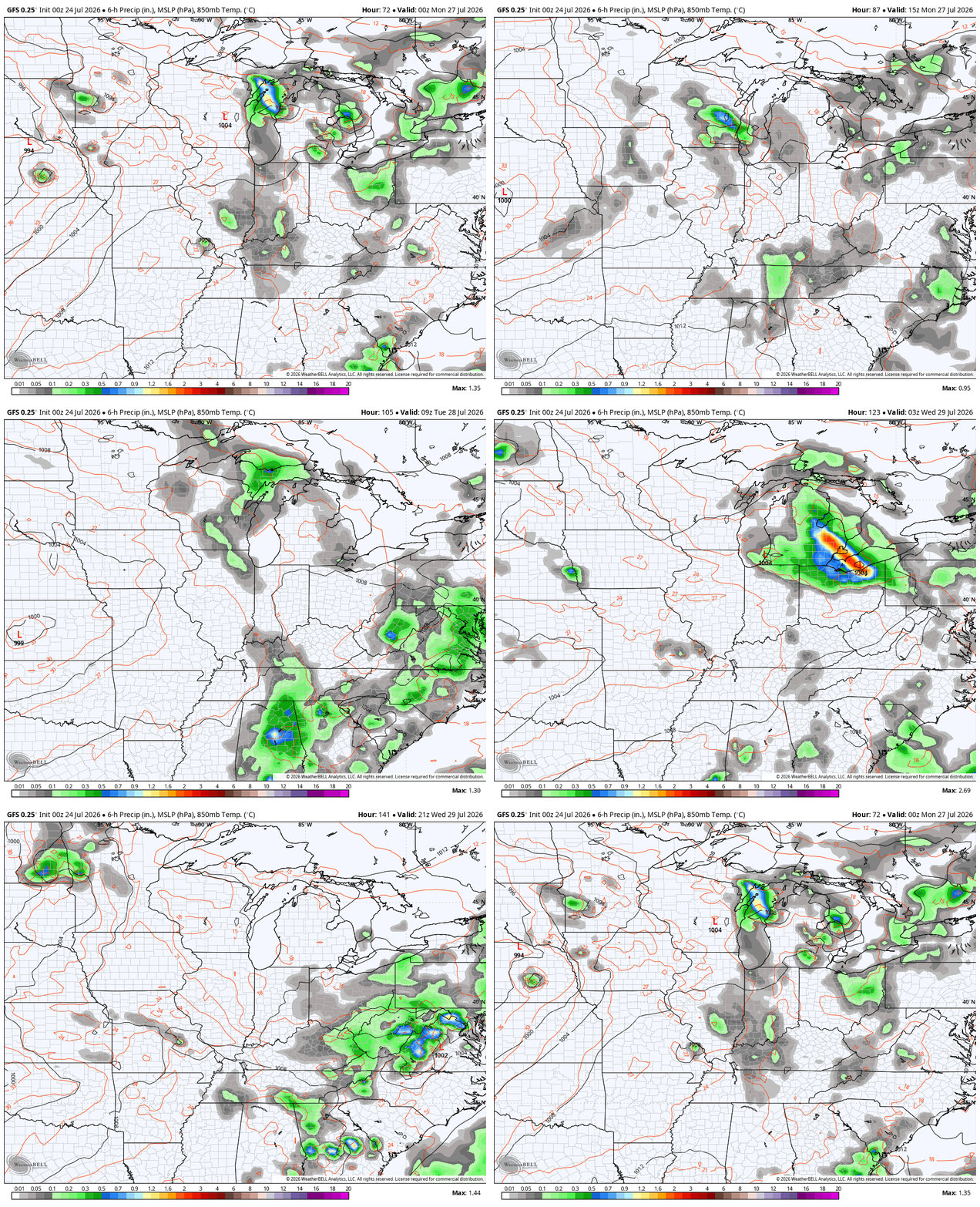
Heat builds across the Plains by the weekend and makes a run at us, but it likely gets cut off at the pass by clusters of storms dropping in from the north and northwest. This action starts as early as Sunday night with a better chance for some strong storm clusters Monday and Tuesday. More storms would then follow by Wednesday as a cold front drops in.
Here’s the GFS from Sunday night through Wednesday…
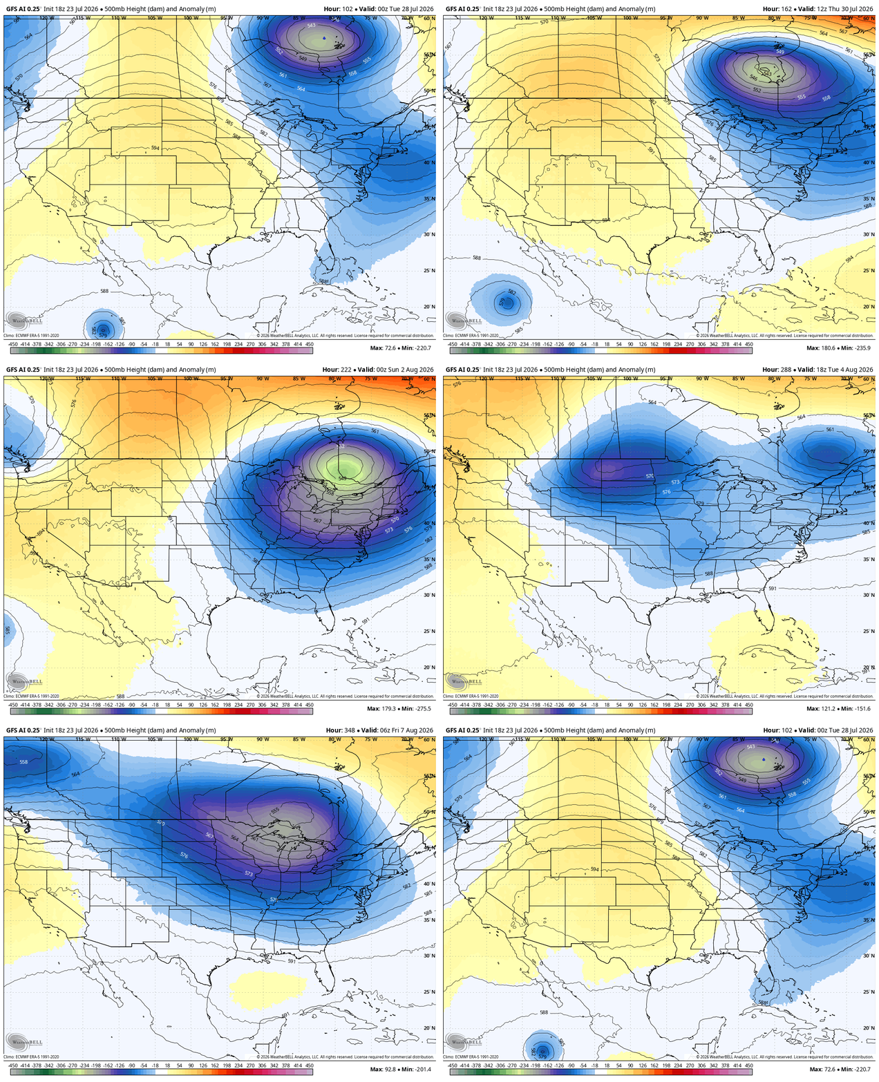
Looking longer range, we find the potential for a deepening trough to dig into the eastern half of the country into the close of July and early August.
The AI versions of the GFS are most emphatic with this possibility. Here’s the GFS AI from next Tuesday through August 8th…
The GFS AI Ensembles are similar…
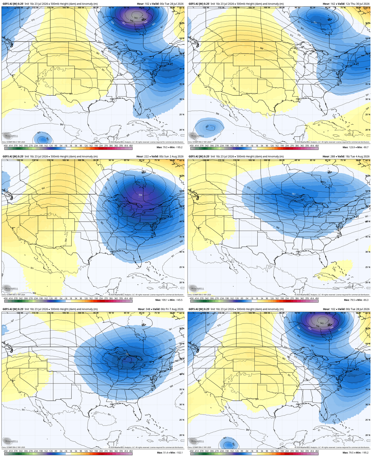
The regular GFS Ensembles are heading in a similar direction…
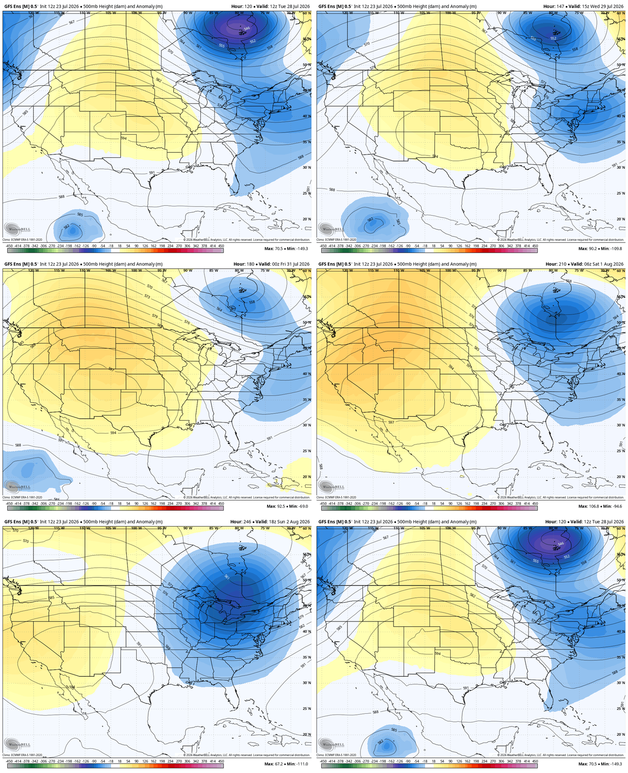
That would make for some really comfy air to start the month of August.
I’ll get to some fall and winter talk this weekend.
Enjoy this fantastic Friday and take care.

Thanks Chris. Those ensembles look more like Fall rather than the last month of Summer. The trough’s are moving farther south than usual. Still looking forward to your Fall and Winter forecast.
I’m looking forward to the coming heat wave, despite the bias of these models.
Jeff, If this Huge Heat Dome couples with the Bermuda High ( 40 to 60 % chance. ) High temperatures may reach 95 to 100 degrees in Kentucky. This would reduce crop yields significantly. Please let’s hope the jet stream stays active across the Great Lakes or Ohio Valley, it can flatten the ridge and allow fronts to come south, and continuing this great growing season.